Historic Landscape
Characterisation
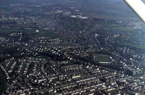
Merthyr Tydfil
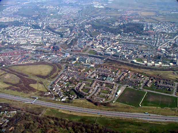
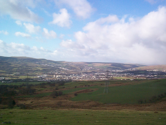
Merthyr Tydfil occupies a natural basin at the head of the Taff valley. High hills and ridges reach 450m above OD on all sides, with development constrained to the basin floor and smaller tributary valleys of the Taff, which itself provides the only natural route out of the basin to the south east. However, it is not topography alone that has shaped the town, but the mineral resources contained within its hinterland. It was probably the largest iron-making town in the world in the early to mid- 19th century, with an output calculated to be a quarter of that of the entire United States of America. The town, and its associated landscape, was rapidly transformed from a modest village in the 1750s to the largest town in Wales by 1801.
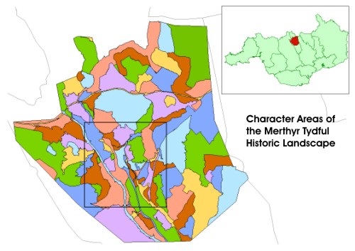
Despite extensive recent land reclamation and the sanitisation of the surrounding waste tips, overall Merthyr still retains its industrial landscape character as the most significant Welsh town of the Industrial Revolution. The town and its environs remain a potent example of an internationally renowned industrial landscape of the 18th and 19th centuries and a permanent reminder of man's exploitation of the landscape.
The primarily late 18th to 19th centuries landscape comprises numerous relict elements and foci set within the present landscape. These individual elements consist of the remains of large ironworks, remnants of the associated coal mining industry, water power eats, an early iron bridge, communication systems, including early tramroads, tips, terraced industrial housing, and the ironmasters house, Cyfarthfa Castle. Merthyr Tydfil, however, retains not only its economic significance, but also its importance as a religious, literary and political centre.
The area identified here contains many and diverse elements, which include Merthyr's Dowlais Ironworks, established in 1759, and probably the first such works to use coke in South Wales. It was followed by the foundation of other ironworks such as Plymouth in 1763, Cyfarthfa in 1765 and Penydarren in 1784. Other subsidiary works were created in the early 19th century at Ynysfach by Cyfarthfa, Ivor by Dowlais, Dyffryn by Plymouth, with further forges at Pentrebach, a part of Plymouth.
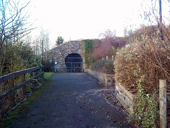
Locally, early communication systems survive, though to varying degrees. Adjoining the Cyfarthfa Ironworks lies the Pontycafnau bridge built in 1793, and the first ever iron railway bridge to be built. The bridge has added significance in that it had a combined use as an aqueduct. The Gyrnos tramroad which used the Pontycafnau bridge carried limestone from the Gyrnos quarries and exists today as a scenic footpath retaining its stone sleeper blocks. The remains of limekilns and fulling mills survive on either side of the route. Elsewhere, the line of the Penydarren tramroad, built in 1802 to carry iron by horse-drawn tram, survives and is also historically significant as the route of the first steam-hauled railway journey by Richard Trevithick's 1804 locomotive. The tramroad also includes a tunnel constructed under the Plymouth Ironworks.
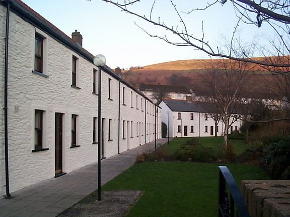
Short sections of the famous Glamorganshire Canal, built in the 1790s, also survive as important landscape features, including a restored section in front of Chapel Row. This is crossed by the relocated Rhydycar bridge which is an early iron girder bridge dating from the 1790s. Chapel Row itself was built by the Cyfarthfa Iron Company as workers' houses, one of which is restored, both as an example of a period ironworker's cottage and also as the birthplace of the renowned composer Dr Joseph Parry. In a sharp distinction which reflects the other social extreme of the Merthyr ironmasters' activities, Cyfarthfa Castle, overlooking the Cyfarthfa Ironworks, was the largest and grandest ironmaster's house in Merthyr Tydfil, and amongst the most notable surviving industrialist's house in Wales. The house is situated in 64ha of grounds, which were landscaped by the Crawshay family to include woodlands and a lake. This grand house and its parkland setting also provide an interesting and important contrast to the other relict landscape features of Merthyr.
Merthyr Tydfil Historical Processes, Themes and Background
- The Natural Landscape and geological
background
- Agriculture
- Military and Defensive Landscapes
- Funerary and Ritual Landscapes
- Parkland and Picturesque
Landscapes
- Industrial Landscapes
- Transport and Communications
- Industrial Urban Landscapes
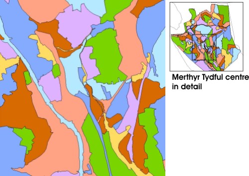
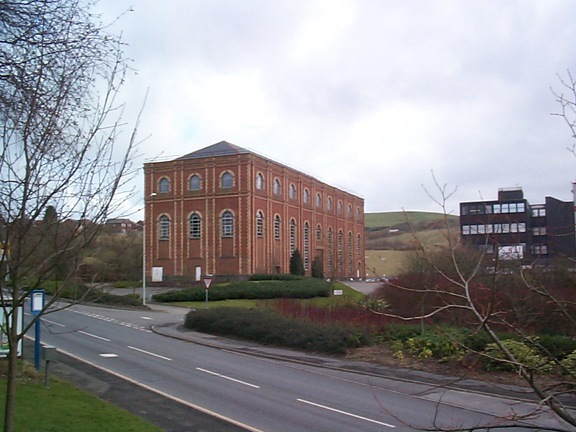
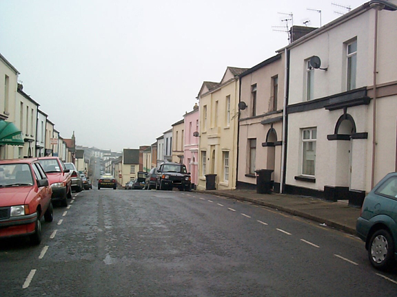
HLCA 001 Merthyr Tydfil: Historic and Commercial
Core Pre- and early industrial settlement core with later expanded
industrial settlement: pre-industrial religious, commercial and administrative
centre developed during the post-medieval and industrial period; post-medieval,
19th and 20th century religious, commercial, administrative and other
buildings; historic events and associations; industrial transport corridor
(Back to map)
Click here for further information
about this Historic Landscape Character Area
Click here for a
character area map
(Photo: GGAT Merthyr 001)
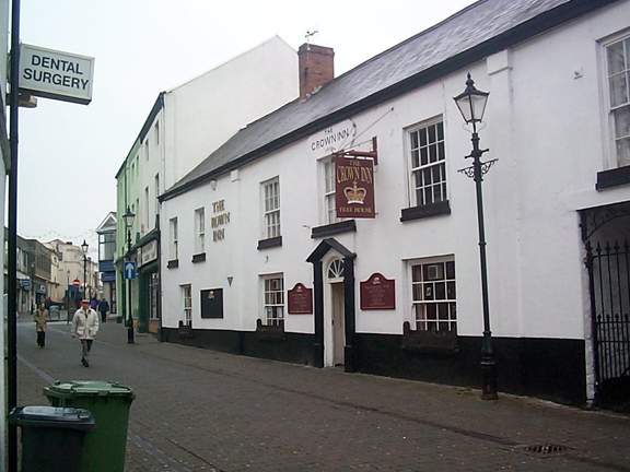
Merthyr Tydfil: Historic and Commercial Core character area: historic
town centre.
(Photo: GGAT Merthyr 002)
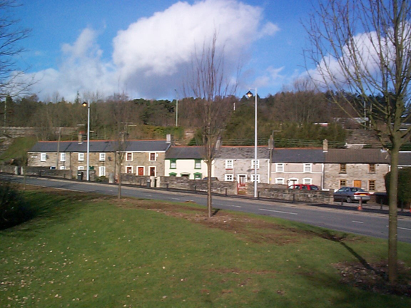
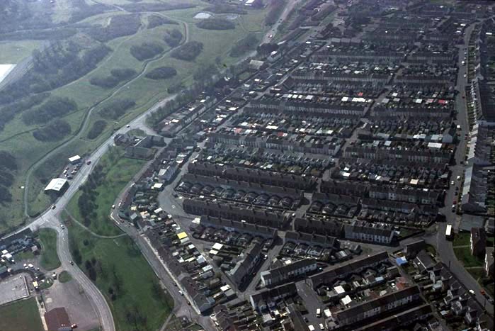
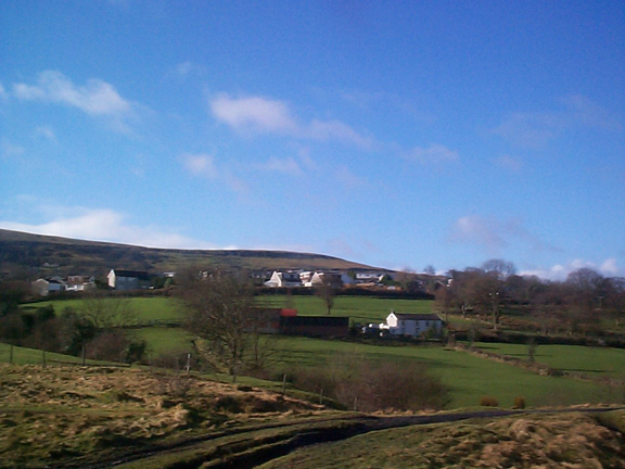
Williamstown, Cae-Pant-Tywyl1, Tydfil's Well and Morgan Town character area: important early worker's housing and small commercial development.
HLCA 002 Williamstown, Cae-Pant-Tywyll, Tydfil's
Well and Morgan Town Well preserved ironworks settlement: early
industrial settlement expansion mixed linear and regular layout, with
minor late urban renewal; minor commercial development; close association
with Cyfarthfa Iron Works; industrial transport corridor
(Back to map)
Click here for further information
about this Historic Landscape Character Area
Click here for a
character area map
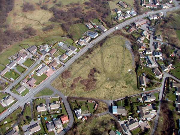
HLCA 003 Penydarren Park and Gwaelod-y-Garth
Premier middle-class suburban development over former parkland; regular
blocks of terraces and larger semidetached and detached villas; site of
former ironworks master's residence; prominent recent leisure function
(Back to map)
Click here for further information
about this Historic Landscape Character Area
Click here for
a character area map
(Photo: GGAT Merthyr 003)
Penydarren Park and Gwaelod-y-Garth character area: premier late 19th century and early 20th century middle-class residential area.

(Photo: GGAT Merthyr 004)
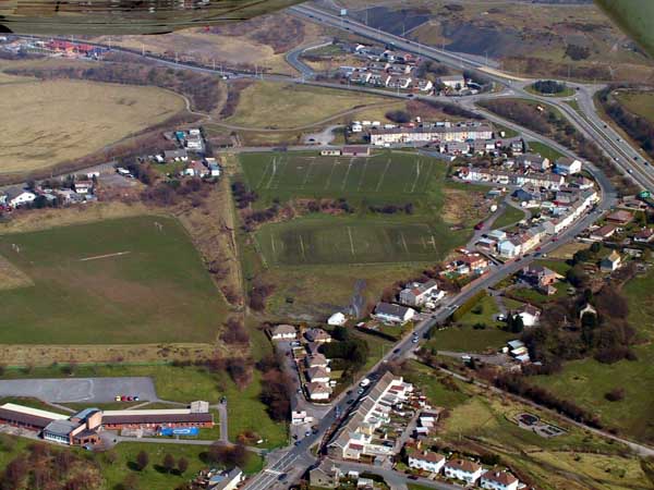
Penydarren Iron Works Area character area: site of early ironworks later developed for workers' housing.
HLCA 004 Penydarren Iron Works Area
Early ironworks area with remains of blast furnaces and adjacent area
of late 19th / early 20th century industrial housing,' nationally and
internationally important historic, and technological associations; site
of industrial transport features and power generation
(Back to map)
Click here for further information
about this Historic Landscape Character Area
Click here for a
character area map
HLCA 005 Penydarren Industrial settlement:
Iron Company owned settlement of early dense scatter/cluster and, linear
ribbon development supplemented by planned settlement of regular linear
blocks of terracing, including early local authority housing
(Back to map)
Click here for further information
about this Historic Landscape Character Area
Click here for a character area map
(Photo: GGAT Merthyr 005)
Penydarren character area: ironworkers' settlement of the early 19th century.
(Photo: GGAT Merthyr 006)
Merthyr Tydfil, South: Plymouth Street Area character area: industrial settlement based on ribbon development.
(Back to map)
Click here for further information
about this Historic Landscape Character Area
Click here for a
character area map
HLCA 007 Dowlais Industrial settlement: Iron Company owned settlement with regular and evolved element to layout; initial ribbon development and unplanned irregular dispersed settlement 'squatter-type' at Cwm Rhyd-y-Bedd, supplemented by linear grid planned core, public, educational and religious buildings; extensive 20th century redevelopment; transport corridor
Click here for further information about this Historic Landscape Character Area
Click here for a
character area map
(Photo: GGAT Merthyr 007)
Dowlais character area: early ironworkers' settlement
(Photo: GGAT Merthyr 008)
Dowlais Iron Works Area character area: important early ironworks, now an industrial park.
HLCA 008 Dowlais Iron Works Area Industrial
Area: former ironworks site; nationally and internationally important
historic, technological, and artistic associations; site of ironmaster
's residence; water management and power generation.
(Back to map)
Click here for further information
about this Historic Landscape Character Area
Click here for a
character area map
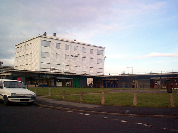
HLCA 009 George Town, Former Industrial Settlement
Industrial settlement area; remodelled in recent years but early
regular street layout maintained; transport corridor; 19th century religious
buildings; historic associations (Crawshays of Cyfarthfa; Joseph Parry.
(Back to map)
Click here for further information
about this Historic Landscape Character Area
Click here for a
character area map
(Photo: GGAT Merthyr 009)
George Town, Former Industrial Settlement character area: industrial settlement now almost entirely redeveloped for modern housing.

(Photo: GGAT Merthyr 010)
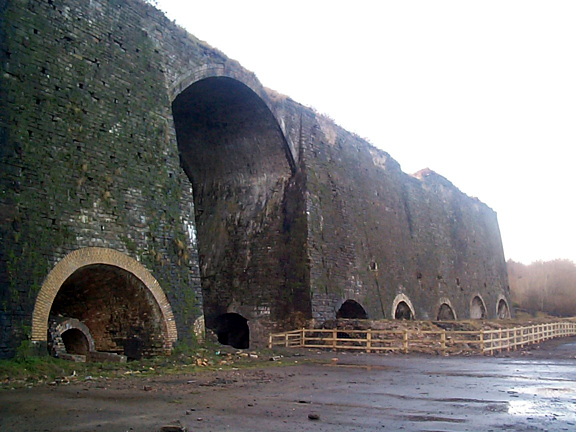
Ynys Fach Iron Works Area character area: early ironworks with surviving remains.
HLCA 010 Ynys Fach Iron Works Area Industrial
remains: ironworks, area partly taken by Technical College; historic,
technological, and artistic associations.
(Back to map)
Click here for further information
about this Historic Landscape Character Area
Click here for a
character area map
HLCA 011 Llwyn-Celyn and Ynys Fach Modern
estate settlement over area formerly characterised by mixed agricultural
and industrial use, including ironstone mining and industrial transport.
(Back to map)
Click here for further information
about this Historic Landscape Character Area
Click here for a
character area map
(Photo: GGAT Merthyr 011)
Llwyn-Celyn and Ynys Fach character area: modern urban area.
(Photo: GGAT Merthyr 012)
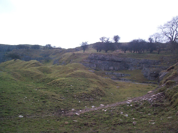
Cyfarthfa iron Works and Associated Features character area: important early ironworks with surviving remains.
HLCA 012 Cyfarthfa Iron Works Iron Works
and nearby interrelated features: including industrial transport and water
management features; historic, technological and artistic associations;
site of former ironmaster's residence.
(Back to map)
Click here for further information about this Historic Landscape Character Area
Click here for a character area map
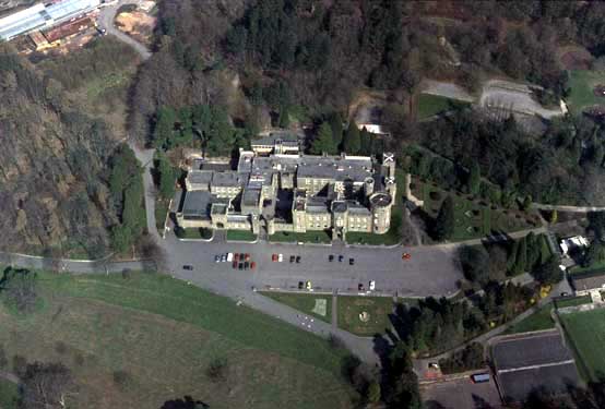
HLCA 013 Cyfarthfa Castle and Park Ironmaster's
seat, historic park and garden; visual connectivity to associated ironworks
and industrial extractive landscape; later museum and school; recreational
area; historic and artistic associations.
(Back to map)
Click here for further information
about this Historic Landscape Character Area
Click here for a
character area map
(Photo: GGAT Merthyr 013)
Cyfarthfa Castle and Park character area: ironmaster's house and park.
(Photo: GGAT Merthyr 014)
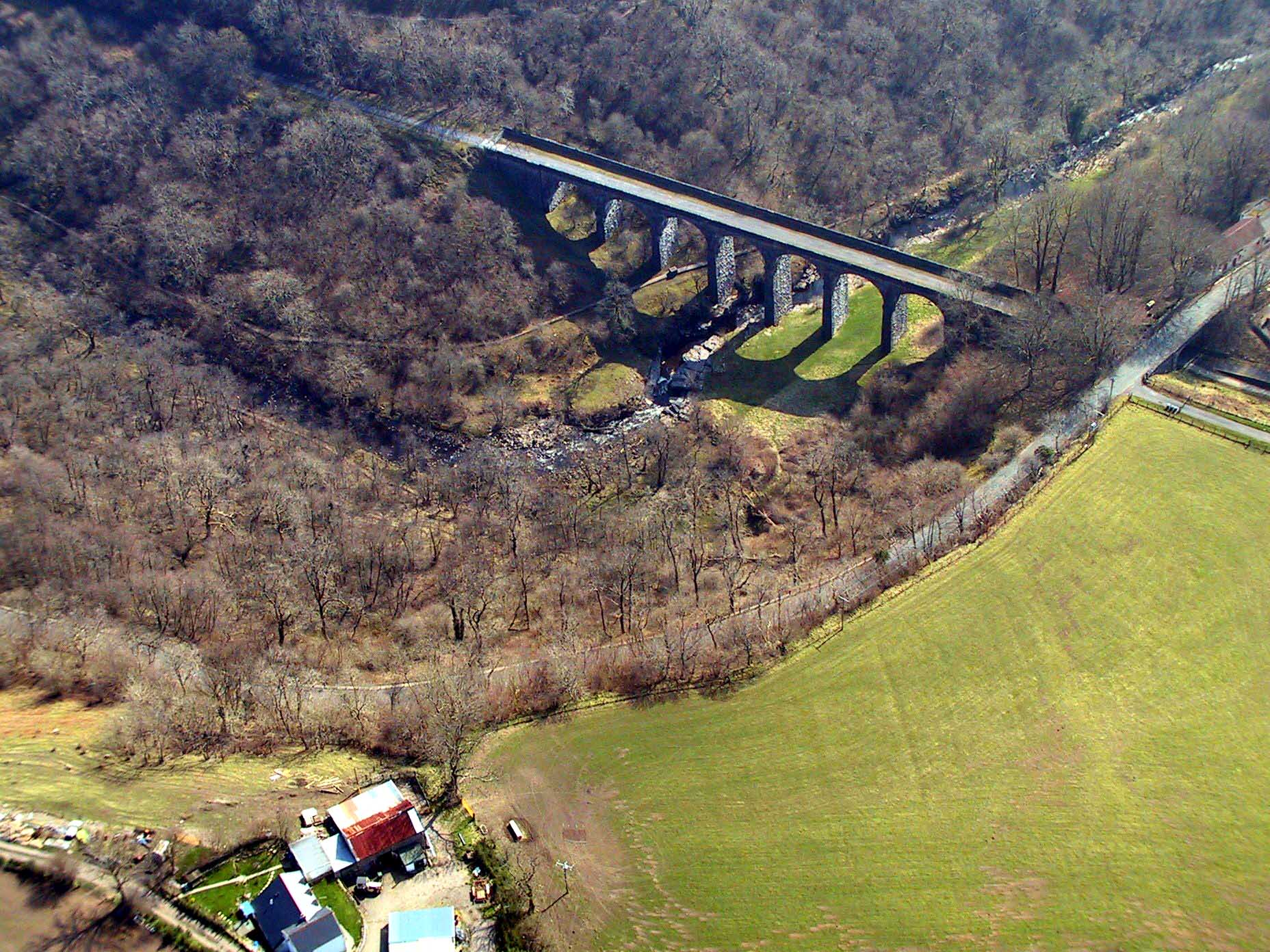
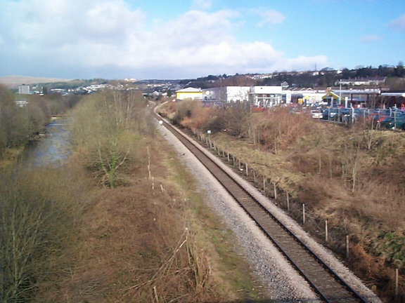
River Taff Canal and Railway Corridor character area: route of canals,
railways, tramways and roads alongside River Taff.
HLCA 014 River Taff
Canal and Railway Corridor Main north-south communication corridor
canal, tramroad, industrial and public railroad corridor; 18th and 19th
century extractive features, principally pits, levels and mines and associated
water management features; industrial housing; important historic and
cultural associations; Ancient Woodland
(Back to map)
Click here for further information
about this Historic Landscape Character Area
Click here for a
character area map
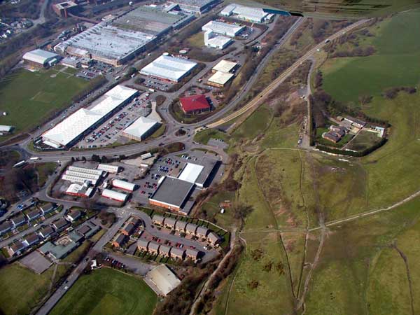
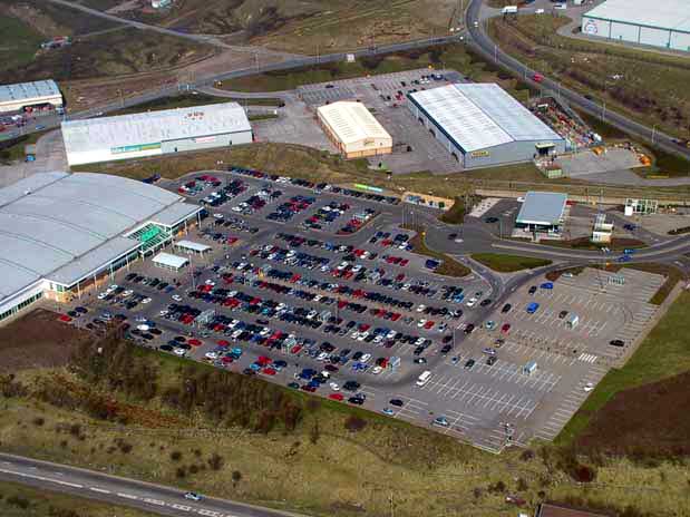
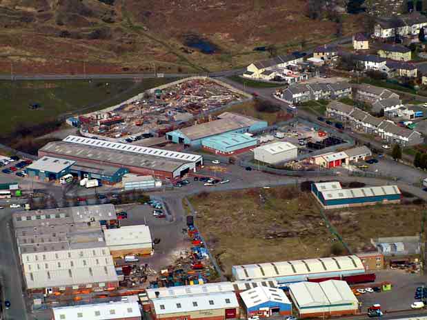
HLCA 015 Taff Vale Industrial and Business Parks
Recent industrial/retail area built partly over former ironworks, associated
tips and related transport and water management features; site of associated
coal workings; site of ironworks settlement; post-war industrial architecture.
(Back to map)
Click here for further information
about this Historic Landscape Character Area
Click here for a
character area map
(Photo: GGAT Merthyr 015)
Taff Vale Industrial and Business Parks character area: 20th century industrial and retail area.

(Photo: GGAT Merthyr 016)
Upper Abercanaid character area: important early 19th century canal-side colliery.
(Back to map)
Click here for further information
about this Historic Landscape Character Area
Click here for a
character area map
HLCA 017 Graig Early canal side colliery settlement (Glamorganshire Canal) and coal pit.
Click here for further information
about this Historic Landscape Character Area
Click here for a
character area map
(Photo: GGAT Merthyr 017)
Graig character area: early canal-side settlement.

(Photo: GGAT Merthyr 018)
Abercanaid and Llwyn-yr-Eos character area: 19th century mining settlement characterised by a rectilinear grid layout.
HLCA 018 Abercanaid and Llwyn-yr-Eos Important surviving example of a mid-l9th century planned industrial settlement; site of early canal side settlement, Llwyn-yr-Eos
Click here for further information
about this Historic Landscape Character Area
Click here for a
character area map
HLCA 019 Penydarren Tramroad Corridor
Corridor of nationally important Penydarren Tramroad and other mineral
lines, Plymouth Iron Works site; historic associations; site of industrial
housing; mining features.
(Back to map)
Click here for further information
about this Historic Landscape Character Area
Click here for a character area map
(Photo: GGAT Merthyr 019)
Penydarren Tramroad Corridor character area: tramroad associated with the first recorded steam locomotive journey to be undertaken on rails.
(Photo: GGAT Merthyr 020)
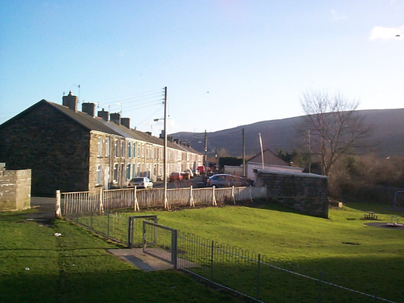
Pentrebach character area: industrial settlement of ironworkers' houses.
HLCA 020 Pentrebach Industrial settlement:
pre-1850s isolated industrial rows with early 20th century colliery based
expansion and later social housing; transport and water management features,
ironmaster's residence.
(Back to map)
Click here for further information
about this Historic Landscape Character Area
Click here for a
character area map
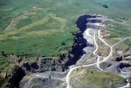
HLCA 021 Clyn-Mil and Wernlas Opencast Area
Late 20th century open cast and reclamation: previously characterised
as an area of intensive coal and iron ore workings of 19th century date,
with industrial transport and water management features.
(Back to map)
Click here for further information
about this Historic Landscape Character Area
Click here for a
character area map
(Photo: GGAT Merthyr 021)
Clyn-Mil and Wern-Las Opencast Area character area: former ironstone and coal workings removed by opencasting and reclamation.
(Photo: GGAT Merthyr 022)
Clyn-Mil, Pencoedcae and Trebeddau character area: mixed agricultural
and industrial area (coal and iron ore workings), now partly reclaimed.
HLCA 022 Clyn-MiI, Pencoedcae and Trebeddau Agricultural
enclosure; site of late 18th/l9th century coal and iron ore workings;
site of industrial transport and water management features; post-medieval
farmsteads and industrial stables; limited reclamation.
(Back to map)
Click here for further information
about this Historic Landscape Character Area
Click here for a
character area map
(Back to map)
Click here for further information about this Historic Landscape Character Area
Click here for a character area map
(Photo: GGAT Merthyr 023)
Clyn-Mil Workings character area: extensive and well-preserved remains of early surface workings of coal and ironstone.
(Photo: GGAT Merthyr 024)
Graweth and Pen-y-Lan character area: agricultural landscape of irregular enclosures with traditional boundaries and associated farmsteads.
HLCA 024 Graweth and Pen-y-Lan Surviving
area of post-medieval evolved irregular small agricultural enclosures
with relatively small-scale industrial influence (coal andiron ore) for
the area.
(Back to map)
Click here for further information
about this Historic Landscape Character Area
Click here for a
character area map
HLCA 025 Nantyrodyn and Bwllfa Workings Minor
post-medieval enclosure and settlement (ruinous); extractive industrial
landscape: trial and coal levels; agricultural/industrial tracks/possible
tramway and incline corridor; Ancient Woodland
(Back to map)
Click here for further information
about this Historic Landscape Character Area
Click here for a
character area map
(Photo: GGAT Merthyr 025)
Nantyrodyn and the Bwllfa Workings character area: industrial landscape of coal workings, but with relict areas of enclosed waste and woodland.

(Photo: GGAT Merthyr 026)
Cilfach-yr-Encil character area: agricultural landscape of irregular enclosures.
HLCA 026 Cilfach-yr-Encil Surviving area
of pre-industrial evolved irregular small agricultural enclosures with
little industrial influence.
(Back to map)
Click here for further information
about this Historic Landscape Character Area
Click here for a
character area map
HLCA 027 Taff Fechan Transport corridor:
public rail and road, Ancient Woodland
(Back to map)
Click here for further information
about this Historic Landscape Character Area
Click here for a
character area map
(Photo: GGAT Merthyr 027)
Taff Fechan character area: transport corridor based on public rail networks of the 19th century.
(Photo: GGAT Merthyr 028)
Taff Vale Railway Corridor character area: transport corridor based on Brunel's Taff Vale Railway.
HLCA 028 Taff Vale Railway Corridor Rail
transport corridor; historic associations; water management features.
(Back to map)
Click here for further information
about this Historic Landscape Character Area
Click here for a
character area map
HLCA 029 Ivor Iron Works Area Industrial
area: ironworks
(Back to map)
Click here for further information
about this Historic Landscape Character Area
Click here for a
character area map
(Photo: GGAT Merthyr 029)
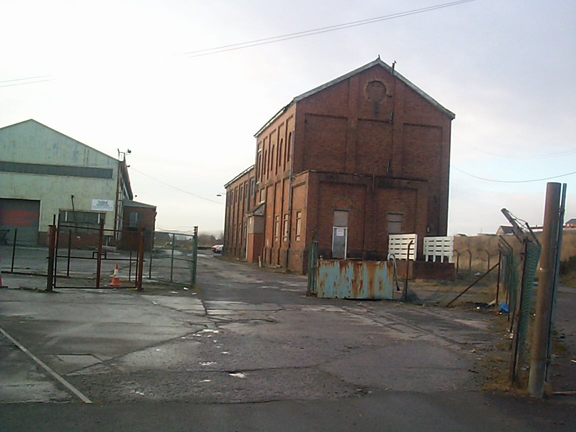
Ivor Iron Works Area character area: site of the early 19th century ironworks with later disused industrial buildings.
(Photo: GGAT Merthyr 030)
Pantcadifor, Rhyd-y-Bedd and Caeracca character area: roadside settlement associated with local quarries.
HLCA 030 Pantcadifor, Rhyd-y-Bedd and Caeracca
Minor industrial settlement: early ribbon development with later regular
terraces; major cemetery; transport corridor (railway); historic associations
(Back to map)
Click here for further information
about this Historic Landscape Character Area
Click here for a
character area map
HLCA 031 Merthyr Common, Central Nationally
important Industrial landscape; water management and extractive features
associated with the Dowlais and Penydarren Ironworks; industrial and post-medieval
upland settlement; transport networks -industrial and public rail; area
of industrially altered common.
(Back to map)
Click here for further information
about this Historic Landscape Character Area
Click here for a
character area map
(Photo: GGAT Merthyr 031)
Merthyr Common, Central character area: area of water management features begun in 1818.
(Photo: GGAT Merthyr 032)
Cwm Bargoed Washery character area: modern industrial area with extensive
waste tips and lagoons.
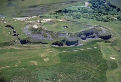
HLCA 032 Cwm Bargoed Washery In use as
a coal washery: waste and lagoons; industrial remains: extractive (site
of colliery and pits, engine house and smithy; transport corridor: railway
and tramroad and associated features (site of station and signal box),
site of water management feature (reservoir), site of domestic structures
(Railway Terrace)
(Back to map)
Click here for further information
about this Historic Landscape Character Area
Click here for a
character area map
HLCA 033 Garth Fawr Unimproved Common
Potential nationally important relict landscape: relict prehistoric settlement
and associated remains; industrial: extractive features (quarry and possible
levels)
(Back to map)
Click here for further information
about this Historic Landscape Character Area
Click here for a
character area map
(Photo: GGAT Merthyr 033)
Garth Fawr Unimproved Common character area: important relict prehistoric landscape.
(Photo: GGAT Merthyr 034)
Thomas Town (West) character area: late 19th century urban extension originating as tramside settlement.
HLCA 034 Thomas Town (West) Urban industrial
development: linear tramside settlement with later regular linear grid
additions of predominantly middle-class housing; 19th century public and
religious buildings
(Back to map)
Click here for further information
about this Historic Landscape Character Area
Click here for a
character area map
HLCA 035 Pengarnddu Transport corridor;
water management area; domestic and agricultural buildings; industrial
settlement associated with limestone quarries; improved agricultural land
and enclosure of Common edge; Military landscape. Volunteers rifle range;
historic associations
(Back to map)
Click here for further information
about this Historic Landscape Character Area
Click here for a
character area map

(Photo: GGAT Merthyr 035)
Pengarnddu character area: mineral railways serving limestone quarries.

(Photo: GGAT Merthyr 036)
Thomas Town (East) and Penyard character area: 20th century urban extension of Thomas Town.
HLCA 036 Thomas Town (East) and Penyard 20th
century urban expansion of 19th century Thomas Town, early social housing;
landscaped industrial extractive features; education and leisure; municipal
park and gardens; commemorative (Boer War memorial)
(Back to map)
Click here for further information
about this Historic Landscape Character Area
Click here for a
character area map
HLCA 37 Ysgubor Newydd 20th century council estate; social domestic housing
Click here for further information
about this Historic Landscape Character Area
Click here for a
character area map
(Photo: GGAT Merthyr 037)
Ysgubor Newydd character area:20th century council housing estate.
(Photo: GGAT Merthyr 038)
Mountain Hare character area: industrial settlement of isolated roads
and ribbon development.
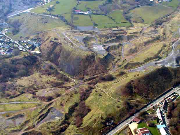
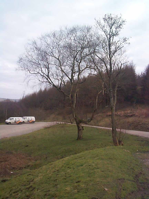
HLCA 38 Mountain Hare Small industrial settlement of isolated terraced rows and ribbon development associated with nearby coal and ironstone workings; close proximity to tramroad/railway corridor.
Click here for further information
about this Historic Landscape Character Area
Click here for a
character area map
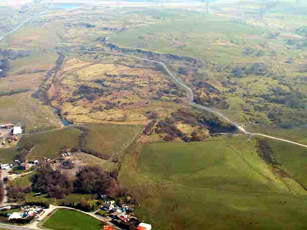
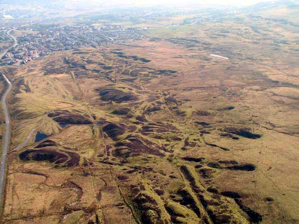
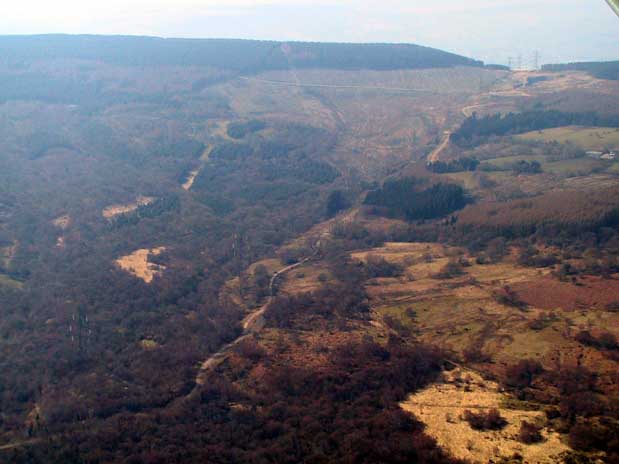
HLCA 39 Ffos-y-Fran Nationally important Industrial landscape associated with the Dowlais Ironworks; industrially altered upland Common: intensive area of extractive features predominantly early to mid 19th century coal and ironstone workings along mineral outcrop, primarily levels and pits, also early remains of crown pit workings, and patch workings; transport networks; industrial and public rail, drainage features: the Dowlais Free Drainage System; industrial settlement: includes scheduled Ffos-y-fran Iron Worker's settlement
Click here for further information
about this Historic Landscape Character Area
Click here for a
character area map

(Photo: GGAT Merthyr 039)
Ffos-y-Fran character area: extensive and nationally important landscape
of industrial sites.
(Photo: GGAT Merthyr 040)
Incline Top character area: route of the Penydarren Incline and the
Dowlais Railway.
HLCA 40 Incline Top Transport corridor, industrial; industrial incline-top settlement,' reclaimed landscape formerly characterised by industrial extractive and water management features.
Click here for further information
about this Historic Landscape Character Area
Click here for a
character area map
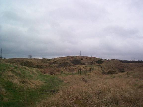
HLCA 41 Merthyr Common, North Common land, water management features (Dowlais Free Drainage and Merthyr Tydfil Corporation); minor industrial extractive landscape.
Click here for further information
about this Historic Landscape Character Area
Click here for a
character area map
(Photo: GGAT Merthyr 041)
Merthyr Common, North character area: area of common land containing
industrial water-management features.

(Photo: GGAT Merthyr 042)
Twynau Gwynion Quarries character area: series of 19th century quarries.
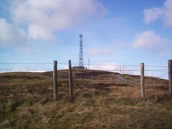
HLCA 42 Twynau Gwynion Quarries Limestone quarries associated with the Dowlais Ironworks and later the Rhymney Ironworks; transport corridor.
Click here for further information
about this Historic Landscape Character Area
Click here for a
character area map
HLCA 43 Garth and Blaen-Y-Garth Medieval/post-medieval agricultural enclosure: evolved irregular pattern, traditional enclosure boundaries; vernacular domestic and agricultural; minor industrial extractive landscape and water management features.
Click here for further information
about this Historic Landscape Character Area
Click here for a
character area map
(Photo: GGAT Merthyr 043)
Garth and Blaen-y-Garth character area: agricultural landscape characterised
of irregular enclosures.
(Photo: GGAT Merthyr 044)
Morlais Castle Quarries character area: extractive landscape of limestone
quarries.
HLCA 44 Morlais Castle Quarries Industrial extractive landscape: large imposing limestone quarries associated with the Penydarren and Dowlais Iron Works, associated tramroad corridors.
Click here for further information
about this Historic Landscape Character Area
Click here for a
character area map
HLCA 45 Morlais Hill and Castle Relict defensive and agricultural landscape; industrial planned Farm; large irregular-shaped fields, early religious, funerary and ritual features; industrial transport corridor; early 20th century leisure characteristics; public health buildings
Click here for further information
about this Historic Landscape Character Area
Click here for a
character area map
(Photo: GGAT Merthyr 045)
Morlais Hill and Castle character area: area of prehistoric and medieval
features, dominated by Morlais Castle.
(Photo: GGAT Merthyr 046)
Bryniau Quarries character area: extractive landscape with quarries
and associated tramroad.
HLCA 46 Bryniau Quarries Industrial extractive landscape associated with the Dowlais and Ivor Ironworks, industrial tramroad.
Click here for further information
about this Historic Landscape Character Area
Click here for a
character area map
HLCA 47 Dowlais Top Reclaimed industrial area, recent commercial, retail and light industrial area, site of industrial extractive landscape: quarries and spoil tips, rail corridor: Brecon and Merthyr Railway (including Dowlais Top Station) and sidings associated with Dowlais Iron Company Railway.
Click here for further information
about this Historic Landscape Character Area
Click here for a
character area map
(Photo: GGAT Merthyr 047)
Dowlais Top character area: reclaimed industrial land redeveloped for
commercial, retail and light industrial use.

(Photo: GGAT Merthyr 048)
Cwm Blacks character area: reclaimed area of intensive 19th century
coal workings.
HLCA 48 Cwm Blacks Reclaimed 19th century coal workings; urban green space; modern transport corridor.
Click here for further information
about this Historic Landscape Character Area
Click here for a
character area map
HLCA 49 Bon-y-Maen Modern industrial estate; former agricultural land; former industrial tramroad (on line of access road along north east side of HLCA)
Click here for further information
about this Historic Landscape Character Area
Click here for a
character area map
(Photo: GGAT Merthyr 049)
Bon-y-Maen character area: modern industrial estate.
(Photo: GGAT Merthyr 050)
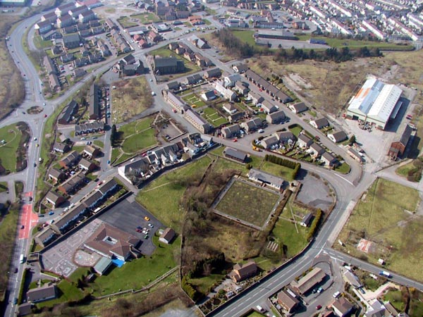
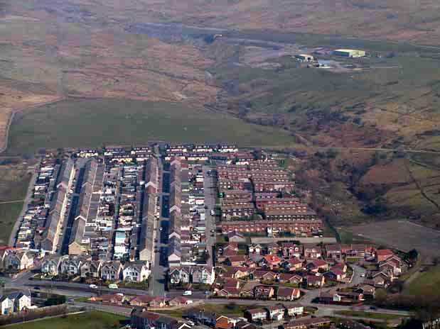
Gurnos and Galon Uchaf character area: mid 20th century urban landscape.
HLCA 50 Gurnos and Galon Uchaf Modern urban estates, with commercial, educational and health facilities; site of post-medieval agricultural holdings; transport corridor: road, including Roman, and former industrial tramway; site of water management features (eg the Goitre Pond and the network of associated drainage channels and reservoirs); site of minor industrial extractive features (eg coal and ironstone level, east of Goitre).
Click here for further information
about this Historic Landscape Character Area
Click here for a
character area map
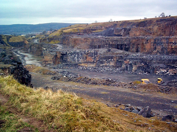
HLCA 51 Vaynor Quarry Modern extractive landscape: large active stone quarry; site of industrial tramroad, limekilns; religious, funerary and ritual: site of Roman inscribed stone.
Click here for further information
about this Historic Landscape Character Area
Click here for a
character area map
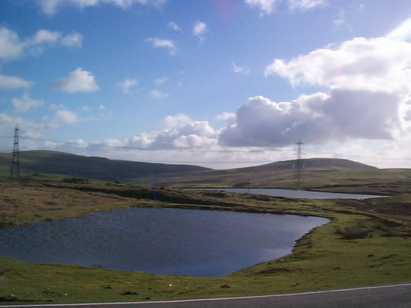
(Photo: GGAT Merthyr 051)
Vaynor Quarry character area: large active stone quarry.
(Photo: GGAT Merthyr 052)
Gurnos Farm and Bunker's Hill character area: agricultural landscape
of planned medium-large regular enclosures.
HLCA 52 Gurnos Farm and Bunker's Hill Agricultural landscape of late 18th/early 19th century improved medium-large regular (some irregular) agricultural and wooded enclosures; model estate farm (Gyrnos), with contemporary agricultural features; drystone walled enclosures; site of deserted rural settlement of Pantton; transport corridor. road and tram, including course of Roman Road
Click here for further information
about this Historic Landscape Character Area
Click here for a
character area map
HLCA 53 Y Graig, Gurnos Small open area of scrub woodland and pasture; network of tracks.
Click here for further information
about this Historic Landscape Character Area
Click here for a
character area map
(Photo: GGAT Merthyr 053)
Y Graig, Gurnos character area: open landscape of pasture and scrub
woodland.
(Photo: GGAT Merthyr 054)
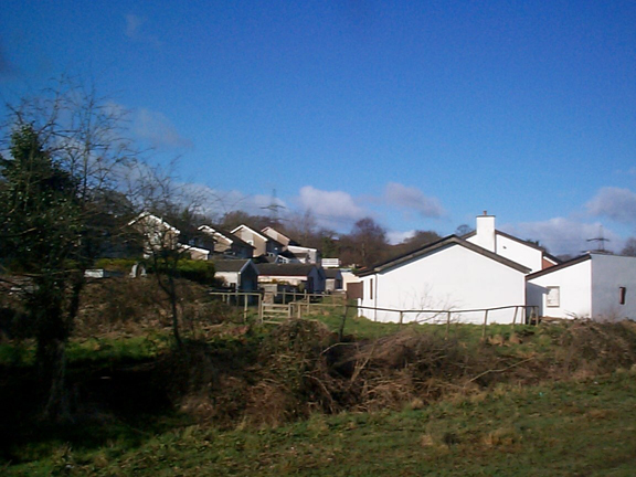
Lakeside Gardens character area: late 20th century housing development.
HLCA 54 Lakeside Gardens Modern housing development; ancient transport corridor (at eastern edge).
Click here for further information
about this Historic Landscape Character Area
Click here for a
character area map
HLCA 55 Cefn Coed-y-Cymmer Early industrial squatter" settlement: irregular dispersed layout with central linear ribbon core, wider streets near Pont-y-Cefn (associated with Crawshay family), early industrial housing; commercial function; religious, funerary and ritual: churches and chapels, transport corridor, road, rail, and electric tram and associated bridges
Click here for further information
about this Historic Landscape Character Area
Click here for a
character area map

(Photo: GGAT Merthyr 055)
Cefn Coed-y-Cymmer character area: important industrial worker's squatter
settlement.
(Photo: GGAT Merthyr 056)
A465 (T) Heads of the Valleys Road character area: route of mid 20th
century arterial road.
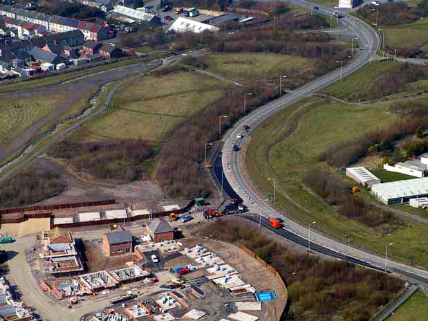
HLCA 56 A465(T) Heads of the Valleys Road Transport corridor; mid-20th century road and bridge construction.
Click here for further information
about this Historic Landscape Character Area
Click here for a
character area map
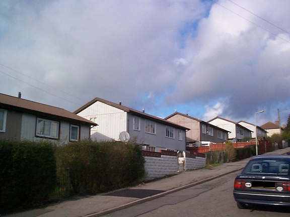
HLCA 57 Trefechan Post Second World War social housing development, domestic, public and commercial buildings.
Click here for further information
about this Historic Landscape Character Area
Click here for a
character area map
(Photo: GGAT Merthyr 057)
Trefechan character area: modern architect-designed self-contained community.
(Photo: GGAT Merthyr 058)
Ty-Newydd character area: post-medieval enclosed agricultural landscape.
HLCA 58 Ty-newydd Post-medieval agricultural enclosed landscape remnant, small, irregular enclosures, drystone field boundaries; religious, funerary and ritual feature.
Click here for further information
about this Historic Landscape Character Area
Click here for a
character area map
HLCA 59 Blaen-y-Dyffryn Medieval/Post-medieval agricultural landscape; small irregular enclosures associated with post-medieval agricultural holdings; traditional drystone boundaries.
Click here for further information
about this Historic Landscape Character Area
Click here for a
character area map
(Photo: GGAT Merthyr 059)
Blaen-y-Dyffryn character area: post-medieval enclosed agricultural
landscape.
(Photo: GGAT Merthyr 060)
Cefn CiI-Sanws character area: largely unenclosed upland landscape.
HLCA 60 Cefn Cil-Sanws Unenclosed upland, minor agricultural industrial extractive landscape; disused rifle range; historic religious place name associations.
Click here for further information
about this Historic Landscape Character Area
Click here for a
character area map
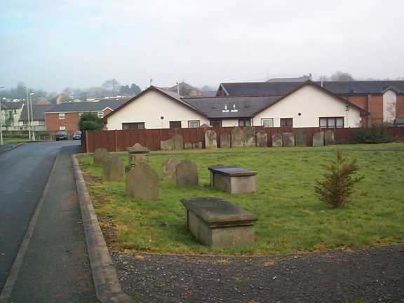
HLCA 61 Taff Fawr River Valley Religious, funerary and ritual landscape: 19th century and later cemeteries; rail and road corridor, agri-industrial features, site of
Click here for further information
about this Historic Landscape Character Area
Click here for a
character area map
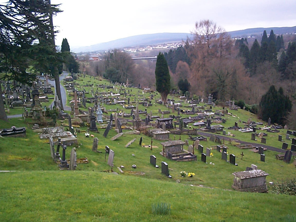
(Photo: GGAT Merthyr 061)
Taff Fawr River Valley Corridor character area: valley landscape with
important cemeteries.
(Photo: GGAT Merthyr 062)
Coed Meurig character area: agricultural enclosed landscape with traditional
boundaries and post-medieval farms.
HLCA 62 Coed Meurig Agricultural landscape; traditional drystone and hedged bank boundaries and sheep pens; post-medieval farms with farm buildings; Ancient Woodland; Historic association; minor industrial incursion.
Click here for further information
about this Historic Landscape Character Area
Click here for a
character area map
HLCA 63 Clwyd-y-Fagwyr, Gellideg and Pen-Llwyn-Deri Industrial settlement of isolated rows (19th century) now dominated by large regular planned estates of council and suburban housing (mid-late 20th century); religious, funerary and ritual: non-conformist chapels; industrial landscape: levels, and spoil tips; industrial water management: reservoirs/ponds; tramroad corridor.
Click here for further information
about this Historic Landscape Character Area
Click here for a
character area map
(Photo: GGAT Merthyr 063)
Clwyd-y-Fagwyr, Gellideg and Pen-Llwyn-Deri character area: 20th century
council estates with earlier clusters and rows of cottages.
(Photo: GGAT Merthyr 064)
Winch Fawr, Pen-yr-Heolgerrig, Cwm Do, and Upper Cwm Glo Workings character
area: a series of late 18th to 20th century ironstone and coal workings.
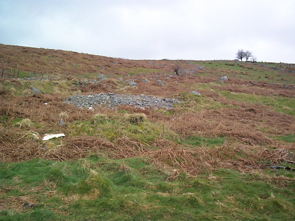
HLCA 64 Winch Fawr, Pen-yr-Heolgerrig, Cwm Du, and Upper Cwm Glo Workings Nationally and internationally important industrial extractive landscape associated with the Cyfarthfa Ironworks: levels (Cwmdu Drift,), pits, mine shafts, collieries, quarries, open cast workings spoil tips, airshafts and industrial buildings (such as the stables and other buildings at Cwmdu Pit); water management and drainage: leats, drains, ponds reservoirs; transport corridor: tracks, inclines and tramroads; agricultural: relict boundaries, clearance cairns, and sheep dip; religious, funerary and ritual; Bryn-y-Badell Bronze Age round cairn.
Click here for further information
about this Historic Landscape Character Area
Click here for a
character area map
HLCA 65 Ochr-y-Mynydd, Winch Fawr Industrial settlement: dense scattered pattern typical of "squatter" settlement; industrial extractive landscape features; minor transport.
Click here for further information
about this Historic Landscape Character Area
Click here for a
character area map
(Photo: GGAT Merthyr 065)
Ochr-y-Mynydd, Winch Fawr character area: small industrial squatter
settlement.
(Photo: GGAT Merthyr 066)
Waun-y-Nant Goy Tips character area: industrial landscape of extensive
waste tips.
HLCA 66 Waun-y-Nant Goy Tips Industrial extractive, waste tipping and processing landscape associated with Cyfarthfa Ironworks; industrial transport corridor.
Click here for further information
about this Historic Landscape Character Area
Click here for a
character area map
HLCA 67 Pencoedcae and Brynteg Mixed industrial/agricultural lands cape: open interface between agricultural, industrial and settlement; industrial transport corridor; water management/power generation; industrial extractive landscape associated with Cyfarthfa Ironworks.
Click here for further information
about this Historic Landscape Character Area
Click here for a
character area map
(Photo: GGAT Merthyr 067)
Pencoedcae and Brynteg character area: mixed landscape of agricultural
enclosures and industrial features.

(Photo: GGAT Merthyr 068)
Heolgerrig and Pen-yr-Heolgerrig character area: industrial village
evolved from a squatter settlement.
HLCA 68 Heolgerrig and Pen-yr-Heolgerrig Industrial squatter' settlement of irregular pattern, early linear ribbon development supplemented by terraces and housing estates; religious, funerary and ritual features, ie non-conformist chapels; small undeveloped commercial function; industrial extractive and transport features; minor agricultural features.
Click here for further information
about this Historic Landscape Character Area
Click here for a
character area map
HLCA 69 Cwm Glo, North Area illustrates earlier agricultural/settlement lands cape; religious, funerary and ritual landscape; early nonconformist chapel; historic and religious associations; industrial extractive and water management and drainage features.
Click here for further information
about this Historic Landscape Character Area
Click here for a
character area map

(Photo: GGAT Merthyr 069)
Cwm Glo, North character area: agricultural/settlement landscape with
strong historic and religious associations.
(Photo: GGAT Merthyr 070)
Cwm Glo: Tramroad, Plateway and Incline Corridor character area: extensive
network of inclines and tracks.
HLCA 70 Cwm Glo: Tramroad. Plateway and Incline Corridor Nationally important industrial landscape associated with Cyfarthfa Ironworks; industrial transport corridor: tramroad, plateway and incline corridor; industrial extractive landscape of pits, shafts, levels and tins within the Cwm Glo Valley and along Nant Llwyn-yr-Eos; industrial water management and drainage; relict industrial and agricultural settlement.
Click here for further information
about this Historic Landscape Character Area
Click here for a
character area map
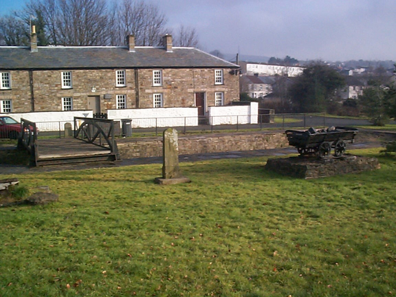
HLCA 71 Upper Collier's Row A nationally important industrial settlement: isolated row of early industrial housing with associated enclosures.
Click here for further information
about this Historic Landscape Character Area
Click here for a
character area map
(Photo: GGAT Merthyr 071)
Upper Collier's Row character area: small settlement of well-preserved
early industrial housing.
(Photo: GGAT Merthyr 072)
Waunwyllt, Pen-y-Lan and Graig Gethin character area: former post-medieval
agricultural landscape now dominated by 20th century forestry.
HLCA 72 Waunwyllt. Pen-y-Lan and Graig Gethin Agricultural landscape of dispersed post-medieval settlement associated with upland sheep farming; irregular evolved field pattern of drystone walled-enclosures largely hidden in forestry; Ancient Woodland and 20th century forestry; extractive landscape associated with the steam coal trade.
Click here for further information
about this Historic Landscape Character Area
Click here for a
character area map
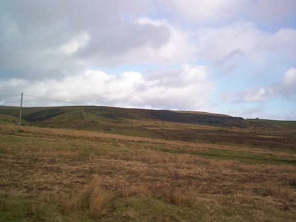
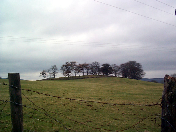
HLCA 73 Mynydd Aberdare Enclosed upland grazing; regular post and wire fenced enclosure; religious, funerary and ritual landscape.
Click here for further information
about this Historic Landscape Character Area
Click here for a
character area map
(Photo: GGAT Merthyr 073)
Mynydd Aberdare character area: enclosed upland landscape.
(Photo: GGAT Merthyr 074)
Blaen-Canaid and Hendre-Fawr character area: post-medieval agricultural
landscape of small irregular enclosures and associated farmsteads.
HLCA 74 Blaen-Canaid and Hendre-Fawr Relict agricultural landscape of small irregular evolved enclosure pattern and associated early post-medieval farmsteads; prehistoric funerary and ritual landscape; important historical and religious associations; Ancient Woodland and 20th century regeneration.
Click here for further information
about this Historic Landscape Character Area
Click here for a
character area map
HLCA 75 Garth Fawr Improved Common Area characterised as improved and enclosed common land, regular large enclosure of recent date; place-name evidence.
Click here for further information
about this Historic Landscape Character Area
Click here for a
character area map

(Photo: GGAT Merthyr 075)
Garth Fawr Improved Common character area: improved and enclosed common
land.
(Photo: GGAT Merthyr 076)
Bargoed Taf character area: enclosed agricultural landscape with irregular
field patterns.
HLCA 76 Taff Bargoed Enclosed landscape of medieval and post-medieval fields, possibly containing fossilised prehistoric elements; evolved/irregular field pattern; field boundaries mostly dry-stone wall and stone-faced banks; remnants of mining features and industrial railway. Extent of enclosure during post-medieval period as indicated by cartographic evidence. Dry-stone walls and stone-faced banks (cloddiau).
Click here for further information
about this Historic Landscape Character Area
Click here for a
character area map
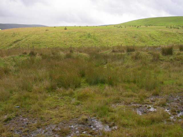
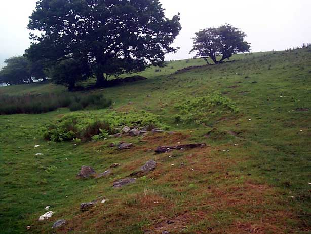
HLCA 77 Merthyr Common, South An important relict pre-historic funerary and ritual landscape: Bronze Age Cairns; Common Land; open mountain sheepwalk, little above ground industrial exploitation.
Click here for further information
about this Historic Landscape Character Area
Click here for a
character area map
(Photo: GGAT Merthyr 077)
Merthyr Common, South character area: extensive upland area of common
land preserving prehistoric landscape.
(Photo: GGAT Merthyr 078)
Dowlais Great Tip, Trecatti, Trehir and Twyn-Y-Waun character area:
reclaimed industrial landscape.
HLCA 78 Dowlais Great Tip, Trecatti, Trehir and Twyn-y-Waun Reclaimed industrial landscape; an area, formerly similar to HLCAs 031 and 039, since subject to reclamation, opencast and landfill, or combinations thereof former site of multi-period extractive and drainage features associated with the Dowlais Ironworks; former site of industrial and post-medieval upland settlements; former site of a regionally important Medieval Fair/market.
Click here for further information
about this Historic Landscape Character Area
Click here for a
character area map
HLCA 79 A470(T) Road North-south road transport corridor, late 20th century; former railway corridor (second half of 19th century); former industrial extractive landscape associated with the steam coal trade.
Click here for further information
about this Historic Landscape Character Area
Click here for a
character area map
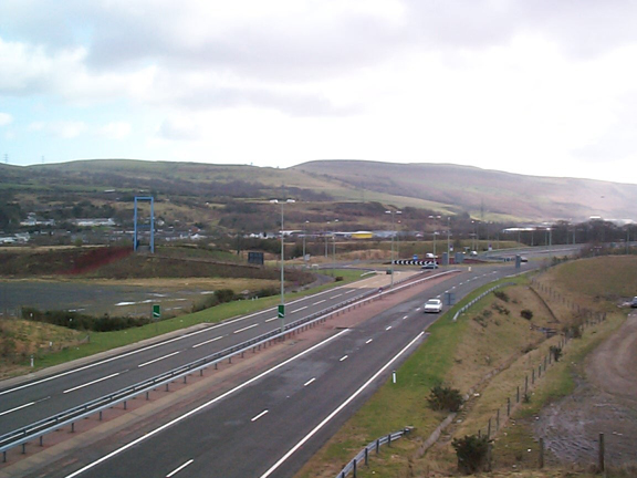
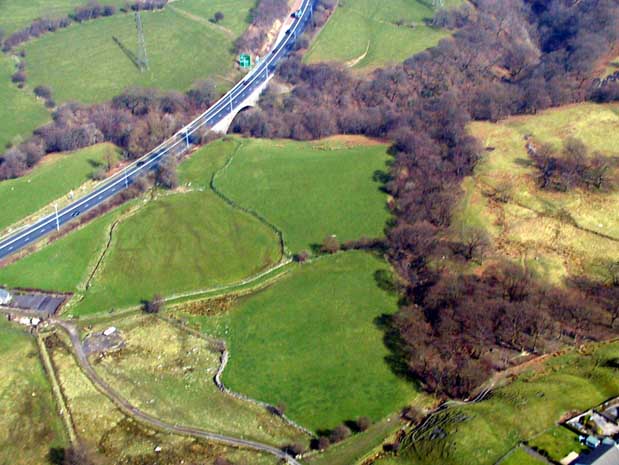
(Photo: GGAT Merthyr 079)
A470(T) Road character area: modern road corridor linking Merthyr Tydfil
with Cardiff.