Historic Landscape
Characterisation
Merthyr Tydfil
043 Garth and Blaen-y-Garth
HLCA 43 Garth and Blaen-Y-Garth Medieval/post-medieval agricultural enclosure: evolved irregular pattern, traditional enclosure boundaries; vernacular domestic and agricultural; minor industrial extractive landscape and water management features.
(Photo: GGAT Merthyr 043)
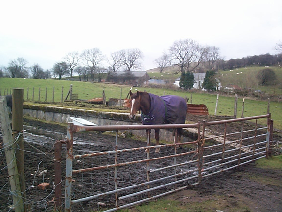
Garth and Blaen-y-Garth character area: agricultural landscape characterised
of irregular enclosures.
Summary
An agricultural landscape characterised by an area of surviving medieval or post-medieval irregular enclosures, traditional field boundaries, and vernacular domestic and agricultural buildings. There are also localised evidence for small-scale extraction, and water-management features associated with public health improvements of the late 19th century.
Historical background
The historic landscape area of Garth and Blaen-y-garth comprises an area of post-medieval evolved agricultural enclosure with medieval origins. The holding is centred on the post-medieval farm of Garth Farm, which lies on the site of the medieval settlement of Castell Madoc, a fortified manor known to have been abandoned by the 14th century.
The post-medieval (early 18th century) farmhouse at Garth belongs to the hearth passage group of sub-medieval houses, and is of the three-unit chimney backing on entry type with hail between heated outer and narrow inner rooms, typical of the Blaenau. A characteristic feature of the building is the lateral stone stairs within an outshut.
The Tithe map of 1850 details the layout of the area's farmsteads and holdings prior to the arrival of the lines of the Brecon and Merthyr Railway. The holding of Garth, owned by one Mary Williams, was characterised by an irregular arrangement of linear fields, possible amalgamated medieval strip fields, while Blaen-y-Garth (Blaenayr Garth) was characterised by larger irregular enclosures of possibly later date. While little had altered by the date of the OS survey of 1875, a series of quarries had been added to the west and north of Garth farm, those to the west were connected to Pantysgallog by track or minor tramroad.
Later landscape features include the Garth Storage Reservoir and Filter Beds constructed by 1884 for the Merthyr Tydfil Corporation and linked by 12" main to the Lower Neuadd Reservoir of 1884, and later by high level aqueduct to the Upper Neuadd Reservoir and to a new service reservoir at Pengarnddu.