Historic Landscape
Characterisation
Merthyr Tydfil
038 Mountain Hare
HLCA 38 Mountain Hare Small industrial settlement of isolated
terraced rows and ribbon development associated with nearby coal and ironstone
workings; close proximity to tramroad/railway corridor.
Click here for a
character area map
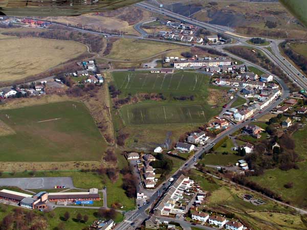
(Photo: GGAT Merthyr 038)
Mountain Hare character area: industrial settlement of isolated roads
and ribbon development.
Summary
An industrial settlement of isolated roads and ribbon development to the east of Twynyrodyn.
Historical background
The historic landscape area of Mountain Hare comprises a small settlement built initially on the edge of the Common and adjacent land owned by the Penydarren Iron Company, and part of a dispersed ribbon development known as Penyrheol-Merthyr extant by 1814. By 1850 Mountain Hare comprised a small scatter of cottages and an L-shaped range of Industrial Rows, along Penyrheol Road and including Mardy Street, at the junction of the tracks to the Common; ie routes to Incline Top, Penydarren, Long Town, and Twynywaun. The settlement was also located conveniently close to both the tramways of both the Penydarren and Dowlais Iron Companies.
By 1875, the settlement had expanded to gain an additional terraced row to the east of Mardy Street and boasted an Inn, the Mountain Hare, from which the later settlement took its name. Between 1898 and 1915, a further terrace was constructed along Pantyffin Road. Minor infilling and an additional housing development later took place, eg in the area between Goatmill Road and the A4060(T).