Historic Landscape
Characterisation
Merthyr Tydfil
063 Clwyd-y-Fagwyr, Gellideg and Pen-Llwyn-Deri
HLCA 63 Clwyd-y-Fagwyr, Gellideg and Pen-Llwyn-Deri Industrial settlement of isolated rows (19th century) now dominated by large regular planned estates of council and suburban housing (mid-late 20th century); religious, funerary and ritual: non-conformist chapels; industrial landscape: levels, and spoil tips; industrial water management: reservoirs/ponds; tramroad corridor.
Click here for a
character area map
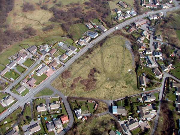
(Photo: GGAT Merthyr 063)
Clwyd-y-Fagwyr, Gellideg and Pen-Llwyn-Deri character area: 20th century
council estates with earlier clusters and rows of cottages.
Summary
A settlement dominated by 20th century council estates, but retaining earlier small discrete clusters of cottages and isolated rows of houses. Other features include non-conformist chapels and industricla features associated with coal and iron ore extraction and transportation.
Historical background
The historic landscape area of Clwyd-y-Fagwyr, Gellideg and Pen-Llwyn-Deri comprises as a settlement dominated by 20th century council estates, but which initially developed as small and discrete clusters of cottages and small rows centred at Clwyd-y-Fagwyr and Pen-llwyn-deri, with further isolated properties extending to Gellideg. The settlement, built on land of the Dynevor Estate, was probably initially agricultural, but later became associated with coal and iron ore mining. The original agricultural settlement dated to the 18th century and maps of 1814, 1826, and, in particular, the first edition 6-inch OS map of 1875 chart its later expansion.
The settlement comprises isolated industrial rows, now dominated by large regular planned estates of council and suburban housing (mid-late 20th century), including bungalows, and further recent extension carried out during the late 20th/early 21st century with executive housing developments (eg Castle Park). Early industrial housing survives at Gellideg (15-21 listed grade II) also 23-28 and bake house, and at Clwyd-y-Fagwyr, which included a former brew house, the Harp Inn, while the area also contains characteristic non-conformist chapels (Clwyd-y-Fagwyr Methodist and Nant-gau lndependent).
Interspersed around the original isolated rows were workings and tips associated with the Cyfarthfa Mines; an industrial landscape, principally of levels, such as William Morgan's Level, R Morgan's Level, Baynon's Level, and spoil tips including finger tips, together with associated industrial water management features (ie water balance ponds and reservoirs). The area also functioned as a tramroad corridor with a complex and extensive network of tramroads connecting the area's levels and pits to the ironworks at Cyfarthfa (eg the Mynydd Aberdare - Cyfarthfa Tramroad, and the Cyfarthfa - Clwyd-y-Fagwyr Tramway). The extensive network of tramroads was begun during the late 18th century, the development of which is charted by maps of 1814, 1826, and in particular the 1st edition 6-inch OS map of 1875.