Historic Landscape
Characterisation
Merthyr Tydfil
046 Bryniau Quarries
HLCA 46 Bryniau Quarries Industrial extractive landscape
associated with the Dowlais and Ivor Ironworks, industrial tramroad.
Click here for a
character area map
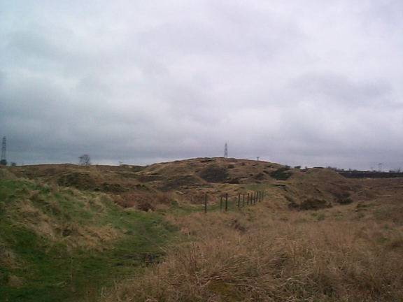
(Photo: GGAT Merthyr 046)
Bryniau Quarries character area: extractive landscape with quarries
and associated tramroad.
Summary
An industrial extractive landscape associated with Dowlais and Ivor Iron Works, containing quarries and an associated tramroad.
Historical background
The historic landscape area of Bryniau Quarries comprises an area of poorly drained rough grazing, part of the Castle Farm holding of the Plymouth Estate, leased to the Dowlais Iron Company during the 19th century. The area, depicted as wooded (scrub) on maps between 1766-1875, was being quarried by 1875. At this date a small quarry within the Bryniau enclosure was being worked connected by tramroad to the Dowlais area and the Ivor Iron Works, in particular. The quarry with its associated tram network had expanded considerably by 1915. Other features of the 19th century (and earlier) were tracks leading to Castle Farm.