Historic Landscape
Characterisation
Merthyr Tydfil
040 Incline Top
HLCA 40 Incline Top Transport corridor, industrial; industrial incline-top settlement,' reclaimed landscape formerly characterised by industrial extractive and water management features.
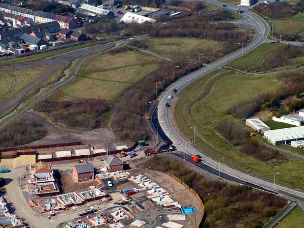
(Photo: GGAT Merthyr 040)
Incline Top character area: route of the Penydarren Incline and the
Dowlais Railway.
Summary
A major industrial transport corridor, characterised by the route of
the Penydarren Incline and the Dowlais Railway. New roads in the area
primarily serving the area's industrial estates continue the transport
corridor characteristics. The settlement of Incline Top contains early
industrial housing as well as the now more prominent recent industrial
estate.
Historical background
The historic landscape area of Incline Top comprises an industrial transport corridor, associated with both Penydarren and Dowlais Ironworks. Cartographic evidence indicates that a network of tracks, plateways and or tramroads was in place by 1814, shown in more detail on the OS surveyor's drawing of 1826, connecting Penydarren Ironworks with the Pencoedcae Colliery, via Pantyffin. The area was largely part of the Penydarren Iron Company land by the Tithe of 1850, with a part to the west leased from William Thomas. The Penydarren Incline at Incline Top was extant by 1850 and the tramroad connecting the Penydarren and Cwmbargoed Pits was at least partly in place by 1850, heading from Incline Top as far as the junction at Mountain Hare.
In 1851, the Dowlais Iron Company had opened its railway from Dowlais to the Taff Vale Terminus and sidings off Plymouth Street. The 6-inch OS map of 1875 detailed the tramroad system at its peak; including the Penydarren tramroads with an additional incline to the north of Bradley Row with an engine house. The Dowlais Railway with its incline engine house was also shown; this line ran south and southwest through the area from Dowlais to its junction with the Taff Vale Railway. Numerous other tramroads served the various pits and levels of the area and the adjacent hinterland.
The Zigzag Branch (later Dowlais Steel Works Branch of the GWR and Rhymney under construction in 1875, was yet to penetrate the area, by 1898 the latter had been completed. Apart from minor remnants most of the Penydarren tramroad system in the area was disused and lifted by 1898.
By 1850, Incline Top comprised a settlement of four isolated rows with associated linear yards (including Bradley Row), at the head of the Penydarren Incline, from the two original small rows of collages indicated in 1814. Between 1875 and 1898 the area gained a mission Room adjacent to a cottage extant in 1875 by the side of the Penydarren Tramroad, little change is visible thereafter. Bradley Row is now demolished and only a much-altered fragment of one of the former rows remains north of the incline's route in addition to a nearby, detached collage, extant in 1850.
The area was formerly an industrial extractive area with numerous coal and ironstone pits and levels. In addition to the area's transport network, other industrial features such as coal levels (both ironstone and coal), airshafts and engine houses were extant in the landscape by 1875. Also in place were water management features such as the reservoir to the northwest of Mountain Hare, disused by 1898. Other former characteristic features were reservoirs and leats, part of a much more extensive water management system (the Dowlais Free Drainage System), which here appeared to have supplied the water to the water balance systems of the local pits and probably the engines associated with the various inclines (see HLCAs 039 and 031).