Historic Landscape
Characterisation
Merthyr Tydfil
035 Pengarnddu
HLCA 035 Pengarnddu Transport corridor; water management
area; domestic and agricultural buildings; industrial settlement associated
with limestone quarries; improved agricultural land and enclosure of Common
edge; Military landscape. Volunteers rifle range; historic associations
Click here for a
character area map
Summary
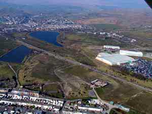
A transport corridor associated with the limestone quarries at Twynau Gwynion, where mineral railways replaced the 18th-19th century pack-horse route. It also contains extensive remains of the Dowlais Free Drainage System and the former industrial settlement of Pengarnddu, associated with the adjacent limestone quarries.
Historical background
The historic landscape area of Pengarnddu comprises an area of semi-improved land bordered at the north and east by the Rhymney Limestone Railway of c 1864. The latter served the Twynau-gwynion quarries (HLCA 042), connecting the quarries with the Guest's Ironworks at Rhymney and was connected to the ironworks by the Rhymney Mineral (Limestone) Railway in c 1864. The Twynau Gwynion Tramroad of 1805 to Dowlais Ironworks passed through the area; a Tramroad bridge of 1805/15 survived until 1984. The area also contains the remains of the Brecon & Merthyr (Newport Branch) Railway, dating from between 1860 and 1865.
Interesting water management features dating from the 19th century, also survive in the area, part of the extensive 'Dowlais Free Drainage System': these remains are primarily Lower (Fish Pond) and Upper Reservoirs (New Pond) with associated leats (with brick and masonry lining) and aqueducts (masonry), and a 19th century red-brick pumping station, below Upper Reservoir. Lower Reservoir was built before 1850, while Upper reservoir dates to between 1850 and 1875.
The area largely formed part of the Bute Estate during the l850s and included the farm of Blaen-Morlais. The area contains the small industrial settlement of Pengarnddu, extant in 1814. By 1875, this comprised two isolated rows, one associated with yards, to either side of the existing farmstead, and a school to the southwest. By 1915, the settlement boasted a church, St Michaels south of the school and a public house, among other features. By the 1960s the settlement has been abandoned, the farmstead and one cottage remaining.
