Historic Landscape
Characterisation
Merthyr Tydfil
061 Taff Fawr River Valley
HLCA 61 Taff Fawr River Valley Religious, funerary and ritual landscape: 19th century and later cemeteries; rail and road corridor, agri-industrial features.
Click here for a
character area map
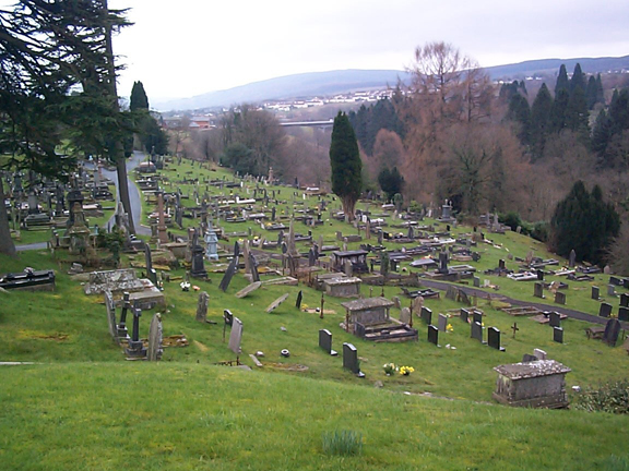
(Photo: GGAT Merthyr 061)
Taff Fawr River Valley Corridor character area: valley landscape with
important cemeteries.
Summary
A valley landscape largely characterised by established use for burial purposes
Historical background
The historic landscape area of Taff Fawr River Valley Corridor comprises the valley of the Taff River to the north of the Cyfarthfa Ironworks.
A major effect on the character of the area was the use of the area for burial following the establishment of the Cefn Cemetery in 1858; proposals of 1857 authorised the laying out of the ground, and erection of chapels, lodge and boundary wall. The main cemetery between Brecon Road and the Taff was depicted in 1890 with a chapel and lodge. By 1919, the cemetery had expanded to take in an area to the westside of the Taff, linked by bridge. In 1860, the Jewish Community purchased land for a Jewish Burial Ground, to the east side of Brecon Road: the first burial was in 1870; burials had previously taken place in Swansea. The Jewish Burial Ground with its small mortuary chapel doubled in size between 1890 and 1918, an indication of the size of the Jewish Community at the time.
The area formed the corridor of the construction railway for Llwyn-Onn Reservoir, built between 1914 and 1927.