Historic Landscape
Characterisation
Merthyr Tydfil
071 Upper Collier's Row
HLCA 71 Upper Collier's Row A nationally important industrial settlement: isolated row of early industrial housing with associated enclosures.
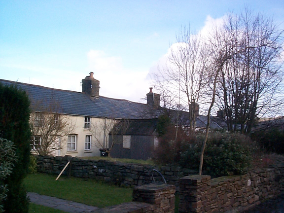
(Photo: GGAT Merthyr 071)
Upper Collier's Row character area: small settlement of well-preserved
early industrial housing.
Summary
A small but nationally important settlement of well-preserved late 18th to early 19th century industrial housing (listed grade II) with associated enclosures/allotments.
Historical background
The historic landscape area of Upper Collier's Row is a relatively rare and interesting example of a late 18th/early 19th century industrial workers' settlement. The main feature of the settlement, shown on surveyors' drawings of 1814 and 1826, and detailed on subsequent 6-inch OS maps (1875-1915), is an isolated row of one-up-one-down colliers' cottages, with a cat-slide roof addition to the rear, most have been enlarged by knocking two cottages into one. The row retains substantial stone stacks and preserves much of its 19th century character intact with minor 20th century alteration; No. 8 in particular. The row, part of the Dynevor Estate during the 19th century, housed colliers working the Cyfarthfa mines and was conveniently located adjacent to both the Cyfarthfa Canal basin at Llwyn-celyn and the Cyfarthfa Tramway (and later the Cwm Pit Railway). The industrial housing is associated with irregular enclosures or allotments located in an adjacent, but separate area to the south.