Historic Landscape
Characterisation
Merthyr Tydfil
011 Cyfarthfa Iron Works
HLCA 011 Llwyn-Celyn and Ynys Fach Modern estate settlement
over area formerly characterised by mixed agricultural and industrial
use, including ironstone mining and industrial transport.
Click here for a
character area map
(Photo: GGAT Merthyr 011)
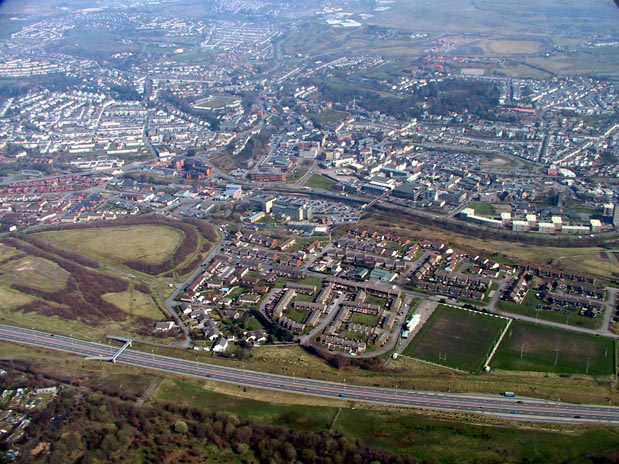
Llwyn-Celyn and Ynys Fach character area: modern urban area.
Summary
This is a modern urban area built over former mixed agricultural and industrial land where tipping from the Cyfartha works had occurred. It is characterised by late 20th century council housing and executive housing.
Historical background
The historic landscape area of Llwyn-celyn and Ynys Fach is an area of recent local authority and executive housing bounded on the west by the A470(T) road on the line of the former Gethin Railway and the Brecon and Merthyr Railway (Merthyr Branch) and on the east by the remains of the Ynys Fach ironworks.
The area, part of the Dynevor Estate, was centred on the farm of Llwyn Celyn. The holding, located just east of the Cyfarthfa Canal and which dates from at least the 18th century appears to have formed part of Wern farm by 1850. Tipping from the Cyfarthfa works encroached upon the area, so that by 1878 its agricultural viability must have been in serious doubt. The 25-inch and 6-inch OS maps of 1875 and 1878 show the area containing industrial features such as a disused ironstone level, an ironstone shaft with associated smithy, engine house, together with the Ynys Fach Mineral Railway and an extensive area of rail sidings associated with the adjacent Ynys Fach works.