Historic Landscape
Characterisation
Merthyr Tydfil
062 Coed Meurig
HLCA 62 Coed Meurig Agricultural landscape; traditional drystone and hedged bank boundaries and sheep pens; post-medieval farms with farm buildings; Ancient Woodland; Historic association; minor industrial incursion.
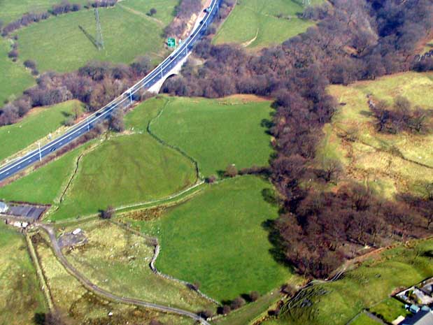
(Photo: GGAT Merthyr 062)
Coed Meurig character area: agricultural enclosed landscape with traditional
boundaries and post-medieval farms.
Summary
An agricultural enclosed landscape of traditional hedgebanks and dry stone boundaries associated with post-medieval farms. The area also has minor industrial characteristics in the form of tips extending from workings to the south of the Swansea Road A4102 (Clwyd-y-Fagwyr, Gellideg and Pen-Llwyn-Deri, area HLCA 063).
Historical background
The historic landscape area of Coed Meurig comprises an area of agricultural enclosure and ancient and environmentally sensitive deciduous woodland in the area to north of the A465 (T) and Gellideg. The area contains post-medieval farms with farm buildings, including Coed Meurig, Tai Mawr, Tai Mawr-uchaf, Pen-Rhiw, Cwmffrwd, Ty'n Coedcae and Cwm-Waun-newydd, the latter two lying just west of the historic landscape boundary. These are associated with a landscape of by drystone walled enclosures and sheep pens. The area was part of the Dynevor Estate during the 19th century, leased to various tenant farmers.
Progressive encroachment on waste during the early post-medieval period is suggested by nature of enclosure (intakes of rough grazing), and supported by place-name evidence, ie Ty'n Coedcae and Cwm Waun-newydd; the latter are later additions, which having been enclosed were later settled separately from the original holding, possibly through permanent occupation of earlier temporary structures. The earlier holdings were Coed Meyric (Coed Meurig), Tai Mawr, Tai Mawr-uchaf, Pen-rhiw and Cwmffrwd; all of which were well-established permanent settlements by the 18th century and appear on Yates' map of 1799. All the holdings of the area were extant by 1814, detailed by later maps (1826-1850; and all three editions of the 6-inch OS maps (1875-1915).
Though there has been some minor industrial incursion, this typically was in the form of tips extending from workings to the south of the Swansea Road A4102 (HLCA 063). These tips were being created during the first quarter of the 19th century and are first detailed on a map of 1826. The 1st edition 1875 OS 6-inch map of the area depicts the full extent of the industrial encroachment in the area.