Historic Landscape
Characterisation
Merthyr Tydfil
050 Gurnos and Galon Uchaf
HLCA 50 Gurnos and Galon Uchaf Modern urban estates, with
commercial, educational and health facilities; site of post-medieval agricultural
holdings; transport corridor: road, including Roman, and former industrial
tramway; site of water management features (eg the Goitre Pond and the
network of associated drainage channels and reservoirs); site of minor
industrial extractive features (eg coal and ironstone level, east of Goitre).
Click here for a
character area map
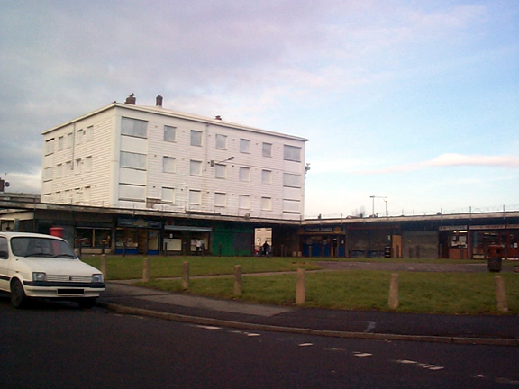
(Photo: GGAT Merthyr 050)
Gurnos and Galon Uchaf character area: mid 20th century urban landscape.
Summary
A mid 20th century urban landscape characterised by council housing estates with associated commercial, educational and health facilities, built on former agricultural land with some industrial features.
Historical background
The historic landscape area of Gurnos and Galon Uchaf comprises housing estates of local authority housing created during the early 1960s. The area displays an attempt to integrate commercial facilities at the core of the settlement. The estates at Gurnos are laid out in a variety of differing patterns centred on the Prince Charles Hospital. A unifying feature are the street names, which follow a common theme of plants and trees, such as Acacia Avenue, Sycamore Road, Chestnut Way and Honeysuckle Close.
Additional distinctive features of the area are large schools, which with playing fields and allotments preserve to an extent the former open nature of the area, this is particularly evident at the south of the area (HLCA 050). The area included the former holding of Gwaunferran Farm (the Dairy on the 1850 tithe map). The Penydarren Iron Company owned, or leased most of the area for agricultural purposes. Apart from agricultural land, the area contained leats and reservoirs such as those which formerly connected Goitre Pond (now infilled) to Penydarren, and which formed a part of a water management system supplying the needs of the Penydarren Ironworks. These features were extant by 1826, shown on the tithe map of 1850 and elaborated by 1875, the lower reservoir at Gwaelod-y-garth in use as a swimming pool by 1915. In 1858, the Penybryn filterbeds and storage tanks were constructed by the Merthyr Tydfil Corporation to supply domestic water to Merthyr and Penydarren piped from the Taff Fechan at a point near Dolygaer; this was in operation by 1861. Supply to Dowlais and Pant was via a service reservoir at Dowlais Top (HLCA 035) to which water was pumped by steam engine until 1884.
The small road/tramroad junction settlement of Gwaelod-y-garth, the early development of which is charted by maps of 1814, 1826, and 1850, lies at the southwest corner of the area (030B). Though the settlement has been almost submerged by the expansion of Penydarren Park, isolated rows of industrial housing (extant in 1875), still survive.
Prince Charles Hospital (built in 1965-75 by Sir Percy Thomas and Partners, with additions of 1989-91) comprises a formal modem structure of two parallel five-storey ranges with service towers linked by a series of cross ranges.
Prior to the construction of the housing estates the area was characterised by a mixed regular and irregular field pattern of generally large improved enclosures of late 18th/early 19th century date. The area contained the holdings of Galon Uchaf, Penygarn (kennels), Gain, Goitre, parts of Gellifaelog, Bonymaen and Gymos (Gurnos), only the latter farmstead survives (see HLCA 052) just north of the A465(T). The use as the area as a transport corridor from the Roman period, and especially during the 19th century (eg the limestone tramway to Penydarren Iron Works from Morlais Castle Quarries) has had some influence on the present road system. The current main arterial routes of the area are essentially those established before the end of the 19th century.