Historic Landscape
Characterisation
Merthyr Tydfil
014 River Taff Canal and Railway Corridor
HLCA 014 River Taff Canal and Railway
Corridor Main north-south communication corridor canal, tramroad,
industrial and public railroad corridor; 18th and 19th century extractive
features, principally pits, levels and mines and associated water management
features; industrial housing; important historic and cultural associations;
Ancient Woodland
Click here for a
character area map
(Photo: GGAT Merthyr 014)
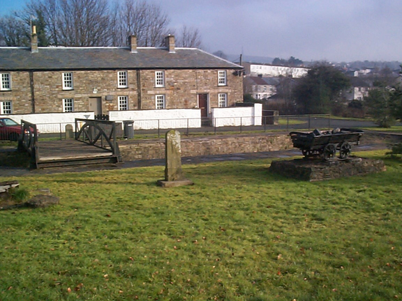
River Taff Canal and Railway Corridor character area: route of canals,
railways, tramways and roads alongside River Taff.
Summary
An important communication corridor contains the Glamorganshire and Cyfartha Canals, as well road links and the remains of tramroads and railways. The earliest communication link was the parish road, supplemented in the late 1770s by the canal supplying the Cyfartha Iron Works with coal and ironstone. The system was greatly expanded from the opening years of the 19th century. The area is characterised by two surviving canals and the remains of former industrial railways, the embankments, cuttings, bridges and other features associated with them. There are also features associated with mining, and the surviving industrial housing of George Town.
Historical background
The historic landscape area of the River Taff Canal and Railway Corridor contains extensive road, canal, tramroad and rail remains, in addition to remains associated with coal and ironstone mining. The present appearance of the landscape of area is largely due to the rapid growth of the iron and coal industries in the region during the 18th and 19th centuries. Most of the sites are directly associated with coal and ironstone extraction and the transport system which developed alongside it.
The rapid development of the coal and ironstone workings within the area is associated with the resurgence in the iron industry seen during the latter half of the 18th century, a direct result of technical innovation, which enabled coke to be used in iron smelting. Dowlais was the first ironworks using the new puddling process to be established in the Merthyr region; soon after in 1765 Anthony Bacon established the ironworks at Cyfarthfa. The Cyfarthfa Ironworks drew its raw materials from the coal and ironstone workings on land leased from the Dynevor estate including those workings located in the area.
The transport networks of the area start with the old parish road, later augmented by the construction of the Cyfarthfa Canal to transport coal direct from levels to the ironworks. Constructed during the late 1770s, the canal appears on Yates's map of 1799, (closed 62 years later in 1856). The canal was connected to an adit at Wern, from which coal was loaded directly on to small iron boats or 'buckets' entering the adit mouth. The ironworks together with the coal and ironstone workings began a rapid period of expansion under Richard Crawshay, who leased Cyfarthfa in 1786; this early success was in part due to the construction in 1794 of the Glamorganshire Canal.
While the early extraction industry largely depended on surface workings using a mixture of patching (a process which scours the land of its topsoil), small pits, and where the topography allowed levels driven into the hillsides (Osborne 1976, 41), the real boom years in the industry occurred during the 1820s and 1830s. It was during this period that the deep pits, such as Colliers' Row Pit, Glyndyrys Pit, Rhyd-y-Car Pit and Cwm Colliery, began to be sunk in the area.
The main means of haulage within the shafts was the water balance system, which depended on a plentiful and constant supply of water (Thomas 1981, 306-308); several of the reservoirs in the study area are likely to be relict features associated with this system. The extraction of ironstone and coal in particular continued throughout the 19th century, fluctuating with economic demand. By the end of the 1920s, the area was largely derelict though there appears to have been a brief period of mining activity during the Second World War.
From about 1800 the development of a complex transport network began; initially tramroads and later during the 1840s railways, first transporting coal and iron ore to the Cyfarthfa Ironworks and later serving wider markets. These included the Ynys-fach, Gethin, Cwm Pit and the Vale of Neath Railways and the B&M and L & NWR Joint Line (see also HLCA 027 and HLCA 055) were the main examples.