Historic Landscape
Characterisation
Merthyr Tydfil
022 Clyn-Mil, Pencoedcae and Trebeddau
HLCA 022 Clyn-MiI, Pencoedcae and Trebeddau Agricultural
enclosure; site of late 18th/l9th century coal and iron ore workings;
site of industrial transport and water management features; post-medieval
farmsteads and industrial stables; limited reclamation.
Click here for a
character area map
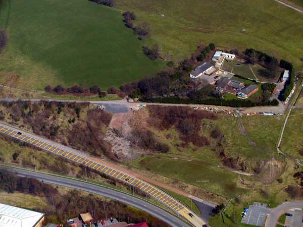
(Photo: GGAT Merthyr 022)
Clyn-Mil, Pencoedcae and Trebeddau character area: mixed agricultural
and industrial area (coal and iron ore workings), now partly reclaimed.
Summary
A mixed agricultural and industrial area characterised by late 18th and 19th century coal and iron ore workings, with associated transport and water management features. It has undergone limited reclamation, but some industrial features may survive, especially transport features.
Historical background
The historic landscape area of Clyn-Mil, Pencoedcae and Trebeddau comprises the farms of Upper Clyn-Mil, Pencoedcae and Cwmblacks, and Trebeddau. The site of the former industrial farm of Lower Clyn-Mil and the adjacent Clyn-Mil Pit (No. 1; coal and ironstone), its associated water balance reservoir. The area lies on the fringe of the main area of opencast and although a limited amount of reclamation has occurred within the area at Trebeddau, remnants of the area's industrial past might survive, typically transport features such as inclines and tramroads.
The area's agricultural holdings were detailed on mid-18th century estate maps and formed part of the St Fagans (later Plymouth Iron Company) Estate. The farms follow the general post-medieval vernacular tradition of the area, although apparently little of interest remains to the present day. The earlier farmstead at Lower Clyn-Mil (demolished) is shown by 1850 as having a quadrangle range of buildings more typical of an industrial farm. The building was referred to as Clyn-Mil stables; like the stables at Dowlais, this appears to have been the works stables associated with the Plymouth Iron Works.
The exploitation of the area's mineral reserves began at the end of the 18th century with the founding of the Plymouth Ironworks. By 1813 Iron Mines already dominated the Cwmblacks/Pencoedcae area to the north, including the Pencoedcae Colliery (adjacent to Pencoedcae Cottage. A contemporary network of tramroads and inclines connected the various workings both within the area and beyond to the Plymouth Iron Works. These included Ironstone levels and patch workings within the adjacent areas to the north and east, and within Cwmblacks itself. The cartographic evidence indicates that an upsurge in mining activity occurred during the period 1850-1875, if not before; both Clyn-Mil No. 1 and New Pits near Cwmblacks were in operation by this period and a massive tip connected by tramroad to Clyn-Mil No. 1 had been created, this survives today in a semi-landscaped state adjacent to the dualled A4060(T). By 1901/1905 both pits were disused; their current condition is unknown. Similarly, the current condition of other industrial features, such as levels, airshafts, leats and reservoirs, is unknown.