Historic Landscape
Characterisation
Merthyr Tydfil
070 Cwm Glo: Tramroad, Plateway and Incline Corridor
HLCA 70 Cwm Glo: Tramroad, Plateway and Incline Corridor Nationally important industrial landscape associated with Cyfarthfa Ironworks; industrial transport corridor: tramroad, plateway and incline corridor; industrial extractive landscape of pits, shafts, levels and tins within the Cwm Glo Valley and along Nant Llwyn-yr-Eos; industrial water management and drainage; relict industrial and agricultural settlement.
Click here for a
character area map
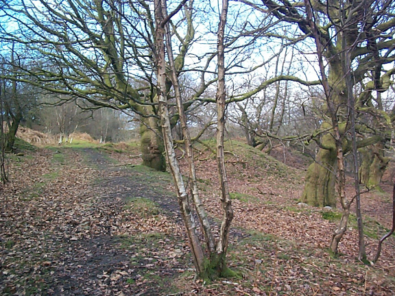
(Photo: GGAT Merthyr 070)
Cwm Glo: Tramroad, Plateway and Incline Corridor character area: extensive
network of inclines and tracks.
Summary
A transport corridor, comprising an extensive network of inclines and tracks connecting with the rail, tramroad and canal corridor. The area is also characterised by industrial extraction features, levels, shafts, pits and waste tops, along with water management features. It forms a nationally important industrial landscape associated with Cyfartha Iron works.
Historical background
The historic landscape area of Cwm Glo: Tramroad, Plateway and Incline Corridor comprises a network of inclines, plateways and tramroads connecting the extensive workings and tips within the Cwm Glo Valley and along the slopes below Blaen-canaid with the rail, tramroad and canal corridor (HLCA 014) to the east. The transport network of the area was established some time before 1814, as indicated by Surveyor's drawings of 1814, and 1826. Greater detail of the network of the period is provided by the 1st edition 6-inch OS map of 1875, detailing in particular the main north-south Tramroad from Cyfarthfa Ironworks via Coedcae and Cwm-glo pits to the quarries and level at Upper Black Pins Level (south), and the east-west Cwm-glo-Upper Wern Incline to the Cwm Pit Railway. In addition the 1875 map indicated a network of minor north-south tram or haulage roads gently traversing the slope below Blaen-canaid, these features, not shown as railed in 1875, could be early 19th or late 18th century in date and appear to have been associated with early workings mainly levels. The major industrial transport network developments during the period 1875-1898 were the abandoning of the Cwm-glo Incline with the closure of Cwm-glo Pit, and the development of the tramroad and incline system serving Cwmdu Drift, the latter was connected to the Cwm Pit Railway, just north of Lower Colliers Row (itself extant in 1875).
According to cartographic evidence, the main area of early (pre-1814) workings was along the southern side of the Cwm-glo Valley centred on Cwm-glo-fach, or the area between Cwm-glo Pit and Pen-y-coedcae. The early extraction industry largely depended on surface workings using a mixture of patching, shallow pits, and levels driven into the hillsides.
The deep pits of the area, such as the Cwm-glo (Robbins Pit) and Coedcae Pit, began to be sunk during the 1820s and 1830s, the boom years of iron ore and coal extraction. Water balance systems provided the main means of haulage within the shafts of the period; several of the reservoirs in the study area are likely to be relict features associated with this system. These included the Coedcae Reservoir and outlet leat, the Upper Wern Feeder, and the Lower Colliers Reservoir. The extraction of ironstone and coal in particular continued throughout the 19th century, fluctuating with economic demand. By the end of the 1920s, the area was largely derelict though there appears to have been a brief period of mining activity during the Second World War.
The settlement features of the area, such as the agricultural/industrial farmsteads of Pen-y-Coedcae and Pencae and the industrial Lower Colliers' Row with its associated allotments were all in place by 1814.