Historic Landscape
Characterisation
Merthyr Tydfil
047 Dowlais Top
HLCA 47 Dowlais Top Reclaimed industrial area, recent commercial, retail and light industrial area, site of industrial extractive landscape: quarries and spoil tips, rail corridor: Brecon and Merthyr Railway (including Dowlais Top Station) and sidings associated with Dowlais Iron Company Railway.
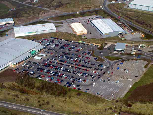
(Photo: GGAT Merthyr 047)
Dowlais Top character area: reclaimed industrial land redeveloped for
commercial, retail and light industrial use.
Summary
An area of largely reclaimed industrial land, now redeveloped for modern
commercial, retail and light industrial use.
Historical background
The historic landscape area of Dowlais Top comprises former industrial landscapes associated with the Dowlais Ironworks. The area to the north contained extensive workings, extant in 1814 and 1826 and connected to Dowlais and Dowlais Top by haulage or tramroad. These workings, depicted on later maps as quarries with numerous linear and lobed tips, were the remains of early surface or patch workings, and levels probably worked from the adjacent settlement of Penygarnddu (HLCA 035) and Dowlais Top. The workings, like those to the south (Ffos-y-fran HLCA 039) would have been largely redundant by the 1860s, confirmed by the apparent lack of associated railed tramroads depicted on the 1875 OS 6-inch maps. Rail and tramroad routes passed through the area: that of the Twynau Gwynion Tramroad ('Tramway' in documentary evidence) of 1805 to Dowlais Ironworks, later the Rhymney Limestone Railway of c 1864, and the B&M (Newport Branch) Railway c 1860-1865, opened 1863. The latter had a station at Dowlais Top, detailed on the 1st, 2nd and 3rd edition 6-inch OS maps (1875-1915). This survives to the present-day. A kiln was depicted in the area adjacent to the Twynau Gwynion Tramway in 1826, apparently still extant in 1875 as a limekiln adjacent to the Rhymney Limestone Railway. Leats associated with the Dowlais Free Drainage system (see neighbouring 5) also once existed in the area.
The area to the south comprises an open area of reclaimed industrial land to the south of Dowlais Top primarily a former rail corridor associated with Dowlais Iron Company Railway, which formerly contained lines and sidings in area north east of the charging bank and blast furnaces of Dowlais Ironworks. The lines served both the Dowlais and Ivor Works and connected tips, and the Dowlais coke yard. The present character of the area is that of a recreational landscape with sports facilities, football fields and until recently commercial provided by the site of recently demolished MacDonalds Restaurant, one of the earliest in the area.