Historic Landscape
Characterisation
Merthyr Tydfil
049 Bon-y-Maen
HLCA 49 Bon-y-Maen Modern industrial estate; former agricultural land; former industrial tramroad (on line of access road along north east side of HLCA)
Click here for a
character area map
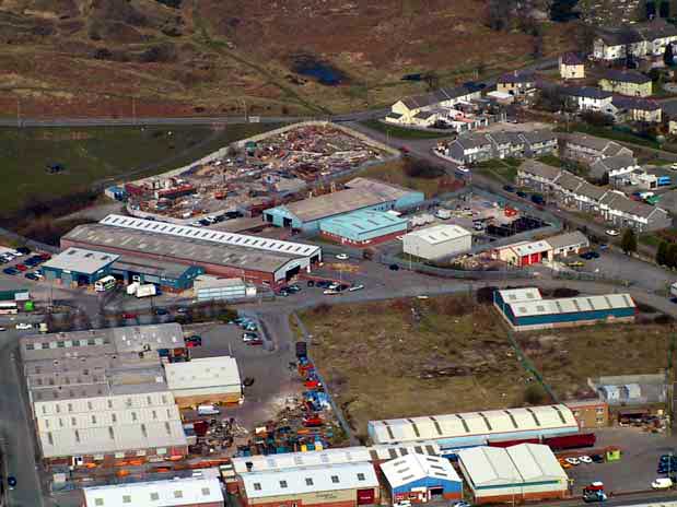
(Photo: GGAT Merthyr 049)
Bon-y-Maen character area: modern industrial estate.
Summary
A modern industrial estate built on the site of former agricultural land with a fieldscape of large but irregular fields, associated with the holding of Bon-y-maen.
Historical background
The historic landscape area of Bon-y-Maen was formerly similar to the adjacent surviving agricultural area of HLCA 052, and included a rectangular range of buildings, the post-medieval farmstead, on the southern edge of a very large sub-circular enclosure of unknown date to the north of Cwm Rhyd-y-Bedd. The northwest boundary of the area is formed by the Bryniau Road to Pant, while along the northeast is Heol Rhyd-y-Bedd, which formerly carried the line of the tramroad from Bryniau Quarry to the Dowlais lvor Ironworks, shown on maps between 1878/9 and 1915.
The entire area was radically changed during the 1930s when ICI established a works in the area, in operation by 1939. The construction of the Heads of the Valleys Road during the mid-1960s opened up the area to renewed commercial and industrial possibilities and in response the site of the old works area was developed as the Merthyr Tydfil Industrial Estate by the Borough in 1966. The current features of the area comprise mixed industrial and commercial units and a sports ground.