The Historic Landscape Character Areas (HLCAs)

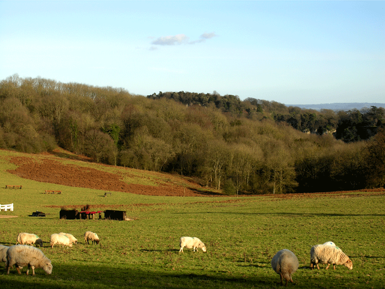
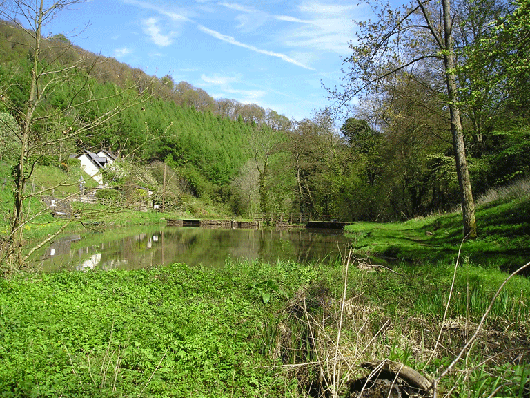
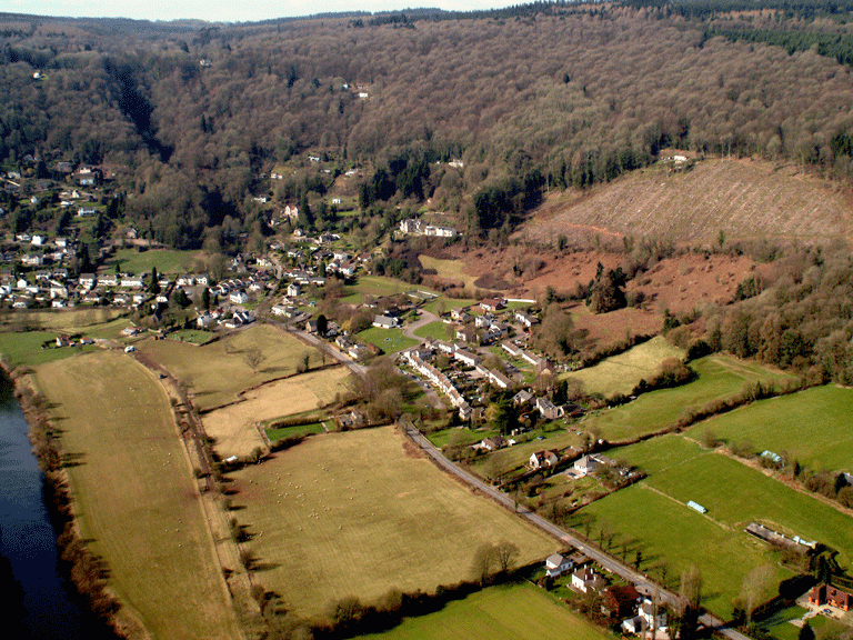
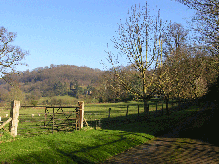
HLCA 001 The River Wye
Communication and coastal maritime corridor: bridges; weirs; fords; viaducts; ports/docks; ferries; harbour/fishing; ornamental/leisure and tourism; water supply resources. Back to map
Click here for further information about this Historic Landscape Character Area
Click here for a character area map

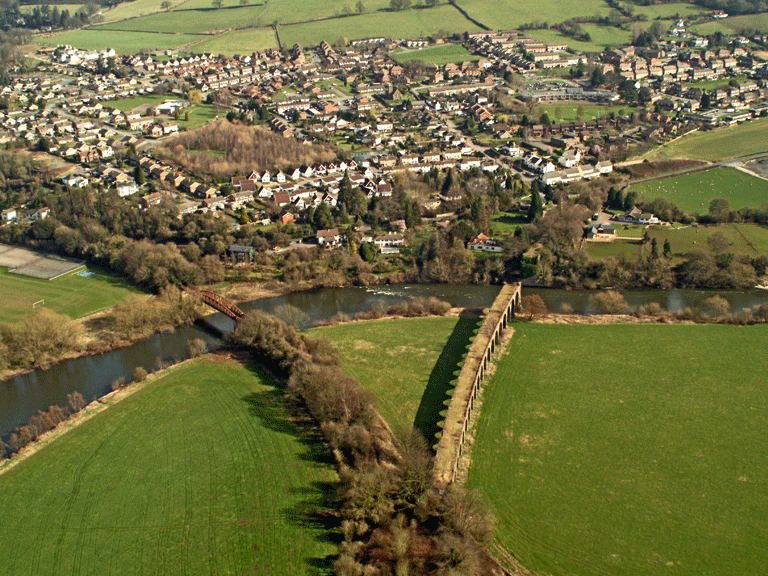
HLCA 002 Chepstow Transport Corridor
Communication and coastal maritime corridor: bridges; footbridges; railway bridges; riverfront and intertidal features, ports/docks; slipway; industrial Archaeology; public and industrial railway; relict/buried Archaeology: Prehistoric settlement; and Roman funerary and ritual (cremations). Back to map
Click here for further information about this Historic Landscape Character Area
Click here for character area map

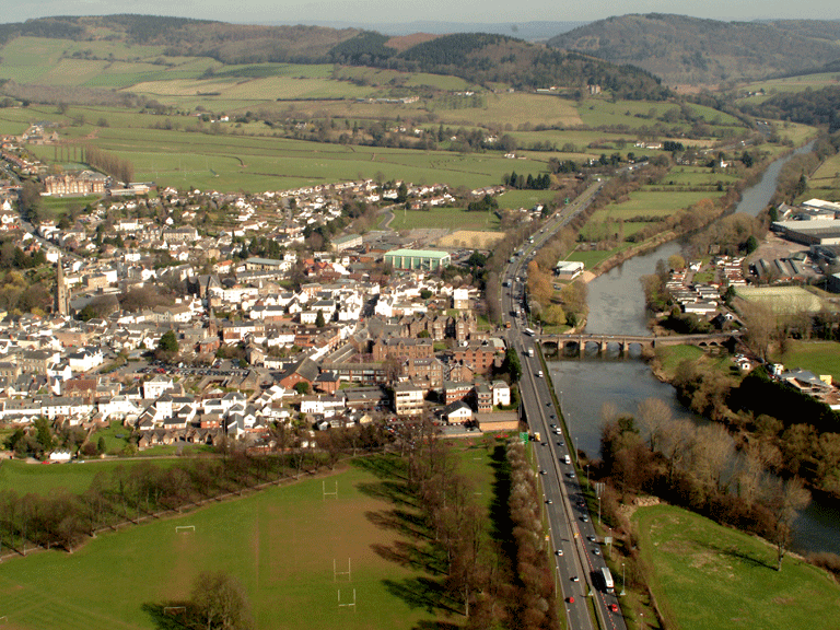
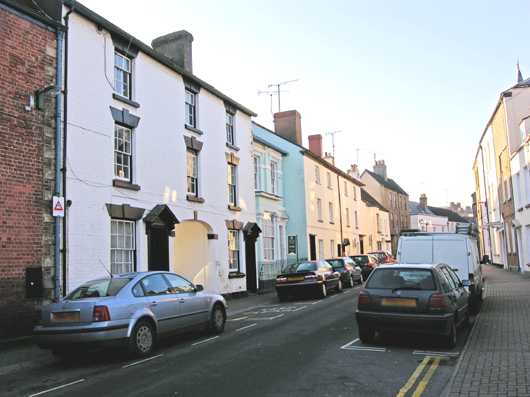
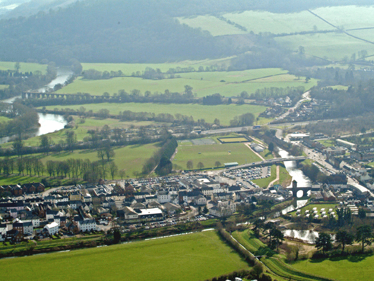
HLCA 003 Chepstow
Historic settlement core: Medieval walled town and early post-medieval extra-mural settlement: nucleated regular and organic (ie linear and irregular cluster); Post-medieval urban domestic, commercial, and civic buildings (medieval structures?); relict Anglo-Norman and medieval defensive; Medieval and Post-medieval ecclesiastic buildings (various); historic associations; communication features. Back to map
Click here for further information about this Historic Landscape Character Area
Click here for character area map
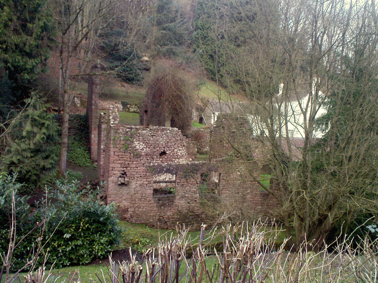
HLCA 004 Piercefield Park Ancient Woodland
Ancient Woodland within Piercefield Park : relict Prehistoric defensive archaeology; Post-medieval industrial extractive and processing features (eg limekilns); ornamental leisure: parkland (ornamental walks and viewpoints); tourism; communication features; historic associations (Picturesque Movement); woodland management. Back to map
Click here for further information about this Historic Landscape Character Area
Click here for character area map

HLCA 005 Piercefield Park
Core of Post-medieval gentry estate associated with the Picturesque Movement: Neoclassical mansion (ruins) and associated outbuildings; ornamental leisure: registered 18th century landscaped parkland and garden; historic associations (Picturesque Movement); Communication features. Back to map
Click here for further information about this Historic Landscape Character Area
Click here for character area map

HLCA 006 The Kymin
Possible encroachment settlement (ie squatter origins): irregular scatter (cottages within small irregular enclosures); communication features; traditional boundaries; broad-leafed woodland and scrub. Back to map
Click here for further information about this Historic Landscape Character Area
Click here for character area map
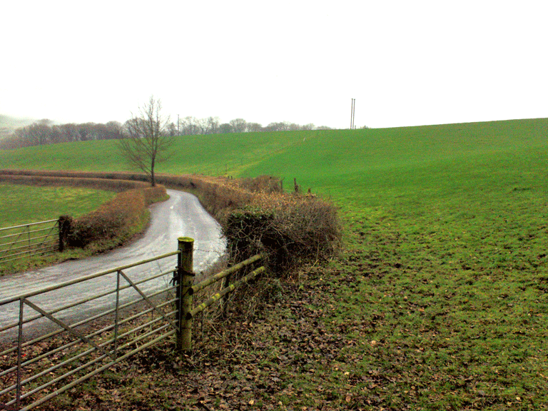
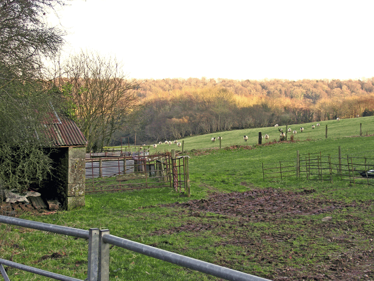
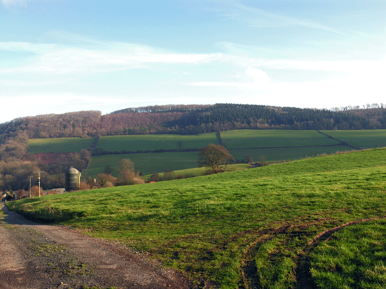
HLCA 007 Livox Farm
Agricultural landscape (single farmstead): regular fieldscape: large rectangular enclosures; traditional boundaries; communication features; buried archaeology; monastic associations. Back to map
Click here for further information about this Historic Landscape Character Area
Click here for character area map
HLCA 008 Reddings Farm
Agricultural landscape (single farmstead): semi-regular fieldscape: partially amalgamated; monastic holding Rudding Grange or "Assart Grange"; traditional boundaries; relict/buried archaeology: prehistoric finds and medieval grange features. Back to map
Click here for further information about this Historic Landscape Character Area
Click here for character area map
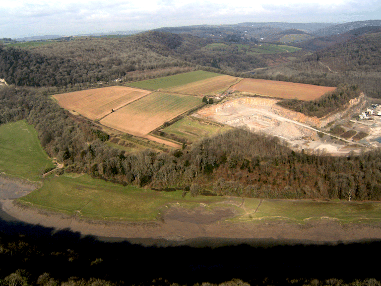
HLCA 009 Tintern Ancient Woodland and Barbadoes Hill
Ancient Woodland with scattered enclosures: post-medieval encroachment (eg. Barbadoes Hill); agri-industrial extraction and processing; relict archaeology: Prehistoric funerary and ritual and medieval/post-medieval settlement/fields; monastic associations (possibly Secular Firmary Grange and Coed-yr-Abad); historic associations; woodland management features/indications (potential). Back to map
Click here for further information about this Historic Landscape Character Area
Click here for character area map
HLCA 010 Dixton Transport Corridor
Transport and communication corridor: roads (Roman and post-medieval) and associated features; public rail; Post-medieval settlement and fields: settlement pattern dispersed farmhouses and cottages, and church; field pattern: regular; traditional boundaries; ecclesiastical features: medieval church and associated cemetery (on early medieval monastic site); relict/buried archaeology (Prehistoric/Roman and Medieval); education; industrial archaeology: metal processing, mill and cider house. Back to map
Click here for further information about this Historic Landscape Character Area
Click here for character area map
HLCA 011 Monmouth
Historic settlement core: Medieval/post-medieval settlement and associated Anglo-Norman castle; settlement pattern nucleated regular and organic (ie linear and irregular cluster); Post-medieval urban domestic, commercial, and civic buildings (medieval structures?); Anglo-Norman, medieval and post-medieval defensive features; relict and buried archaeology (multiperiod); communication features; Medieval and Post-medieval ecclesiastical features (churces, cemeteries and chapels); Industrial archaeology (eg. mill; brewery, site of tannery); historic associations. Back to map
Click here for further information about this Historic Landscape Character Area
Click here for character area map
HLCA 012 Fairoak Fieldscape
Post-medieval agricultural landscape: semi-regular fieldscape; traditional boundaries; Post-medieval dispersed settlement (farms and cottages); small planned settlement; relict archaeology; communication features; water resources (pond). Back to map
Click here for further information about this Historic Landscape Character Area
Click here for character area map
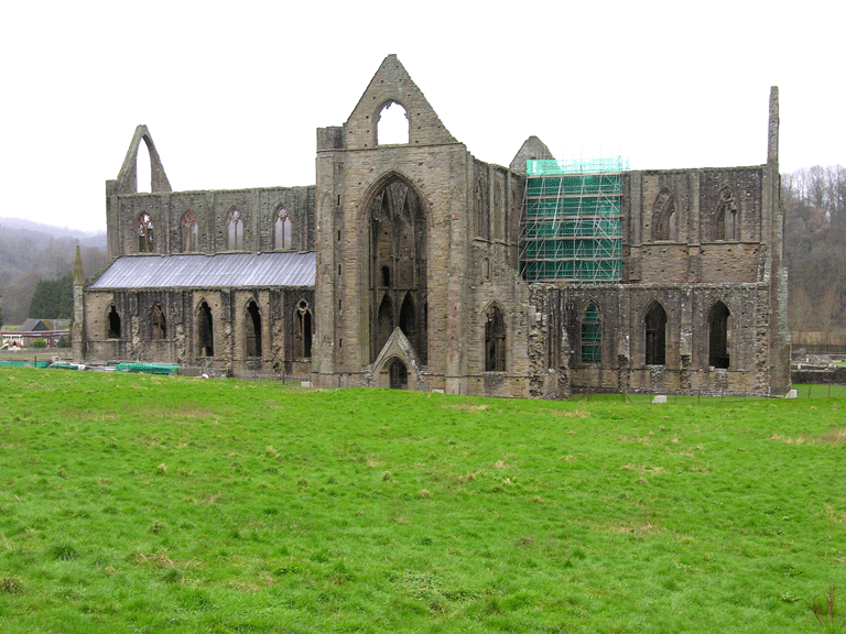
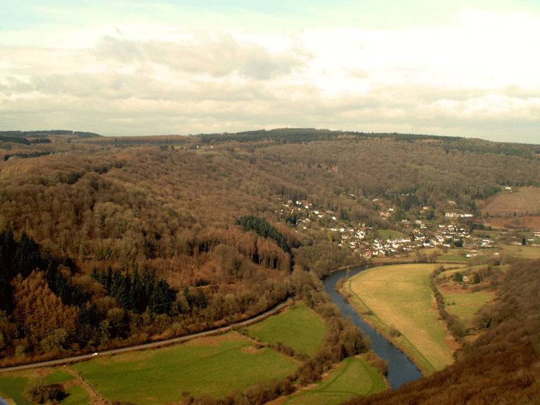
HLCA 013 Tintern
Monastic and settlement landscape associated with Picturesque Movement: relict archaeology: monastic (Cistercian Abbey of Tintern and significant associated monastic features); historic associations & ornamental/leisure and tourism (Picturesque Movement); industrial archaeology; medieval and post-medieval settlement/fields: organic cluster and later ribbon development settlement pattern; distinctive vernacular style (reuse of former conventual structures); traditional building materials and distinctive boundaries; communications; and wooded setting. Back to map
Click here for further information about this Historic Landscape Character Area
Click here for character area map
HLCA 014 Angidy Valley
Industrial landscape: relict industrial archaeology: metal processing; mills; quarrying; water management features (weirs, leats and dams); communication features (inluding industrial rail and bridges); Post-medieval industrial settlement (informal dispersed pattern of Georgian style houses and cottages with associated enclosures; distinctive vernacular style; post-medieval settlement features/building types (non-conformist chapels; public house; 19th century school); historic and monastic associations (monastic land); traditional boundaries. Back to map
Click here for further information about this Historic Landscape Character Area
Click here for character area map
HLCA 015 Upper Redbrook Fieldscape
Medieval/Post-medieval agricultural landscape: varied pattern of small - medium fields; settlement predominantly dispersed farmsteads; traditional boundaries; relict archaeology: medieval monastic settlement/fields (Beaulieu or Grace Dieu Grange); communication features (eg. incline over bridge, and industrial rail). Back to map
Click here for further information about this Historic Landscape Character Area
Click here for character area map
HLCA 016 Tintern Parva
Medieval/Post-medieval settlement: nucleated cluster, ribbon development and dispersed farmsteads and cottages; relict archaeology: medieval and post-medieval settlement/fields; monastic (former manor/Hospice at Tintern Parva); 19th century settlement features/building types (place of worship, police station, public houses); communication features; Medieval/Post-medieval ecclesiastical (church and cemetery and non-conformist chapel); varied agricultural field pattern, some amalgamation, other areas reverting to scrub woodland; Ancient Woodland; industrial archaeology (malthouse, smithy and wharf). Back to map
Click here for further information about this Historic Landscape Character Area
Click here for character area map
HLCA 017 Wye Valley Railway South
Communication/transport corridor: major roads; public rail (station buildings and signal box); regular agricultural field pattern: large meadows, and some strips; settlement pattern: dispersed farmsteads; industrial archaeology: metal processing, cider production; ornamental leisure and tourism. Back to map
Click here for further information about this Historic Landscape Character Area
Click here for character area map
HLCA 018 Chippenham
Registered park (PGW (Gt) 6), 20th century garden/park now a sports and recreation ground; ornamental leisure: sports facilities (tennis courts, bowling green, football, rugby); buried and relict archaeology: historic common in Monmouth (stones and winning post OS 1st edition); Post-medieval settlement/fields (Chippenham Cottage); boundaries of adjacent properties (railings and gate piers). Back to map
Click here for further information about this Historic Landscape Character Area
Click here for character area map

HLCA 019 Highmeadow Woods
Ancient Woodland: woodland management features: charcoal burning hearths; relict industrial archaeology: charcoal burning at Priory Grove; and quarrying; communication: footpaths (picturesque walk through Beaulieu wood); public rail (dismantled Ross-Monmouth railway); Roman road (OS 1st edition); ornamental/leisure; tourism (picturesque walk and viewing platforms); woodland boundaries. Back to map
Click here for further information about this Historic Landscape Character Area
Click here for character area map
HLCA 020 Hadnock Fieldscape
Agricultural landscape: varied irregular pattern of curvilinear fields at the centre of the area (fossilized medieval open fields?), some 20th century amalgamation in south; traditional boundaries; Medieval/Post-medieval settlement/fields; settlement pattern: dispersed farmsteads and cottages (including minor gentry house Hadnock Hall); buried and relict archaeology: Roman settlement (villa), finds and industrial archaeology; communication features (including hollow way /Roman Road); public rail). Back to map
Click here for further information about this Historic Landscape Character Area
Click here for character area map
HLCA 021 Newton
Agricultural landscape: irregular pattern of irregular fields (minor 20th century amalgamation and sub-division); traditional boundaries; Medieval/Post-medieval settlement/fields: loosely dispersed settlement pattern of farms and cottages and a linear group of minor gentry houses (Newton Court and Hall); relict/buried industrial archaeology: medieval mill and metal processing sites (also additional potential for prehistoric, medieval and post-medieval buried features); communication features (sunken lanes); traditional boundaries (high mortared walls and earthen banks); historic associations; mixed woodland, and orchard. Back to map
Click here for further information about this Historic Landscape Character Area
Click here for character area map
HLCA 022 Cuckoo Wood
Ancient Woodland with isolated post-medieval encroachment of smallholdings and walled enclosures: relict industrial archaeology: quarrying; traditional boundaries (dry-stone walls) and other boundary features (eg The Resting Stone); communication features. Back to map
Click here for further information about this Historic Landscape Character Area
Click here for character area map

HLCA 023 Hayes Coppice
Ancient Woodland with irregular enclosures associated with Newton Court: mixed parkland planting; industrial archaeology: quarrying; communication and boundaries (estate walls) and boundary features; relict Archaeology: potential for woodland management features. Back to map
Click here for further information about this Historic Landscape Character Area
Click here for character area map
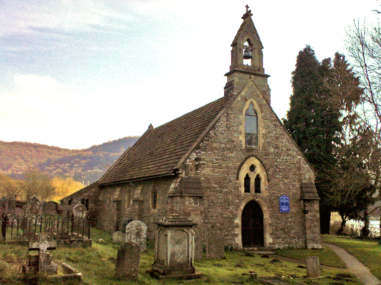
HLCA 024 Llandogo
Medieval/Post-medieval settlement with early medieval origins and associated agricultural hinterland: settlement pattern: nucleated cluster around church; ribbon development and irregular cluster on slope; typical 19th/20th century settlement features/building types; ecclesiastical: medieval/post medieval church and cemetery (early medieval origins); post-medieval chapel; traditional boundaries; varied irregular enclosure/field pattern: small wooded (orchards?) enclosures associated with settlement, medium to large irregular fields around Rectory; Communication features. Back to map
Click here for further information about this Historic Landscape Character Area
Click here for character area map

HLCA 025 Pilstone
Agricultural landscape: irregular evolved pattern of small - medium-sized irregular fields some 20th century amalgamation, plantation and orchards located around farms; traditional boundaries; dispersed settlement of isolated farmsteads and Pilstone House and garden; distinctive vernacular style: 16th century farmhouse (Pilstone Farm), and Victorian gentry house (Pilstone House); communication features; mixed woodland (& orchards). Back to map
Click here for further information about this Historic Landscape Character Area
Click here for character area map
HLCA 026 Pen-y-Fan
Evolved irregular agricultural landscape with dispersed settlement: varied small-medium enclosures, including initial and successive irregular enclosures and more regular infilling; traditional field boundaries; scrub/unmanaged land; orchards; settlement pattern: loose dispersed scatter of houses and cottages, basically smallholdings; Communication features; tourism (Swiss chalet caravan park). Back to map
Click here for further information about this Historic Landscape Character Area
Click here for character area map
HLCA 027 Hael Woods
Ancient Woodland with dispersed wooded irregular encroachment and scattered (ribbon development) post-medieval? settlement (the Birches): industrial archaeology: metal processing (early Whitebrook wireworks site); quarrying (including millstones); limekilns; cider presses/mills; water management: leats, reservoir, dam (association with Whitebrook wireworks); historic associations; woodland management features; boundary features (boundary stones). Back to map
Click here for further information about this Historic Landscape Character Area
Click here for character area map
HLCA 028 The Narth
Irregular post-medieval and 20th century settlement on the edge of Trellech Common: scatter of post-medieval farmsteads and cottages with recent dense, though irregular development of bungalows and houses; irregular evolved fieldscape of small irregular enclosures, minor amalgamation and subdivision for building plots; good 19th century vernacular buildings; mixed woodland; traditional boundaries; communication features. Back to map
Click here for further information about this Historic Landscape Character Area
Click here for character area map
HLCA 029 Whitebrook Valley
Primarily industrial settlement: loose dispersed scatter and small clusters/ribbon development of cottages and larger houses/farms; varied enclosure pattern with irregular evolved enclosures and regular rectilinear enclosures; post-medieval settlement features/building types; industrial archaeology; mills (paper, corn and cider mills, and former wireworks); possible iron forge site (slag heap) and quarries; water management features associated with mills: reservoirs, leats and sluices; wells associated with settlement; communication features; traditional boundaries; mixed woodland and coniferous plantation. Back to map
Click here for further information about this Historic Landscape Character Area
Click here for character area map
HLCA 030 Tregagle and Pen-twyn Fieldscape
Varied agricultural landscape: evolved irregular pattern of small fields (heavily wooded) around Tregagle, elsewhere larger curvilinear, rectilinear and sub-rectangular enclosures (partially amalgamation); loosely dispersed settlement of farms and cottages; scrub/unmanaged land; relict archaeology: medieval/post-medieval settlement/fields, prehistoric finds; communication features. Back to map
Click here for further information about this Historic Landscape Character Area
Click here for character area map
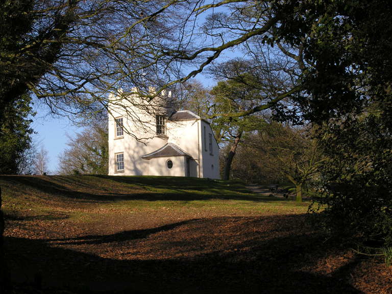
HLCA 031 Kymin Naval Temple
Registered parkland and garden with commemorative temple: ornamental/leisure (tower/folly/viewpoint); distinctive building type: picturesque pavilion and memorial; historic associations: persons; events; and Picturesque Movement; tourism (National Trust property); Ancient Woodland; communication features. Back to map
Click here for further information about this Historic Landscape Character Area
Click here for character area map
HLCA 032 Pen-y-garn and Church Hill Common
Varied landscape of amalgamated former irregular evolved enclosure and more regular post-medieval enclosure (improved common); small parcel of surviving common; medium-sized regular and large amalgamated enclosures (former irregular fieldscape); traditional boundaries; broadleaf woodland and scrub/unmanaged land; relict archaeology: medieval settlement/fields (deserted medieval settlement?); communication features. Back to map
Click here for further information about this Historic Landscape Character Area
Click here for character area map
HLCA 033 The Garth and Wyesham Fieldscape
Varied agricultural landscape: medium-sized slightly irregular fields (result of field amalgamation) and regular fields); traditional boundaries; settlement pattern: loose dispersed scatter of farmsteads and cottage, country house/vicarage (the Garth); communication features; ecclesiastical/monastic association: the Garth (medieval hermitage and appropriated church/monastic landholding); potential relict/buried archaeology: medieval settlement/fields; historic associations. Back to map
Click here for further information about this Historic Landscape Character Area
Click here for character area map

HLCA 034 Penallt
A small loose organic clustered settlement of farmsteads and cottages with associated enclosures focused on Penallt Old Church (St Marys); relict/buried archaeology; possible medieval shrunken village and fieldscape; varied field pattern of evolved irregular enclosures at core of settlement; more regular elsewhere; traditional boundaries (including dry-stone walls); ecclesiastical features: Medieval/post-medieval church and cemetery; communication features; Ancient Woodland and scrub/unmanaged land. Back to map
Click here for further information about this Historic Landscape Character Area
Click here for character area map
HLCA 035 Wyesham
Post-medieval (19th century suburban clustered and mid-20th century planned nucleated) settlement dominated by transport and communication; 20th century housing estates (social and private), leisure facilities (Tennis courts and school playing fields, and sports ground) and industrial estates; post-medieval and 20th century settlement features/building types; communication features (major roads; disused industrial and public rail); ecclesiastical features: medieval chapel and19th century church (St James) and cemetery; site of post-medieval (19th century) industrial features. Back to map
Click here for further information about this Historic Landscape Character Area
Click here for character area map
HLCA 036 Troypark Wood
An area of Ancient Woodland (wider setting of HLCA038) with small enclosures and sheepfolds; traditional boundaries; industrial archaeology: quarries; cider mill; communication features; settlement pattern: rare dispersed farmstead and other minor structures. Back to map
Click here for further information about this Historic Landscape Character Area
Click here for character area map

HLCA 037 Troy Farm Fieldscape
Agricultural landscape and associated essential setting for Troy House (HLCA038): regular fieldscape of medium-large enclosures associated with planned home farm; varied traditional boundaries; characteistic buildings: farmstead and outbuildings (Home Farm); estate cottages and lodges (some in picturesque vernacular style); relict/buried archaeology: prehistoric-post-medieval settlement/fields; industrial archaeology: Roman bloomery; post-medieval? Tuck mill; relict ornamental/leisure: post-medieval garden and parkland features associated with Troy House (eg Old Parke area, ponds, conduits, and grotto); historic associations; communication features. Back to map
Click here for further information about this Historic Landscape Character Area
Click here for character area map
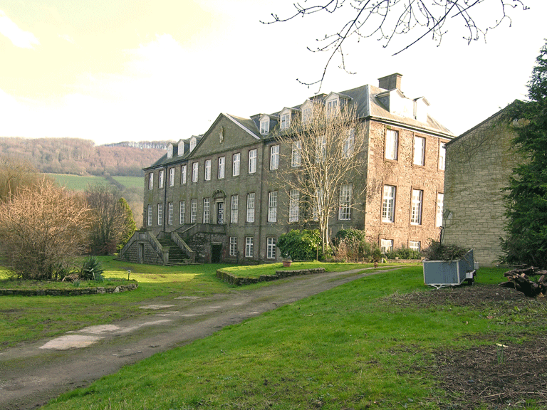
HLCA 038 Troy House
Post-medieval country house in Classical style, Troy House, within associated registered park and garden of 17th18th century date; relict archaeology post-medieval settlement/fields; country house and associated outbuildings, eg school building additions, ice house; ornamental/leisure: parkland and garden; historic associations. Back to map
Click here for further information about this Historic Landscape Character Area
Click here for character area map

HLCA 039 Wye Valley Railway North
Communication/transport corridor: major roads (A466); milestones; public rail (Wye Valley Railway); agricultural field pattern: large regular enclosures, meadows; traditional boundaries; Ancient Woodland; ornamental leisure and tourism (part of the Wye Valley walking route). Back to map
Click here for further information about this Historic Landscape Character Area
Click here for character area map

HLCA 040 Lord's Grove Woodland
Area of Ancient Woodland: other broadleaf woodland; relict industrial archaeology: quarries; communication features (including industrial Rail). Back to map
Click here for further information about this Historic Landscape Character Area