Historic Landscape Characterisation
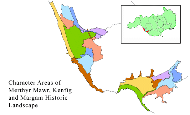
Merthyr Mawr, Kenfig and Margam Burrows
Accumulations of wind blown sand have formed considerable areas of littoral dunes at a number of points along the South Wales coast, with their distribution primarily controlled by coastal topography and by the prevailing westerly winds. They are commonly found in the bays, where their extent is controlled by the size of the bay and the relief of the hinterland. Historical evidence indicates that the processes of be-sandment were very active in the later medieval period, during the 13th t o 15th centuries, with a deterioration of climate and a noticeable increase in be-sanding as the result of storms, higher rainfall and abnormal tides, all occurring in combination. These conditions led t o the erosion of coastal sand dunes and the movement of material inland.
Use the map to select your area of interest or go directly to character area summaries.
Merthyr Mawr, Kenfig and Margam Burrows are two discrete areas of dunes situated on the west coast of Glamorgan and they present the supreme examples in South Wales of these natural and uncontrollable forces, and the significant impact they had on earlier societies. Inevitably, two landscapes are represented, the one at Margam and Kenfig as the be-sanded landscape that essentially derived from adverse weather conditions and tidal phenomena in the Middle Ages and perhaps earlier, and the other at Merthyr Mawr as a generally more ancient landscape with archaeological sites completely buried by these natural forces.
Merthyr Mawr Warren
Merthyr Mawr Warren is located on the north west side of the estuary of the River 0gmore.The dune system is much higher than at Kenfig, reaching a height of 80m above OD, and tending to dominate prospects of the estuary and the immediate hinterland around Merthyr Mawr, which, as defined here, includes Ogmore Castle on the opposite bank of the estuary to the dunes.
Over the last century, the dunes have produced a diverse range of archaeological material indicating occupation and activity from the Mesolithic period to the recent past, through the recurrent exposure of buried archaeological features and surfaces caused by the movement of sand. The archaeological potential of the dunes is extremely high, since records of finds suggest occupation sites of the Mesolithic, Neolithic, early Bronze Age (represented by cist graves and tumuli) and Iron Age (with evidence of metalworking). In historic times, medieval occupation is attested by finds of pottery, walling, shell middens, cultivation ridges, roads, boundary stones, and a windmill of possible 15th century date sited on top of the dunes. Movement of the dunes continues and Candleston Castle, a ruined, small, fortified manor house originally built mainly in the late 14th century, was occupied into the 19th century, but now stands up against the eastern edge of the dunes with its land completely buried in sand.
Merthyr Mawr is typical of the villages of the vale of Glamorgan to the east (q.v. Llancarfan,Vale of Glamorgan, p. 50).The medieval church has a collection of Early Christian stones suggesting it might originally have been a monastic clas foundation (a unit of administration based on medieval monastic settlement). Ogmore Castle, a Norman stronghold to the south, is a 12th to 14th centuries masonry castle strategically sited next to a tidal ford across the Ewenny River, a tributary to the Ogmore. It was originally built in earth and timber with a ditch designed to fill with water at high tide, and the early 12th century stone keep subsequently placed within the inner ward is probably one of the oldest Norman stone buildings in South East Wales.
Kenfig and Margam Burrows
These dunes lie about 7km north west of Merthyr Mawr, on the coastal plain between the sea and Margam Mountain to the north, and they have retained their distinctive and striking appearance despite having been bisected by modern rail and motorway communication systems on their eastern fringes. They are much lower, but more extensive than the Merthyr Mawr dunes. Historically and archaeologically, the Kenfig area is rich in the evidence of the past, and includes the be-sanded castle and fortified borough of Kenfig, which have been described as the Pompeii of Britain. Although Kenfig was probably a Norman foundation, other archaeological finds of the prehistoric, Roman and Dark Age periods from the immediate area indicate that it was favoured for settlement from an early date.
The lordship, castle and early medieval borough of Kenfig derived their name from the once important river, the River Cynffig, which rises on Margam Mountain 6km to the north. The castle is situated on its south bank, 2km from the present estuary, though this is of late medieval origin. Originally a broad estuary existed which extended inland almost to the site of the castle, and this early and important geographical feature is evident today by the large land-locked Kenfig Pool and lesser ponds to the north. This original topography made the castle of Kenfig and its attendant borough strategically and militarily significant as they were placed on a port and river of some consequence.
The extensive dunes of Kenfig Burrows so conceal the buried castle and borough that they may best be located in relation to modern features, which in fact, in their own right today, bear testimony to the important position of Kenfig on communication lines. The castle borough lies immediately south of the mainline railway, and some 300m west of the point at which an elevated section of the M4 motorway crosses the railway. The castle cannot lie far from the point where the Roman road from Cardiff to Neath crossed the River Kenfig. This ancient road, the medieval Martima or Port Way, was of Roman origin and the siting of the castle on this strategic thoroughfare, where the river meets the sea, was particularly well chosen.
The strategic and exposed position of the castle borough as the western outpost of the Lords of Glamorgan in the 12th century accounts for its exceptionally full documentary record. Between 1167 and 1321 the Welsh, now confined to the nearby uplands of Margam Mountain, made no less than eight recorded attacks on Kenfig. Today landscape reflects much of the conflict between these warring factions, the one conquering arid enjoying the rich lowlands, the other ousted and confined by military might to the hills within viewing distance of Kenfig's walls.
Both Kenfig Castle and the Church of St James are first mentioned in the period 1135-54. It is clear therefore, that the borough with its recorded church had been founded at the latest by the middle of the 12th century and had been provided with earth and timber defences. In the middle of the 14th century, Kenfig was a substantial borough of perhaps 700-800 persons. 'High','East' and 'West' Streets are recorded, as well as a chapel to St.Thomas, the Guildhall and a maladaria (hospital or leper house). Clearly the borough was flourishing at this time, though during the 15th century the situation deteriorated rapidly through sand encroachment.
By 1470, the town had been virtually abandoned. The following year the burgesses were instructed to leave their church and move to Pyle, where a new settlement was developing. By the 1530s the antiquary Leland noted only 'a village on the est side of Kenfik, and a Castel, both in ruins and almost shokid and devoured with the sandes that the Severne se there castith up'. By 1572, only three burgesses remained, while a borough survey of 1665 recorded only a single family living 'on the site of the ould castle'.
Sker House, which has been included on the south side of the area, was formerly a grange belonging to Neath Abbey.