Historic Landscape Characterisation
Llancarfan
The Vale of Glamorgan, otherwise known as Bro Morgannwg, is a distinctive lowland landscape formed on a gently rolling limestone plateau dissected by shallow valleys, and extending from the outskirts of Cardiff to the east, practically to Bridgend in the west. In its broadest sense the Vale of Glamorgan is traditionally taken to embrace all the lowland area from the coast to the Pennant Sandstone scarp in the north, which effectively marks the hard boundary of the Blaenau or less fertile uplands of Glamorgan. However, the more typical and geographically uniform area lies south of the modern A48, between Barry and the River Ogmore, where the historic character of the landscape, including the large churches and the settlement pattern, is generally untypical of Wales, reflecting more the landscapes across the border in England.
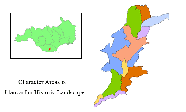
Use the map to select your area of interest or go directly to character area summaries.
The countryside and its nucleated villages within the rural vale are well known for their historic and attractive character. The surrounding agricultural landscape is also rich in hedgerows, trees and small woodlands, many of which are of considerable age. Historically the vale has been an important farming area whose fertility is owed to its shallow but freely-drained soils, which provide excellent land for tillage and pasture, praised by Rice Merrick in the 1580s as consisting of 'pleasant meadows and fruitful pastures, the plains fertile and apt for tillage, bearing abundance of all kinds of grain'.
The villages are characterised by their rural nature, examples of agricultural vernacular architecture and ecclesiastical buildings. The entry roads into the villages are often sunken and hedge-lined, whilst within the settlements stone walls are a prominent feature. Other elements, which are essential to the distinctive vernacular tradition and character of the villages, are the rural buildings (often whitewashed and with small windows and high pitched roofs), their craftsmanship and distinctive construction materials, open spaces and mature flora.
The ancient settlement and secluded valley of Llancarfan, situated in the central plateau of the vale, is one of the best surviving and most complete, typical example of the historic landscape of the Vale of Glamorgan as a whole. The setting of the large church within its picturesque, nucleated village is typical of the strong, monastic and Anglo-Norman influences in the vale, as demonstrated elsewhere such as Llandough, Llantwit Major and Merthyr Mawr. The focal setting of the ancient church at Llancarfan, itself testimony to early Welsh Christianity, can also be regarded as typical of the regional settlement pattern as a whole.
The area delineated here extends from the confluence of the Nant Llancarfan stream with the Kenson River and Llancadle in the south, northwards to the Nant Llancarfan watershed. Here it is defined by the modern A48 near Bonvilston, which is the accepted line of the Roman road from the known auxiliary forts of Cardiff westwards to Neath. The western limits are defined by the minor road running south to Llancadle, with prominent hill contours delineating the eastern limits. The area nowhere exceeds a height of 94m above OD.
The name Llancarfan is derived from the church (llan) and the stream (Nant Carfan or Brook of Stags). The current name is a corruption which first appears in the 12th century. The settlement of Llancarfan and its river valley are of considerable archaeological interest. The earliest evidence of settlement is the large Iron Age hillfort, Castle Ditches, located to the east of the village.
The present church owes its foundation to Cadog ap Gwynllyw, one of the most famous of the 6th century Welsh saints and contemporary of St David. His foundation, built at Llancarfan at a ford, which survives, was of the usual monastic pattern, consisting of a clas or community of monks, with an Abbot and other officers, including a priest or chaplain, a minister or doctor and canons. The monastery was destroyed by the Danes in AD 988. In 1093-94, the Normans invaded Glamorgan and took possession of the monastery, forcing Llancarfan to relinquish its domination over the parish. The monastery was given by Fitzhamon, the Norman lord of Glamorgan, to the Benedictine Abbey of St Peter's, Gloucester, at the end of the 11th century when, as a consequence of conquest, it was reduced to the status of a parish church. The present church of St Cattwg dates from the 14th century, though there is evidence of earlier, 12th century work. A fragment of a shaft of a pillar cross with carved triple looped knotworks, dating from the late 9th or early 10th centuries, is the only surviving relic of the pre-Norman Celtic Church. The church and Nant Llancarfan became the focal points of later settlement, giving rise to much local industry employing water power for corn and woollen mills in the village.
Llancarfan and the surrounding area identified here are thus significant as being one of the best surviving, most typical historic section of the whole of the Vale of Glamorgan and the diversity of past influences which have moulded it into its present form. Equally, the ancient settlement and its early church, set within its distinctive valley, preserves its own special historic identity and links with the past.