Lower Wye Valley
018 Chippenham
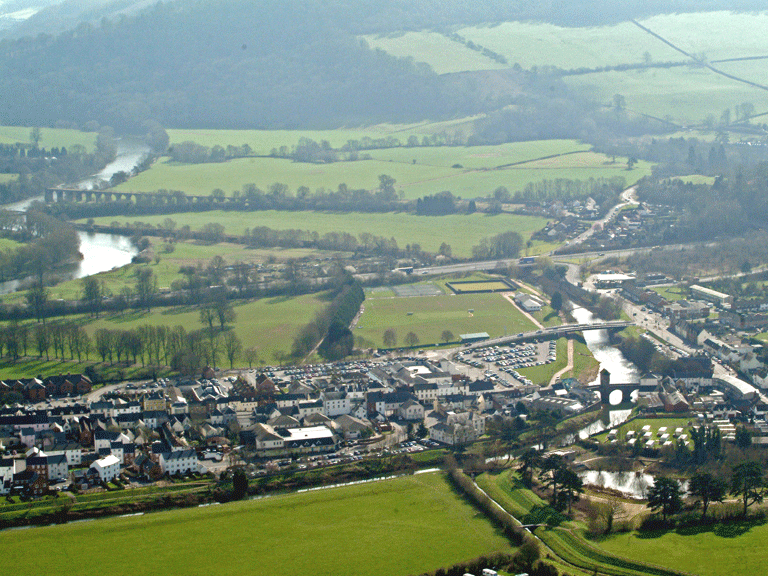
HLCA 018 Chippenham
Registered park (PGW (Gt) 6), 20th century garden/park now a sports and recreation ground; ornamental leisure: sports facilities (tennis courts, bowling green, football, rugby); buried and relict archaeology: historic common in Monmouth (stones and winning post OS 1st edition); Post-medieval settlement/fields (Chippenham Cottage); boundaries of adjacent properties (railings and gate piers). Back to map
Historic Background
The historic landscape area of Chippenham is an area of public parkland that lies on low flat ground in the centre of Monmouth bounded by the town of Monmouth itself to the north and northwest and the Monnow to the south and the modern A40 to the southeast and northeast, the area had formerly extended as far east as the River Wye but was curtailed by the construction of the A40 road. The part of the area that remains to the east of the A40 is now in use as allotments and flood plains for the river.
Chippenham fields have a history of use dating back to the medieval period when they are mentioned in relation to the town of Monmouth itself as an area used for the grazing of animals following the harvest there; presumably some sort of crop was kept up in the area for the remainder of the year. A toll was charged to all those wishing to use the field for animal grazing. Kissack (1974 & 1989) states that the gate known as Chippenham Gate does not appear to have been a part of any defensive system or a gate in the town wall but was the point at which tolls were collected from graziers using the field after the hay had been cut.
The area was common land during the medieval period and survived as such until the nineteenth century. Horses and cows were allowed to graze the area between September and February (Heath 1804). The area also provided a convenient place for leisure activities, when the Chippenham Fields were referred to as 'an agreeable plain.the general rendezvous of Gwentonian beauty on summer evenings' (Barber 1803), and throughout the 19th century the area was used regularly to host horse racing.
Today the field is host to a number of sports pitches, greens and courts. It is in use as a public open space specifically for leisure and is protected as a registered park (PGW (Gt) 6) and is also a designated conservation area. A number of footpaths also take in the park on their route.
Historic Landscape Characteristics
Chippenham is a public park in the centre of Monmouth, it is protected as a registered park (PRN 06113g, PGW (Gt) 6) that has been evaluated as a Grade II and designated as a conservation area. The park toady can be characterised as a public open space that is dedicated to leisure activities.
The south of the park is dominated by sporting leisure facilities, a bowling green, tennis courts and sports ground are located here, the remainder of the park to the north is an area of open recreation ground that is occasionally used as a rugby field. This area of the park is dissected by three straight paths and is grassed and lined with deciduous trees, which were laid out by the Improvement Association in around 1909.
There is the potential for buried archaeology to exist within the character area, for example the now demolished Chippenham Cottage shown on the 1881 First Edition OS map.