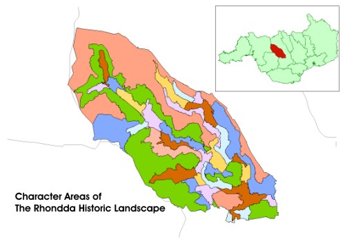
Historic Landscape
Characterisation
The Rhondda
The Rhondda represents a rare and important historic landscape and as such is included in the national Register of Landscapes of Historic Interest in Wales: Part 2:2: Landscapes of Special Historic Interest (2001). Landscape characterisation, which is the purpose of this report, has fully substantiated this view and makes recommendations for the proactive and long-term management of the area.
This important South-Wales historic landscape has been chosen through
professional consensus and represents one of the largest and best-known
mining conurbations and coalfield communities in Britain. The wider landscape
is rich in a diverse and thematic archaeological resource of many periods
and types, showing a high degree of cultural interest and continuity.
Currently, however, the area is actively under threat from a wide variety
of agencies, both public and private, in particular from landscape improvement,
reclamation and urban renewal schemes. These are occurring at a time when
there is not yet a full appreciation of the value and condition of the
archaeological resource, both industrial and earlier, and particularly
in landscape terms.
Therefore, it is both opportune and welcome that this project has been instigated, commissioned and funded by Cadw: Welsh Historic Monuments as part of a wider pan-Wales initiative. It is hoped that this report will provide the catalyst for the urgent consideration of the future conservation of the Rhondda.
The Rhondda Historical Processes, Themes and Background
- The Natural Landscape
- The Geological Background
- The Administrative Landscape
- Funerary, Ecclesiastical
and Legendary Landscapes
- Pre-industrial Settlement
Landscapes
- Agricultural Landscapes
- Military and Defensive Landscapes
- Parkland and Picturesque
Landscapes
- Transport and Communication
- Industrial Background
- Industrial Urban Landscapes and Urban Characterisation
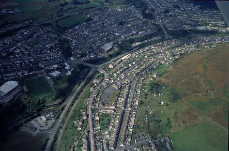
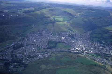
HLCA 001 Porth: Gateway to the Rhondda Valleys
Significant commercial and service centre; composite colliery settlement;
early industrial settlement area with contemporary housing and early colliery
development; characteristic built features, mostly late 19th/early 20th
century, include terraced housing, chapels, churches, public buildings,
shops and workmen's institutes; the current settlement is a nucleated
conurbation centred on a later commercial core; transportation/distribution
focal point; early centre of non-conformist Christianity.
(Back to map)
Click here for further information
about this Historic Landscape Character Area
Click here for a
character area map
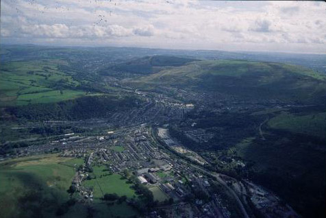
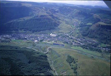
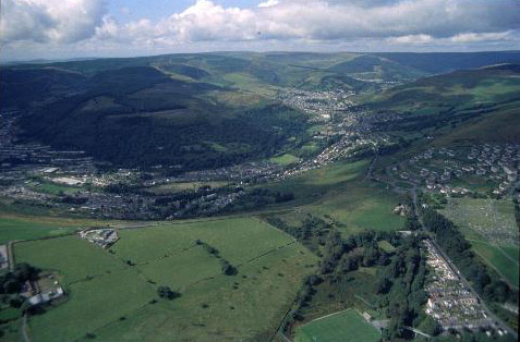
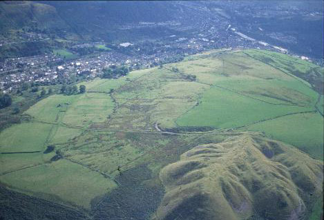
(Photo: GGAT HLCA001)
Porth, view east from Dinas with Mynydd-y-Glyn in the background.
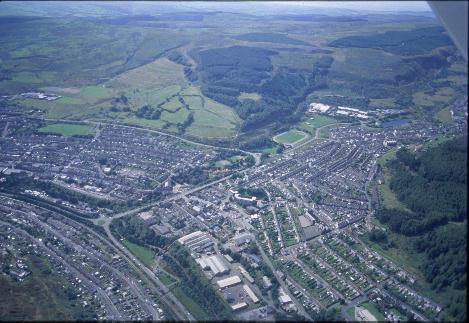
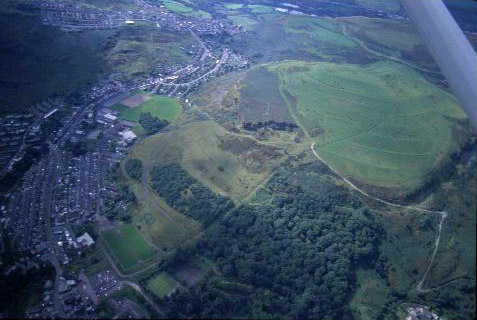
(Photo: GGAT HLCA002)
Rhondda Heritage Park, foreground with part of Trehafod and Mynydd-y-Glyn in background.
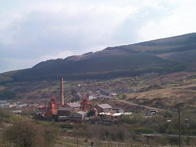
HLCA 002 Hafod
Two linear first phase 'pithead' colliery settlements, originating
as a scatter of isolated terraced rows and cottages, ribbon development
and superimposed late 19th century grid-layout; retains typical terraced
housing, commercial properties and chapels; little commercial development;
surviving industrial monuments, Rhondda Heritage Park.
(Back to map)
Click here for further information
about this Historic Landscape Character Area
Click here for a
character area map
HLCA 003 Penygraig
First phase pithead colliery settlement with earlier nucleated origins,
later industrial ribbon development and late 19th century imposed grid-layout;
retains typical terraced housing, commercial properties and chapels; early
council housing; moderately developed commercial centre; cultural/historical
associations.
(Back to map)
Click here for further information
about this Historic Landscape Character Area
Click here for
a character area map
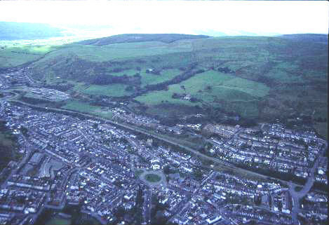
(Photo: GGAT HLCA003)
Aerial view of Penygraig from the north-west with Mynydd Penygraig in the background.

(Photo: GGAT HLCA004)
Williamstown with Mynydd Dinas beyond.
HLCA 004 Williamstown
Minor first phase colliery settlement, later 2nd and 3rd phase expansion;
ribbon development settlement and late 19th century imposed grid-layout;
retains typical terraced housing, commercial properties and chapels; residential
colliery village with low urban morphological and functional development.
(Back to map)
Click here for further information
about this Historic Landscape Character Area
Click here for a
character area map
HLCA 005 Trealaw
Composite colliery settlement, 1st phase pithead settlement, small compact
nucleated colliery-built settlement of linear terraces with extensive
later ribbon accretions; retains typical terraced housing, and chapels,
etc.; residential colliery village with building-club, speculative and
owner-occupier housing; large cemetery serving surrounding area, including
lower and mid-Rhondda Fach; low commercial development.
(Back to map)
Click here for further information
about this Historic Landscape Character Area
Click here for a character area map
(Photo: GGAT HLCA005)
Aerial view of Trealaw from the south-east.

(Photo: GGAT HLCA006)
Tonypandy, centre, with Trealaw in foreground.
Significant commercial and service centre (including Italian cafes and hair dressers); composite settlement, comprising post-medieval precursor centred on Pandy or fulling mill with 1st phase ribbon settlement, with extensive grid-layout additions, predominantly during the 2nd phase; later re-development of initial 1st phase area as commercial centre during late 19th early 20th century; retains typical terraced housing, shops, chapels, and modest public buildings of the period; housing predominantly speculative during later phases.
(Back to map)
Click here for further information
about this Historic Landscape Character Area
Click here for a
character area map
Example of fragmented 1st phase pithead colliery settlements, comprising isolated terraced rows; later, 2nd phase planned settlement with distinctive grid-layout street pattern, and linear terraces, with later 3rd phase hillside accretions, giving the area a largely uniform visual aspect; residential colliery settlements with limited functional/morphological variety; examples of post 1870s building-club and speculative housing; reclaimed colliery landscape; separate tributary side-valley location.
(Back to map)
Click here for further information about this Historic Landscape Character Area
Click here for a
character area map
(Photo: GGAT HLCA007)
Cwm Clydach
(Photo: GGAT HLCA008)
Aerial view of Llwynypia showing the 'Scotch' Terraces, foreground right.
HLCA 008 Llwynypia
Rare example of early 1st phase pithead settlement in the Rhondda; planned,
compact nucleated colliery-built settlement of linear terraces, with mostly
2nd phase ribbon and hillside accretions; residential colliery settlement
with limited functional/morphological variety; early examples of colliery-built
terraced housing - 'Scotch Terraces' distinctive double-fronted terraced
cottages; Llwynypia Colliery Engine House, rare example of surviving industrial
monument in the Rhondda.
(Back to map)
Click here for further information
about this Historic Landscape Character Area
Click here for a
character area map
HLCA 009 Ystrad and Pentre
Mid-19th century 1st phase linear roadside development spreading south
from a nucleus at Pentre, serving a number of collieries; later 2nd phase
expansion on linear grid layout, specifically at Pentre and Bodringall
(Ystrad); continuous residential village with low urban morphological
and functional development; early centre of non-conformist religion; cultural
and historic associations.
(Back to map)
Click here for further information
about this Historic Landscape Character Area
Click here for a
character area map
(Photo: GGAT HLCA009)
Ystrad, view from south showing the late 19th century schools, centre.
(Photo: GGAT HLCA010)
Aerial view showing Gelli, centre, and Ton Pentre, right.
HLCA 010 Ton Pentre and Gelli
Composite colliery settlement comprising: mid-19th century 1st phase 'pithead'
development with initial colliery built housing and grid-layout taking
pre-existing road system into account and adjacent isolated rows; and
later19th century 2nd phase expansion on linear grid layout, including
creation of a large 2nd phase 'pithead' settlement at Gelli and minor
3rd phase additions; residential colliery village with low urban morphological
and functional development; medieval and later parochial centre (Ton Pentre).
(Back to map)
Click here for further information
about this Historic Landscape Character Area
Click here for a
character area map
HLCA 011 Treorchy
Significant commercial and service centre; 1st phase settlement mostly
on Bute Estate land with visibly high degree of planning, comprising generously
laid out main street, later developed as the commercial core with flanking
linear-grid layout established over all three phases; significant commercial
centre developed from initial colliery settlements; characteristic built
features, mostly late 19th/early 20th century, include terraced housing,
chapels, churches, public buildings, shops and workmen's institutes; large
cemetery serving surrounding area, i.e. the Rhondda Fawr; settlement associated
with number of local collieries, but primarily the Abergorki Colliery
with its outlying settlement of isolated rows; major road junction; cultural
associations.
(Back to map)
Click here for further information
about this Historic Landscape Character Area
Click here for a
character area map
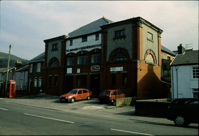
(Photo: GGAT HLCA011)
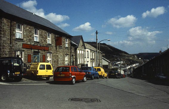
Treorchy: The Abergorgki Workingmens' Institute.
(Photo: GGAT HLCA012)
Cwmparc, view from east with Graig-fawr in the background.
HLCA 012 Cwmparc
Example of pithead colliery settlement(s), which evolved from isolated
rows during the 1st phase, unified into a single continuous linear settlement
during the 2nd and 3rd phases; linear terraces, giving the area a uniform
visual aspect; residential colliery specific settlements with limited
functional/morphological variety; examples of pre-1880s colliery housing
and later speculative housing; reclaimed colliery landscape; separate
tributary side-valley location.
(Back to map)
Click here for further information about this Historic Landscape Character Area
Click here for a character area map
HLCA 013 Treherbert
Estate planned and built 1st phase colliery settlement with mainly minor
additions during the 2nd and 3rd phases; retains typical housing and converted
commercial properties etc; interesting 19th century buildings, i.e. National
School and House, Almshouses and Dumfries Street and numerous chapels;
garden village addition & early council housing; Grid-pattern layout;
moderately developed commercial centre.
(Back to map)
Click here for further information
about this Historic Landscape Character Area
Click here for a
character area map
(Photo: GGAT HLCA013)
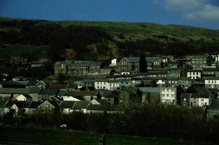
Treherbert: St Mary's Alms Houses, Bute Street.
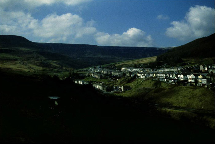
(Photo: GGAT HLCA014)
Aerial view of Ty-newydd with Cwmparc in the background.
HLCA 014 Ty-newydd
Planned colliery-built terraced settlement, originally conceived as a
Model Village; 1st phase colliery settlement with 2nd and 3rd phase additions,
relatively low level of commercial development; typical terraced housing
and converted commercial properties; site of Rhondda Merthyr Colliery
(tips extant).
(Back to map)
Click here for further information
about this Historic Landscape Character Area
Click here for a
character area map
HLCA 015 Blaenrhondda
Linear-planned, valley-head colliery settlement; 1st phase pithead settlement
with outlying isolated rows with 3rd phase additions; predominantly residential
in character with negligible commercial development; homogeneous visual
aspect, while illustrating developments within a formative colliery settlement;
retains distinct village identity separate from neighbouring settlements;
good examples of typical terraced colliery housing and associated chapels
and schools; reclaimed Fernhill Colliery site.
(Back to map)
Click here for further information
about this Historic Landscape Character Area
Click here for a
character area map

(Photo: GGAT HLCA015)
Aerial view Blaenrhondda in the foreground with Cwmparc beyond.
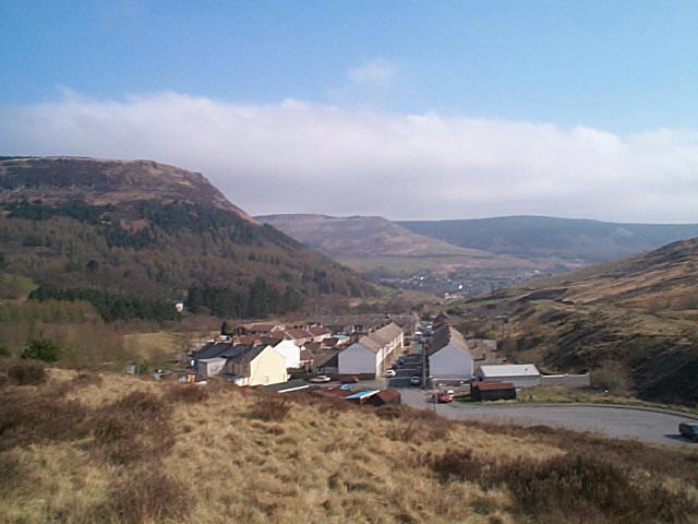
(Photo: GGAT HLCA016)
Blaenycwm, view from the west.
Linear valley-head colliery settlement; 1st phase colliery settlement based around early coal level with and 3rd phase renewal centred on later colliery development, typified by isolated rows and later infilling of renewed 20th century expansion; predominantly residential in character with negligible commercial development; illustrating developments within a formative colliery settlement; originated separately from neighbouring settlements and retains distinct village identity to this day; good examples of atypical and typical terraced colliery housing; reclaimed colliery landscapes; separate tributary side-valley location.
(Back to map)
Click here for further information
about this Historic Landscape Character Area
Click here for a
character area map
HLCA 017 Ynyshir
First colliery settlement in the Rhondda Fach valley; 1st, 2nd and 3rd
phase colliery settlement, originating as typical isolated rows during
1st phase, but present character dominated by late 19th and early 20th
century expansion and linear-layout, development strongly associated with
fortunes of associated collieries; predominantly residential in character,
mostly post-1870s housing stock; minor commercial development
(Back to map)
Click here for further information
about this Historic Landscape Character Area
Click here for a
character area map

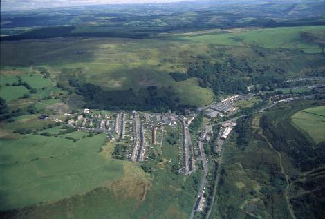
(Photo: GGAT HLCA017)
Aerial view of Ynyshir from the southeast.
(Photo: GGAT HLCA018)
Aerial view of Wattstown from the west.
HLCA 018 Wattstown
Compact 2nd phase pithead settlement associated with a single colliery;
planned, compact settlement of linear terraces, with later 3rd phase additions
including hillside estate; predominant colliery constructed housing -
good examples of post-legislation colliery housing; residential colliery
settlement with limited functional/morphological variety; historic associations.
(Back to map)
Click here for further information
about this Historic Landscape Character Area
Click here for a
character area map
HLCA 019 Pontygwaith, Tylorstown and Stanleytown
A composite colliery settlement area comprising three closely associated
2nd phase 'pithead' settlements associated with two/three collieries;
residential settlements with post-1880s housing stock, including colliery-built
housing, with minor functional/morphological variety and commercial development.
(Back to map)
Click here for further information
about this Historic Landscape Character Area
Click here for a character area map

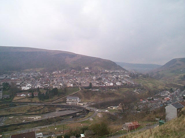
(Photo: GGAT HLCA019)
Stanleytown, view east from above Tylorstown.
(Photo: GGAT HLCA020)
Ferndale from Blaenllechau, view from northeast.
HLCA 020 Blanllechau and Ferndale
A composite colliery settlement area comprising two closely associated
1st phase 'pithead' settlements associated with a single colliery; rare
example of early pithead colliery-built settlements in the Rhondda Fach;
Ferndale: planned, compact nucleated 1st phase settlement of linear terraces,
grid-pattern and ribbon layouts, with mostly 2nd phase additions; Blaenllechau:
a 1st phase linear terraced hillside settlement, originating as isolated
rows, with ribbon development and 2nd phase additions; residential settlements
retaining typical housing and converted commercial properties, including
colliery built housing, building-club and speculative housing; interesting
19th century buildings, i.e. Tre-Rhondda Chapel and Workmen's Institute;
large cemetery serving surrounding area; moderately developed commercial
centre (Ferndale only).
(Back to map)
Click here for further information
about this Historic Landscape Character Area
Click here for a
character area map
HLCA 021 Maerdy
Second phase pithead colliery settlement; valley-head location; single
colliery specific; planned nucleated settlement; second phase core of
uniform homogeneous terraced housing, colliery-built housing and leisure
facilities; strongly residential and relatively low commercial development,
with 3rd phase additions including extensive ribbon development; distinct
separate identity from neighbouring community; reclaimed industrial landscape.
(Back to map)
Click here for further information
about this Historic Landscape Character Area
Click here for a
character area map

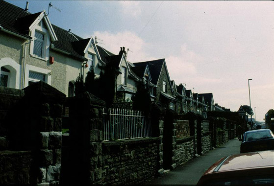
(Photo: GGAT HLCA021)
Maerdy: Typical single-fronted terraced housing, Griffiths Street.
(Photo: GGAT HLCA022)
Aerial view showing the northern edge of Blaenllechau, Ffaldau lies to
the right.
HLCA 022 Ffaldau
Relict agricultural landscape; distinctive field boundaries; detached
part of HLCA 023 Rhondda Fach: Eastern Enclosed Valley Sides.
(Back to map)
Click here for further information
about this Historic Landscape Character Area
Click here for a
character area map
Relict agricultural landscape to an extent modified by industrial development; distinctive field boundaries; documentary evidence of medieval/post-medieval agricultural practice and settlement; post-medieval upland settlement (longhouses); industrial landscape associated with mineral extraction, predominantly coal; ancient woodland and modern forestation.
(Back to map)
Click here for further information about this Historic Landscape Character Area
Click here for a character area map

(Photo: GGAT HLCA023)
Blaenllechau: Post-medieval farm and outbuildings.
(Photo: GGAT HLCA024)
Enclosed slopes of Mynydd Ty'n Tyle, viw from the east.
HLCA 024 Rhondda Fach: Western Enclosed
Valley Sides
Prehistoric funerary landscape; relict agricultural landscape to an extent
modified by industrial development; distinctive field boundaries; documentary
evidence of medieval/post-medieval agricultural practice and settlement;
medieval upland settlement; post-medieval upland farmsteads (longhouses);
industrial landscape associated with mineral extraction, predominantly
coal; ancient woodland and modern forestation.
(Back to map)
Click here for further information
about this Historic Landscape Character Area
Click here for a
character area map
HLCA 025 Mynachdy Penrhys
Upland landscape; core area of medieval grange and pilgrimage site; historic,
cultural and religious significance; relict post-medieval field system
and farmstead(s); minimal industrial influence on the landscape; early
communications; documentary evidence; modern social housing, forestry
and leisure use.
(Back to map)
Click here for further information
about this Historic Landscape Character Area
Click here for a
character area map
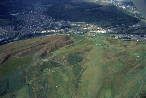
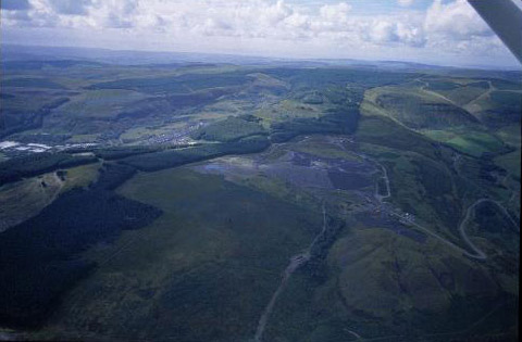
(Photo: GGAT HLCA025)
Aerial view of the character area with the Rhondda Fawr in the background.
(Photo: GGAT HLCA026)
Mynydd Brith-weunydd showing spoil tips and golf course with Llwynypia in the background.
HLCA 026 Mynydd Brith-weunydd and Mynydd Troed-y-rhiw
Upland landscape; prehistoric funerary landscape; early communications
corridor; part of former medieval monastic grange; distinctive and possibly
early boundaries; extensive industrial landscape.
(Back to map)
Click here for further information
about this Historic Landscape Character Area
Click here for a
character area map
HLCA 027 Brith-weunydd and Troed-y-rhiw
Relict agricultural landscape to an extent modified by industrial development;
distinctive and possibly early boundaries; formerly part of medieval Cistercian
grange; post-medieval upland settlement (longhouses); early communications
corridor; remnant ancient woodland and Coedcae field names; industrial
landscape associated with mineral extraction, predominantly coal.
(Back to map)
Click here for further information
about this Historic Landscape Character Area
Click here for a
character area map
(Photo: GGAT HLCA027)
Troedyrhiw: post-medieval enclosure and spoiltips above Ynyshir.
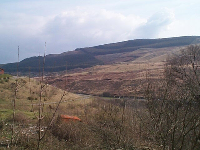
(Photo: GGAT HLCA028)
Aerial view of Mynydd Dinas showing remnant woodland and partly reclaimed/landscaped summit.
HLCA 028 Mynydd Dinas and Mynydd Cymmer
Mountain or upland sheepwalk; relict agricultural features; prehistoric
funerary use; post-medieval settlement, agricultural and industrial; extensive
upland industrial landscape.
(Back to map)
Click here for further information
about this Historic Landscape Character Area
Click here for a
character area map
HLCA 029 Rhondda Fawr: Enclosed Valley Sides
Largely relict medieval/post-medieval agricultural landscape; distinctive
field boundaries; prehistoric funerary landscape and settlement; upland
medieval agriculture and settlement; post-medieval agriculture and farmsteads
(predominantly longhouse regional types); documentary evidence for both
medieval/post-medieval agricultural practice and settlement; extensive
industrial landscape with features dating from the early phases of mineral
extraction.
(Back to map)
Click here for further information
about this Historic Landscape Character Area
Click here for a
character area map

(Photo: GGAT HLCA029)
Mixed woodland and post-medieval enclosure at Cwm-y-fforch, Treorchy.
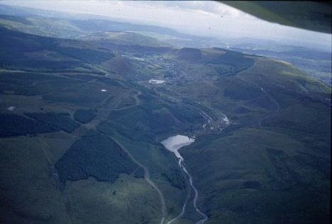
(Photo: GGAT HLCA030)
Aerial view of the Lluest-wen Reservoir and the upper reaches of the Rhondda Fach.
HLCA 030 Rhondda Uplands
Upland mountain sheepwalk, partially forested; multi-period and multi-functional
landscape; prehistoric settlement and funerary landscape; early communication
corridor; Roman and medieval military structures; early medieval administrative
boundaries; medieval upland settlement; post-medieval industrial landscape;
relict upland agricultural landscape; documentary and place name evidence.
(Back to map)
Click here for further information
about this Historic Landscape Character Area
Click here for a
character area map
HLCA 031 Rhondda Uplands (Mynydd Ton - Mynydd
Penygraig)
Upland mountain sheepwalk, partially forested; multi-period and multi-functional
landscape; prehistoric settlement and funerary landscape; early communication
corridor; military structures; early medieval administrative boundaries;
medieval upland settlement; post-medieval industrial landscape; relict
upland agricultural landscape; documentary and place name evidence.
(Back to map)
Click here for further information
about this Historic Landscape Character Area
Click here for a
character area map
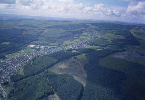
(Photo: GGAT HLCA031)
Aerial view of uplands above Cwm Clydach, showing twentieth century afforestation.

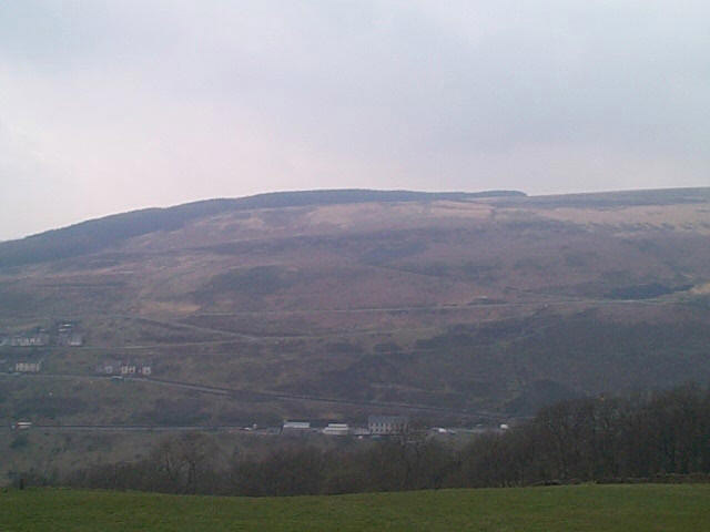
(Photo: GGAT HLCA032)
View of character area from Bwlch-y-Clawdd, showing open nature of the
landscape.
HLCA 032 Parc Cwm Brychinog
Upland mountain sheepwalk, limited forestation; prehistoric funerary landscape;
prehistoric settlement; early communication corridor; early medieval administrative
boundaries; medieval hunting park; relict agricultural features; documentary
and place name evidence; post-medieval industrial landscape.
(Back to map)
Click here for further information
about this Historic Landscape Character Area
Click here for a
character area map
HLCA 033 Rhondda Fawr: Enclosed Valley Sides
(Cwm Lan - Nant-y-Gwiddon)
Largely relict medieval/post-medieval agricultural landscape; distinctive
field boundaries; prehistoric funerary landscape and settlement; upland
medieval agriculture and settlement; post-medieval agriculture and farmsteads
(predominantly longhouse regional types); documentary evidence for both
medieval/post-medieval agricultural practice and settlement; extensive
industrial landscape with features dating from the early phases of mineral
extraction.
(Back to map)
Click here for further information
about this Historic Landscape Character Area
Click here for a
character area map
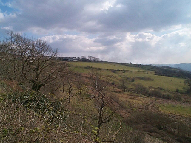
(Photo: GGAT HLCA033)
Former enclosed landscape on slopes of Mynydd y Gelli and Llwynypia Mountain
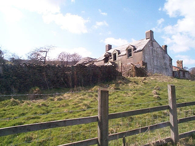
(Photo: GGAT HLCA034)
Gelli-Faelog Farm, derelict post-medieval holding above Tonypandy.
HLCA 034 Rhondda Fawr: Enclosed Valley Sides
(Mynydd Penygraig)
Largely relict medieval/post-medieval agricultural landscape, similar
to HLCA 029, possibly with medieval origins; distinctive field boundaries;
minor industrial extraction features.
(Back to map)
Click here for further information
about this Historic Landscape Character Area
Click here for a
character area map
HLCA 035 Mynydd-y-Glyn
Mountain or upland sheepwalk; relict upland agricultural and industrial
landscape; modern reclamation and forestation.
(Back to map)
Click here for further information
about this Historic Landscape Character Area
Click here for a
character area map
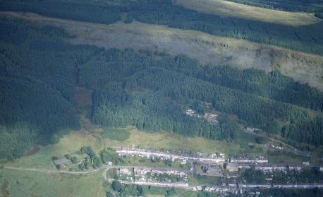
(Photo: GGAT HLCA035)
Mynydd-y-Glyn showing area of landscaped workings and forestry.
(Photo: GGAT HLCA036)
Post-medieval enclosure below Cilely Farm.
HLCA 036 Cilely and Rhiwgarn
Relict agricultural landscape; distinctive boundaries; medieval encroachment;
possible medieval settlement and associated agricultural features.
(Back to map)
Click here for further information
about this Historic Landscape Character Area
Click here for a
character area map