Historic Landscape Characterisation
Gelligaer
The landscape area of Gelligaer Common represents an increasingly rare survival in South East Wales of an area of high upland moor rich in a diverse archaeological resource. The Common and the area lying immediately to the south east is about 8 kms long and l km wide and extends from the pivotal ancient settlement of Gelligaer in the south east to the summits of Pen Garnbugail and Mynydd Fochriw in the north west. The ridgetop occupied by the Common rises gently from about 250m above OD at Gelligaer to over 470m above OD at the rounded summits of Pen Garnbugail and Mynydd Fochriw. However, on either side of the Common, and outside the area described here, slopes tumble steeply into Cwm Bargoed on the west and into the valley of the Bargoed Rhymney on the east, tributaries to the major valleys of the Taf and Rhymney respectively.
The area varies considerably from the moorland plateau of the Common in the north west, with isolated farms and improved, enclosed pasture on its western and eastern flanks, to the enclosed farmland of the south east and the pleasant rural village of Gelligaer which is now adjacent to a primarily industrial urban landscape of the Rhymney Valley. The landscape is diverse both in its form and in its archaeological and historical content, which displays a remarkable continuity of occupation.
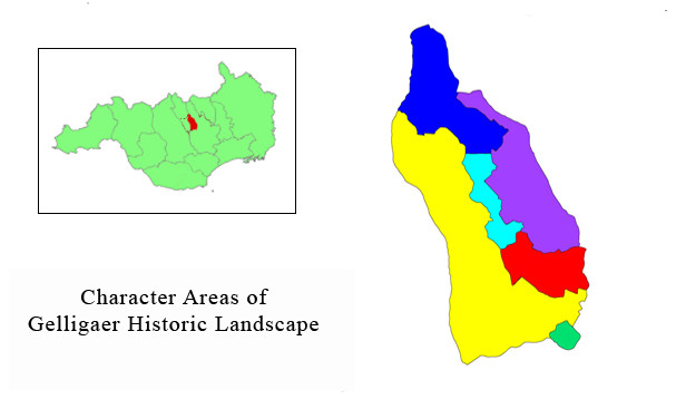
Use the map to select your area of interest or go directly to character area summaries.
The village of Gelligaer comprises a pre-Industrial Revolution core, centered around the early Church of St. Cattwg and the remains of a castle mound, probably of 12th century date. The northern outskirts of Gelligaer contain the earthworks and buried remains of Roman military installations and associated features. At the heart of the complex lie the visible and substantial remains of an early second century stone-built fort. This fort, the Roman name of which is lost, occupies a commanding and strategic position on the broad spur of Cefn Gelligaer. It also straddles the line of the major Roman road running south from Brecon, via Gelligaer Common to Caerphilly and Cardiff. A well-preserved section of the road can be traced for some distance on the east side of Garn Penbugail. To the north west of the fort lies a large rectangular earthwork enclosing an area of about 2.4ha, representing the remains of an earlier and larger fort, constructed as part of the first century campaigning and military dispositions in South Wales. The significant Roman dimension in this landscape area is further enhanced by the preserved remains of at least four Roman earthworks 2kms to the north on the Common, which were probably small military practice-camps.
The landscape of the Common to the north of Gelligaer contains a rich diversity of archaeological sites, demonstrating a long continuity of human occupation and activity. In the millennia before the Roman period, prehistoric activity is well-represented by Bronze Age burial and ritual sites, of which a notable concentration occurs on Pen Garnbugail, and by hut sites and settlements of the succeeding Iron Age.
Occupation in the post-Roman period is attested by the Church of Capel Gwladys and its associated earthworks. The site, referred to in the 12th century Life of St Gwynllyw, in a context which implies that it was of some antiquity at that date, consists of the dry-stone foundations of the rectangular church, about 6m by 12m, comprising a western tower, nave and chancel, set within an enclosure. A rough cross slab with an incised ring-cross was found at the site in 1906 and probably dates to the 8th or 9th centuries. It is preserved in the porch of the later parish church at Gelligaer. An outer enclosure may have been the settlement associated with Capel Gwladys. The association of St Cattwg with Maen Cattwg, a Bronze Age cup-marked stone standing a short distance to the north west of Gelligaer, would on archaeological grounds almost certainly be a later tradition that developed in the area.
Continuity of settlement in the area is further demonstrated by the construction of the earthwork castle at Gelligaer, known as Twyn Castell. The construction of this small castle has been attributed to the Welsh rulers of the mountain commotes of Senghenydd. The castle probably dates to the 12th century as does the parish church of Gelligaer located on slightly higher ground to the west. Both the castle and church, situated close to the Roman forts, represent not only the core of the medieval settlement of Gelligaer, but also reflect a complex shift in settlement pattern.
Rural medieval settlement is well-represented in the area by two significant groups of platform houses, one situated on the east side of the Common and remarkable for being the largest group of such sites in South East Wales, and the other, at Dinas Noddfa, on the western flanks of Pen Garnbugail. Excavations at the latter group by Lady Aileen Fox in 1936 revealed that the rectangular houses had stone and turf walls and had been characteristically built on platforms cut into the slope at one end and built up above the natural slope at the other end. Subsequent excavations at the former group in 1938 found pottery dating to the 13th or 14th centuries, but there was little else found, suggesting the inhabitants led a lowly and impoverished existence.
Lady Fox's work on these sites was archaeologically significant because it recognised the platform house as a distinctive site type, a term which has since been extensively applied, and indeed continues to be applied, to similar structures found in Wales. Her work was also historically and culturally significant because the excavations constituted the first major exploration of a native Welsh medieval settlement in the country.
Today, the Common is visually under threat on all sides from a variety of moden sources; nevertheless, this important relict and diverse historic landscape remains largely intact, though an increasingly rare survivor on the ridges between the South Wales valleys. The wide diversity of settlements, both in date and character and representing military, civilian and religious themes, represent an archaeological and historic resource of considerable importance and potential.