Lower Wye Valley
002 Chepstow Transport Corridor
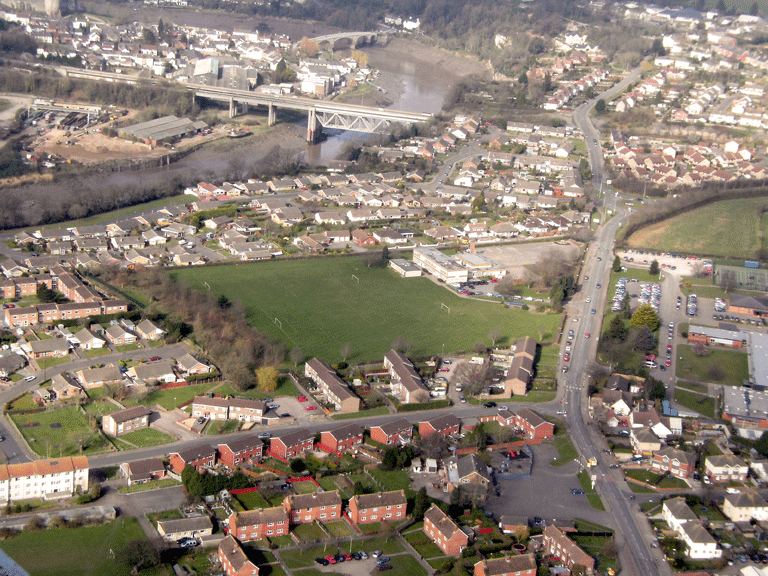
HLCA 002 Chepstow Transport Corridor
Communication and coastal maritime corridor: bridges; footbridges; railway bridges; riverfront and intertidal features, ports/docks; slipway; industrial Archaeology; public and industrial railway; relict/buried Archaeology: Prehistoric settlement; and Roman funerary and ritual (cremations). Back to map
Historic Background
The historic landscape area of the Chepstow Transport Corridor consists of an area of working dockside to the south of the main town of Chepstow; dockside warehousing and a major railway line dominate the area. Although the focal point of the area is just below Chepstow it continues farther south as a narrow strip encompassing the riverbank and railway line to the mouth of the Wye at its confluence with the River Severn.
The earliest evidence for activity in the area is a series of cave deposits that date to the Upper Palaeolithic found at St Peter's Cave (PRN 02216g, SAM MM160). A number of cremations and associated burial wares of Roman date have also been found.
In the medieval period the area was enclosed by the medieval town or Port Wall (PRN 01186g, NPRN 302128, LB 2477, SAM MM002) and though largely orchards and open burgage plots, as a result formed part of the core medieval settlement of Chepstow.
The post-medieval period saw many changes, which ultimately altered the earlier character of the area. The construction of the South Wales Railway, a branch of the Great Western Railway, took place following authorisation by an Act of Parliament in 1845 and is first visible in historic mapping from the 1846 tithe map of the area; the line itself (from Chepstow to Swansea) which caused the first breach in the medieval Port Wall within the area was not opened, however, until 1850 and the Wye Bridge at Chepstow was only completed in 1852. Chepstow Station was opened in 1850, and the Wye Valley line opened in 1876 connecting Chepstow to Monmouth until its closure in 1964 (Barry 1980).
The tithe map of 1846 lists much of the riverfront land as belonging to the Beaufort estate. Study of historic mapping with coverage of the area reveals a number of industrial features including a tramway following the line of the South Wales Railway visible until the Third Edition (1921) OS map. The First Edition OS map also shows a quarry adjacent to and just inside the Port Wall, as well Chepstow Mill (corn), reservoir, mill house and Bonded Yard with nearby landing stage, and two goods sheds and a nursery. A cattle market was added by the turn of the nineteenth/twentieth century.
Chepstow Mill, also described as a steam flourmill, was built in 1851 by Robert Sharpe, a railway contractor, and later became the Fairfield Mabey Works (PRN 04453g, NPRN 2856). The works were offered for sale in 1858 and were purchased by Parnall and Co. of Newport; later in the 1890s the works were converted to a malting by the Cardiff Malting Company. The building was used during the First World War as a billet, or offices, for the Royal Engineers, who at the time were working on the riverfront at the National Shipyard Number One (Rainsbury 1989).
Shipbuilding became an important aspect of the area's history during the First World War (1914-18) when the focus of the industry moved to the area south of the railway line from its former focus closer to Chepstow Bridge: in 1916 the Standard Shipbuilding Company established a shipyard and the medieval Port Wall was partially demolished to make way for the enlarged shipyards and associated railway sidings. The government nationalised the yard in 1917 as 'Number One' of three National Shipyards serving the war effort located in the wider area. The Monmouth Shipbuilding Company purchased the National Shipyard Number One in 1920. The remains of the disused dockyards dominate the area to this day.
Historic Landscape Characteristics
Chepstow Transport Corridor is characterised primarily as a communication corridor and riverside industrial area, with the remains of once extensive WWI dockyards. A series of communication links run through this area, including an industrial and public railway line, the South Wales Railway constructed in 1846, that runs southwest-northeast through the area and was originally carried over the Wye on Brunel's Tubular Bridge of c.1850 (LB 27113 Grade II), partly renewed and extended in 1962 under British Rail. The bridge, constructed of coursed rock-faced stone with tooled stone dressings described fully in the listing description has a 'wide chamfered segmental arch' over the road and 'curved and angled abutments partly buttressed'.
The area contains a number of other communication features including railway bridges, footbridges; of particular note are Chepstow railway station (LB 3586 Grade II; PRN 02817g; and NPRN 34955), and its associated Footbridge (LB 27112).
The main elements to survive within this area are post-medieval industrial features including the former steam flourmill and malting (PRN 04453g NPRN 2856), the Fairfield Mabey Works. The Fairfield Mabey Works were built in 1851, as a steam powered flourmill and were later converted to a malting. During the First World War the Works was used as a billet or offices, and has remained as offices to the present day.
Relict archaeology is a further definable characteristic of the area; prehistoric settlement is attested by the presence of upper Palaeolithic cave deposits at St Peter's Cave (PRN 02216g, SAM MM160), which is now protected as a Scheduled Ancient Monument. Three Roman cremations were discovered within the area, two were contained in associated pottery and a third was in a wooden box or casket. The remains of what appears to be a wooden shrine surrounded one of the cremations. The Port Wall (PRN 01186g, NPRN 302128, LB 2477, SAM MM002), the medieval wall bounding Chepstow, also crosses the area. The wall was bisected by the South Wales Railway by the time of its mapping in the tithe map of 1846. The Port Wall depicted east and west of the railway line on the Second Edition OS map (1901-2) was partly demolished (within the area southeast of the South Wales Railway line) to make way for shipyard enlargement carried out from 1916.