Lower Wye Valley
012 Fairoak Fieldscape
HLCA 012 Fairoak Fieldscape
Post-medieval agricultural landscape: semi-regular fieldscape; traditional boundaries; Post-medieval dispersed settlement (farms and cottages); small planned settlement; relict archaeology; communication features; water resources (pond). Back to map
Historic Background
The historic landscape area of Fairoak Fieldscape is an agricultural area which occupies the summit of the hill which forms the south side of the Angidy valley, and comprises an elliptical area of agricultural land bounded on all sides by woodland, from which the area was probably historically won through the process of assart. It falls within the parish of Chapel Hill, which originally belonged to Tintern Abbey, and was therefore tithe-free. After the dissolution of the monasteries, the land which had belonged to the Abbey was granted to Henry Somerset, the second Earl of Worcester, and remained in the Somerset family (later the Dukes of Beaufort) until 1901, when the Beaufort estate was put up for sale.
Little is known of the history of Fairoak. The First Edition OS map (1881) shows a slightly different field pattern from the present; early maps depict large semi-regular enclosures, while today although relatively unchanged to the east and west of the area, the centre of this field system has been subdivided into narrow sub-rectangular plots. The original field pattern suggests that this was an area of relatively late enclosure; and despite the close proximity of three granges of Tintern Abbey (ie Rogerstone, Trellech and Secular Firmary), there is currently no evidence for medieval occupation. The earliest surviving remains in the area date to the post-medieval period; these include a possible eighteenth century threshing barn at Fairoak Farm (LB 24040). The small area of settlement known as 'The Cot' is also likely to be of post-medieval date; smallholders who rented land in the Wye Valley during the post-medieval period are frequently referred to as 'cot-holders' (Bradney 1913).
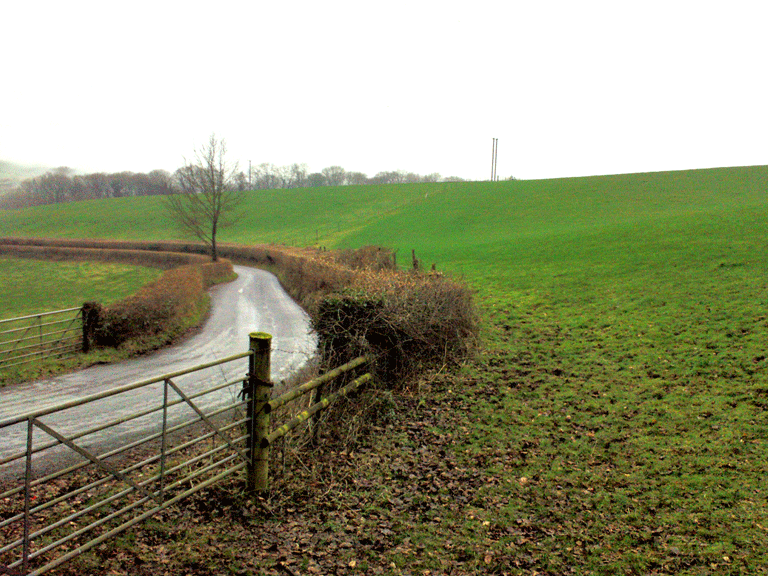
Historic Landscape Characteristics
Fairoak Fieldscape is characterised as a varied agricultural landscape. It can be divided loosely into three zones; unenclosed open fields in the west, regular strip fields at the centre and large irregular enclosures to the east. Boundaries survive only as hedgerows (including laid hedges) and as distinctive well-developed hedgerow trees within central and eastern zones. Communication routes in the area consist of a single winding lane bounded by low earth banks and post and wire fencing, and a trackway (a public right of way).
Settlement within the area is restricted to a group of clustered roadside cottages and a separate (again roadside) large farmstead. Principal building materials within the area are generally rendered coursed stone, and also brick, the principal roofing material being slate. The farmstead at Fairoak, in existence from at least the First Edition OS map (1881), originally comprised a number of buildings arranged on four sides of a roughly square yard. The original layout largely survives with the addition of a large rectangular building to the west of the original farmstead. One of the farm buildings is well preserved, a possible eighteenth century threshing barn (LB 24040), now listed grade II. This building is constructed of local red sandstone rubble with a roof of Welsh slate.