Historic Landscape Characterisation
Clydach Gorge
The short but spectacular Clydach Gorge cuts through the extreme north east corner of the South Wales coalfield, between the North Gwent uplands to the south and Llangattock Mountain to the north. The floor of the gorge drops steeply down from Bryn-mawr in the west at 350m above OD, to Gilwern in the east at 1001n above OD, in a distance of just over 5km. The gorge is seldom more than 0.5km wide and its sides rise extremely steeply, precipitously in places, to gentler slopes on either side above about 350m above OD. The River Clydach plummets and cascades its way through the gorge to join the River Usk at Gilwern where the gorge dramatically opens out into the Usk valley.
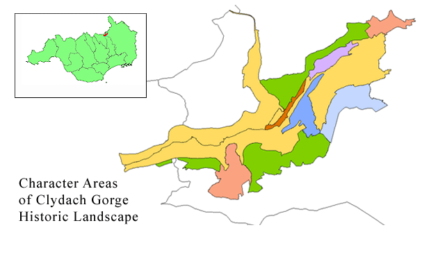
Use the map to select your area of interest or go directly to character area summaries.
As the gorge cuts the South Wales coalfield, it exposes stratified seams of coal, clay and ironstone and then cuts deeply into the Carboniferous Limestone. This geological structure, together with the resource and power of the River Clydach, has ensured that the area was exploited at least from the prehistoric period as evidenced by Craig y Gaer, an Iron' Age fort occupying the top of a natural bluff overlooking the north side of the gorge. The presence of woodland, to provide timber and charcoal for firing furnaces, must also have been a key factor in attracting early industry to the gorge.
Geomorphologically, the steepness of the terrain was an advantage to the early ironworking and lime-burning industries, where the blast furnaces and lime kilns could be strategically built into the valley sides, facilitating the charging of materials from above and their withdrawal from below.
The dramatic landscape and scenery of the Clydach Gorge is supplemented by its diverse historical and archaeological associations, and the variety of communication systems that have utilized the natural communication route of the gorge, which links the inhospitable uplands of Glamorgan with the fertile valley of the River Usk. However, most of the communications systems primarily served the industries that sprang up in the gorge, which from historical documentary evidence were first introduced into it in the 17th century, though medieval exploitation, albeit undocumented, should be expected. It was at this time that the Hanbury family of Pontypool established the Llanelly furnace and forge on the north bank of the river. By 1684, these works were producing large quantities of iron and charcoal, which ensured that the early exploitation and settlement of Clydach Gorge rapidly developed. Clydach House, situated nearby and built in 1693 by Francis Lewis, clerk to the furnace, ostentatiously displays his family arms above the main entrance to the property. Elsewhere in the valley, and in social contrast, are the visible remains of the former workers' houses, including the iron workers' terraces in Clydach South.
The Clydach Ironworks, founded before 1795, was established to exploit the recent introduction of coke as the fuel for blast furnaces. The site of the works lies alongside the modern A465(T) Heads of the Valleys road, with the surviving remains including two large masonry furnaces, together with the foundations of their casting houses, a cupola and other related buildings. The site is approached over a cast iron bridge, Smart's Bridge, dated to 1824. Production at the works continued until about 1860, up to which time it had become the focal point for activity in the gorge. By 1841, over 1350 people, including 133 children under the age of 13, were employed, of whom about two-thirds were engaged in extracting the required iron ore and coal higher up the valley. In its early years, the works were closely associated with the Frere family, which was to gain notoriety for a different reason when Sir Bartle Frere, born in 1815 in Clydach House, became High Commissioner of South Africa, and unwittingly helped to start the Zulu War.
The major industry of the late 19th and early 20th centuries in the gorge was stone quarrying and the manufacture of lime for agricultural and building purposes. The first lime works had started production in 1795, at Blackrock, but numerous other quarries were opened throughout the next century. Llanelly Quarry supplied the Clydach Ironworks with limestone, and subsequently lime for farming and building mortars. It closed finally in 1962. The surviving Clydach Limeworks was built in 1877 to provide lime for building the railway viaduct. Its large kilns, with double draw arches for each shaft, are particularly fine surviving examples.
Communications and transport have also clearly played a fundamental part in the development of the gorge. In the 1790s, railroads and tram roads, both initially horse-drawn, were being built to link mines and quarries with works. In 1793,permission was granted by Parliament for the construction of the Brecknok and Abergavenny Canal, together with a connecting tramway system, the first line of which ran through the gorge. The canal traverses the floor of the gorge near Gilwern on a huge earthen embankment, 25m high, with the river running in a tunnel at its base. The canal between Gilwern and Brecon opened in 1801, but the final connection with Pontymoile to the south was not made until 1812.
Other tramways and inclines to serve specific mines were lad in the gorge, with the consequence that the area now has the densest network of surviving early tram road routes anywhere in Wales. These were supplemented in 1862 by the single track Merthyr, Tredegar and Abergavenny Railway. This was absorbed Into the London and North Western Railway in 1866 and converted to a double track system eleven years later. The precipitous slopes meant that the route could be negotiated only with a series of tunnels, cuttings and viaducts. The route, now dismantled, remains a prominent and spectacular linear feature which can be seen on the south side of the gorge. The present A465(T) Heads of the Valleys road, built in the 1960s, is the latest in a series of road systems that have, from the 18th century, traversed the gorge as important connecting routes.
Today, all mineral and limestone extraction has ceased, leaving little employment within the gorge; nevertheless, the old-established communities still thrive. Vestiges of past industries and communications systems are plentiful, as is the evidence of former social conditions, including not only housing, but also surviving chapels and public houses. The dense and varied industrial sites and successive transport systems in the gorge represent a compact and integrated microcosm of the Welsh industrial past; this, in turn, depended on the remarkable geology and topography of this inspiringly visual historic landscape area.