Historic Landscape Characterisation
Margam Mountain
Margam Mountain is a distinctive block of South Wales uplands on the south west fringe of the Glamorgan Blaenau, where they meet the Bro and overlook and visually dominate the narrow coastal plain near the modern port and industrial town of Port Talbot. From the coastal plain just above sea level, the flanks of the mountain rise steeply to a series of more gentle slopes and plateaux between 200m and 300m above OD, with local crests reaching over 300m above OD, the highest of which is Margain Mountain itself, at 344111 above OD, in the centre of the area. The whole mountain is dissected and indented by several ravines and small wooded valleys or cwmoedd, each with a small stream rising in peat bogs near the crest. On the north east, the area is bounded by the valley of the Llynfi, a tributary of the River Ogmore, and on the north west by the small wooded valley of Cwm Dyffryn. The southern limit is bounded by Cwm Cynffig at the head of the River kenfig, while the western limit coincides with the modern M4 motorway which more or less follows the edge of the coastal plain.
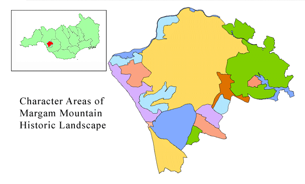
Use the map to select your area of interest or go directly to character area summaries.
The historic landscape identified here is dominated by the steep southern flanks of Margam Mountain, a strategic location which controlled early routes to West Wales, including the main Roman road linking the Roman forts of Cardiff and Neath. Much of the area is now afforested, though archaeologically it benefited from the early landscape studies undertaken in the 1930s. The area displays continuity, density and diversity of human occupation. This was originally concentrated and scattered on the mountain itself, though recently it grew rapidly, forcing itself into the narrow confines of the coastal plain, where the natural topographical limitations and physical constraints at the junction of the Blaenau and Bro of Glamorgan allowed.
Situated above the originally densely wooded valley floors and lowland, yet accessible from the adjacent high ground, the mountain has been the focus of human activity from at least the Bronze Age, as attested by a number of single, and groups of, large cairns and barrows. The Iron Age is also well represented by an unusual concentration of distinctive hill forts, enclosures and habitation sites, and the trackways that connected them. Mynydd y Castell, Caer Cwm Philip and Y Bwlwarcau form a chain of strongholds defending the strategically important route corridor across the southern flanks of the mountain. However, the forts are equally well sited to exploit the extensive mountain pastures to the north, and indeed the complex layout and much lower defences at Y Bwlwarcau could suggest that the site's primary function was stock-raising rather than defence. The succeeding Roman period is attested by the route of the main Roman road, recorded in the 2nd-century Antonine Itinerary, and the discovery of two Roman milestones in the vicinity. Today, its course is probably preserved in the line of Water Street.
The early medieval period is well-represented by the suggested reoccupation of the hillforts and the 7th century Bodvoc Stone sited on a Bronze Age barrow on the mountain. To the southwest, at Margam and Eglwys Nunnydd, there are important early religious associations. Here there is a concentration of religious sites and Early Christian Inscribed Stone monuments, associated with an early Welsh monastic focus. This is attested by both the great Cistercian abbey at Margam, the richest monastic house in Wales, founded in 1147 on a site presumed to be on or near its predecessor; and also by an important church site at Eglwys Nunnydd, a dedication probably associated with St Non, the mother of St David, the Patron Saint of Wales. A major collection of Early Christian Inscribed Stones, ranging from the 6th to the 11th centuries, and found within or close to the area described here, is housed at the Margam Stones Museum next to the Abbey church.
Only part of the Abbey church and fragments of neighbouring buildings survive of this once great establishment - the entire area described here lay within the Abbey's granges. After the Dissolution, much of the Abbey property was acquired by Sir Rice Mansel and remained in the family until 1942. The family's residence was based on the Abbey's domestic ranges, which were added to and altered in a variety of building styles by successive generations. The house was demolished in the late 18th century and a new mansion, Margam Castle, was built in the 1830s. During the last two centuries, the main attractions at Margam have been the magnificent Georgian orangery, built in 1787-90 to provide a repository for an ancient and famous collection of citrus trees, and the surrounding pleasure gardens which were developed mainly in the 19th century. The house and gardens are set in a large walled park which originated in the Tudor period. After a period of neglect, Margam Park was eventually acquired in 1974 by the former West Glamorgan County Council, which began an extensive programme of restoration and rehabilitation.
The continuity of the military significance of the area is demonstrated by the medieval castle of Llangynwyd in the east of the area, the administrative centre of Tir Iarll (Earl's Land), a lordship of the lords of Glamorgan, and also more recently, on the southern crest of Margam Mountain, by the Graig Fawr Chain Home Low Radar Site, constructed as part o f the Second World War defensive measures. Dominating prospects to the southwest, and outside the area currently described here, are the colossal Margam Abbey Steel Works and the Port Talbot area. They represent an example of a new landscape in complete visual contrast with, and out of all proportion to, the earlier, adjacent, more subtly grafted landscape described here.