Lower Wye Valley
008 Reddings Farm
HLCA 008 Reddings Farm
Agricultural landscape (single farmstead): semi-regular fieldscape: partially amalgamated; monastic holding "Rudding Grange" or "Assart Grange"; traditional boundaries; relict/buried archaeology: prehistoric finds and medieval grange features. Back to map
Historic Background
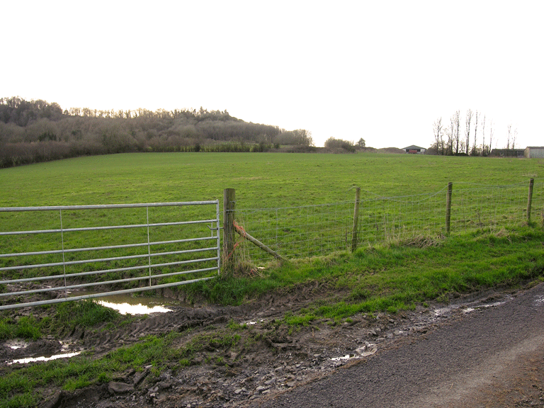
The historic landscape area of Reddings Farm is an agricultural area, which occupies the east-facing slopes of the west side of the Wye Valley, running from the river edge up to the top of the ridge. It is bounded to the north, west and south by ancient woodland; the west bank of the River Wye forms the east edge of the area. This agricultural landscape consists of a single small farm, which was part of the manor of Porthcasseg, in the ownership of Tintern Abbey. This monastic land was granted to Henry Somerset (later the Duke of Beaufort) in 1536-7, and having been monastic land was tithe-free (Locock 1997). It later fell within the parish of Chapel Hill for which there is no tithe map or apportionment available (Bradney 1913, 255).
Activity here can be traced to the prehistoric period; a flint arrowhead of this period has been recovered. Prior to the Norman invasion area was likely to have originally been heavily wooded, as the surrounding area still is, and probably represents an area of medieval assart, encroachment into the woodland waste. The present name of the farm 'Reddings' variously Ruding or Rudding comes from the Old English 'hryding', which means 'a clearing' (Williams 1990).
This area, considered to be the site of a grange of Tintern held with the manor of Porthcasseg (Williams 1976, 113, 133-7), is thought to have been part of the lands given to the abbey by its founder, Walter de Clare, in AD 1131. Williams (2001, 227 fig 103, 311 no.168) identifies this as 'Assart Grange' referred to in charter of 1223 ('grangiam de assarto cum villa de Porcassete'); Bradney (1932, 160), however, places this in the parish of Newchurch. The site is marked by Rees as a manor house, courthouse or grange extant in the fourteenth century located on the southeast boundary of land belonging to Tintern Abbey. Other locations considered as possible contenders for the grange centre, Priory Farm and Great House, have not produced any firm evidence (OS card ST 49 NW 29; Evans 2004).
A drainage system consisting of stone-filled trenches, drains and open ditches has been recorded here (Williams 1990, 62) and this land improvement is considered likely to date to the same period as the initial clearance. Each grange was a relatively autonomous centre, with accommodation for the lay brothers, and a chapel, as well as the agricultural buildings. All of the granges of Tintern principally farmed sheep, necessitating the clearance of woodland.
After the dissolution of the monasteries, the Abbey's holding of Reddings was granted to Henry Somerset, the second Earl of Worcester in 1537 (Maylan 1990, 6). In the later medieval period the monks had rented out their granges to secular farmers and this practice continued under the new owner (Maylan 2000). It seems likely that transfer of ownership from an ecclesiastical to a secular one would in effect have meant little change at least initially to the operation and the layout of the grange. The parish in which Reddings Farm is situated, Chapel Hill, remained in the hands of the Somerset family (who later became the Dukes of Beaufort) until the sale of the Beaufort estates in 1901 when the land was bought by the Crown.
The cartographic evidence shows the layout of the land holding to be largely unaltered since the survey of the First Edition OS map of 1881, apart from a thin strip of land between the A466 road and the river Wye. Here the First Edition OS shows an area of enclosure divided into fields; these boundaries have since been removed, and the area reverted to an uncultivated state.
Historic Landscape Characteristics
Reddings Farm, an area of the farm buildings and associated fields located on a sloping plateau above the River Wye, is characterised by agricultural fieldscape and an isolated farmstead with an ecclesiastic 'grange' association. The field pattern is characteristically semi-regular with partially amalgamated enclosures. The external boundaries to the area are formed of distinctive well-developed hedgerow trees; currently post and wire fencing divides the central fieldscape. The character area also encompasses a strip of uncultivated scrub woodland on the slope above the riverside.
There is a strong theme of ecclesiastical association with the holding forming part of the former grange lands of Porthcasseg Manor belonging to Tintern Abbey, specifically Ruding Grange, literally meaning 'assart' grange; a monastic farm won from woodland or waste. Agricultural features of interest include a sheep house and field drainage system; the drainage system is recorded as a series of stone filled trenches, land drains and open ditches (Williams 1990).
Settlement in the area is limited to an isolated farmstead, which may have medieval origins relating to the grange. The farmstead is shown on the First Edition OS map as a linear arrangement of small rectangular and sub-square buildings, a second linear range of buildings was added during the twentieth century. The principal building material of both the older and the new buildings, some of which are whitewashed, is coursed stone, and the principal roofing material appears to be slate.
A number of archaeological finds have come from the area, including a prehistoric arrowhead; these provide a limited indication of potential earlier occupation.