Lower Wye Valley
014 Angidy Valley
HLCA 014 Angidy Valley
Industrial landscape: relict industrial archaeology: metal processing; mills; quarrying; water management features (weirs, leats and dams); communication features (inluding industrial rail and bridges); Post-medieval industrial settlement (informal dispersed pattern of Georgian style houses and cottages with associated enclosures; distinctive vernacular style; post-medieval settlement features/building types (non-conformist chapels; public house; 19th century school); historic and monastic associations (monastic land); traditional boundaries. Back to map
Historic Background
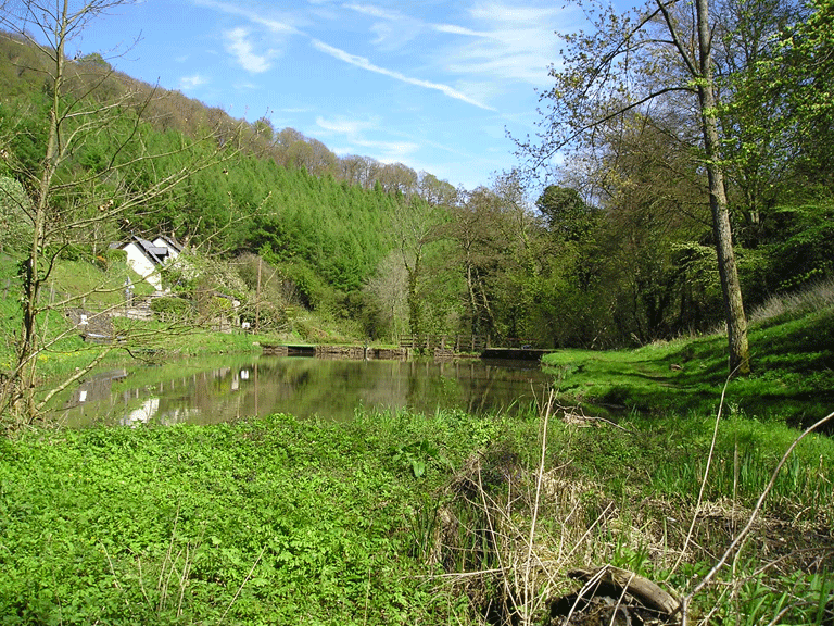
The historic landscape area of Angidy Valley is represented by a steep-sided narrow river valley which is heavily wooded; a fast flowing stream, the Angidy Brook, runs down the river valley from the west to its eastern confluence with the River Wye at Tintern Parva. The area fell historically within the later parish of Chapel Hill which having been monastic land owned by the Cistercian Abbey at Tintern was Tithe-free (Locock 1997). This area of land was granted to Henry Somerset (later the Duke of Beaufort) in 1536-7. The character area includes the junction of the Angidy Valley with the Wye and takes in the northern part of the settlement of Tintern, which has a more industrial characteristic.
Finds of late prehistoric date such as an Iron Age gold stater coin (PRN 06202g) of Anterdig, King of the Dobunni, are the earliest indicators of occupation from the area. During the medieval period the monks of Tintern are attributed with the erection of a series of weirs along the stream that powered two grain mills and a fulling mill within the area; the pools above these weirs were also used by the monks as fish ponds (Williams 2000 241-2, 266).
The area developed as an important centre for industry in the early post-medieval period: the Society of Mineral and Battery Works established a number of ironworks along the Angidy Valley between 1568 and 1631 with the aim of making England self-sufficient in armaments. The Society was established as a royal monopoly whose intent it was to provide brass for cannons and other armaments as required by the Crown. This early intention was quickly abandoned; however, the production of brass and iron wire became the driving force behind the industry here and continued as such throughout the seventeenth century (Newman, 2000). As a result the Lower or Abbey Wire/Ironworks (PRN 00709g, SAM MM266) was in operation in 1566-1567; this was probably the first works to have been developed in the Wye Valley area (Coates 1992). The works consisted of a substantial building containing four water wheels, four hammers, and two annealing furnaces; the complex was water-powered via a leat fed by the Angidy River, supplemented by a reservoir later in the nineteenth century. The Old Furnace blast furnace (SAM MM197; PRN 00712g; NPRN 34136), was in operation from 1669 onwards (Newman 2000) and drawing water from the Angidy via a leat and later a pond off the Angidy. The charcoal fuelled furnace was one of the larger furnaces in existence during the period and is somewhat unusual in its layout. The water to feed the furnace bellows was transported via wooden launder and from the site via a culvert. Coates notes that this layout may have been devised to allow the furnace to operate during periods of flood (Coates 1992).
The iron/wire industries in the Angidy Valley had largely ceased to be in operation by the late nineteenth century with the Lower or Abbey Wire/Ironworks converted to a tin-plating works around 1880.
Historic Landscape Characteristics
Angidy Valley is an area that has been largely characterised by the themes of transport and industry and related post-medieval settlement; at the east of the area this is represented by a mill, and quay, and relates to the informal settlement leading to the quay at Tintern, which includes early cottages, and a chapel, whilst ribbon. The area retains a clear hierarchy of settlement ranging from the substantial houses of ironmasters and managers to small cottages of the workers. Industry evidently had a long history in the area with traces of very early activity still apparent, though much of settlement is the result of expansion in the nineteenth century, some is earlier, for example the building now the Royal George Hotel (LB 24034 Grade II, originated in the sixteenth century and appears to have been enlarged in 1704 by Richard White the owner of the Old Wireworks, and became a hotel in 1835.
There are numerous industrial sites located within the Angidy Valley, including the Tintern Upper Wireworks (New Tongs Mill) (SAM MM268), Old Furnace Blast Furnace (PRN 00712g, NPRN 34136, SAM MM197), and Lower or Abbey Wire/Ironworks (PRN 00709g, SAM MM266). The Old Furnace Blast Furnace (SAM MM197; PRN 00712g; NPRN 34136) was excavated in 1979-80, and subsequently left open, as part of work sponsored by the then Gwent County Council with the aim of creating an industrial trail through the area. The Tintern Upper Wireworks (New Tongs Mill) of 1803 retains substantial retaining walls required to terrace the site, along with the remnants of a wheel pit, water feeder, aqueduct, and annealing furnace. Water management features associated with heavy industry survive largely as relict archaeological features and include eleven water supply ponds and related dams along the length of the river (Newman 2000). Other features include a post-medieval water wheel (PRN 05687g) and culvert (PRN 05685g).
Further important characteristics of the area are its communication routes that exist today as winding lanes, bounded by high earth and dry-stone faced banks. Previously an industrial tramway served the area transporting resources from the dockside on the River Wye to and from the various mills and other works. There are at least two bridges of interest: Pont y Saeson (PRN 00708g), a small bridge that may incorporate the remains of an earlier bridge extent in 1675; and another stone bridge with a shallow arch spanning the Angidy River (PRN 05685.0g).
The area is characterised by an informal pattern of dispersed settlement, along the lower slopes. The Angidy Valley has strong historical associations with the settlement at Tintern, which emerged as an industrial centre in the late sixteenth century. The area displays a range of characteristic building types: substantial early buildings, larger eighteenth century and early nineteenth century houses, non-conformist chapels, a public house; and 19th century school, as well as a series of smaller cottages (mostly late eighteenth to early nineteenth century - generally two-storeyed, two-unit plan with end chimneys, the dominant local vernacular form: these probably relate to industrial history of area. An example of the former is Crown Lodge (LB 24034 Grade II) of c1800; this is a central entrance double depth house with two parallel ranges and a three storey three bay front with 12 and 9 paned sashes and a 6-panel door with two glazed panels and a flat hood on brackets. The elevations are rendered, probably over rubble stone, under a plain Welsh slate roof with red brick gable stacks.
Smaller cottages include Angidy Cottage: which is tiny with vernacular origins, and has been extended and given picturesque detail (ie neatly illustrating two themes - the working landscape and the picturesque). The workers' cottages of the area include Furnace Cottage (LB 24047 Grade II), an altered and extended late 18th century two-storey terrace built of red sandstone rubble with a concrete tiled roof, formerly of three double fronted ironworkers' cottages, probably associated the nearby Old blast Furnace. Bay Cottages (PRN 04632g, NPRN 534, LB 14868 grade II), probably a miller's house and attached cottage, of seventeenth to eighteenth century origin with some early to mid nineteenth century remodelling. This range is two-storeyed and of whitewashed rubble construction with mid-nineteenth century timber casements and steep Roman-tile roof (probably originally stone-tile) and whitewashed end chimneys with later brick stacks. Two-storey double depth plan with an addition, perhaps a wash-house, to the left gable. Also of note is a dated (1699) two-storey building of two-unit plan form seen elsewhere, and a steep pitched roof characteristic of other (early?) buildings in the area, eg Mill House.
The area of Chapel Hill displays characteristic informality of settlement associated with early industrial communities, in which buildings of very different scale and status are in close proximity, with little evidence of planning. Here a finely detailed c1800 house rubs shoulders with a huddle of smaller cottages clinging to the steep slopes. Some of the cottages have hallmarks of 'squatter' origins - small scale, very shallow pitched roofs.
In addition to substantial early nineteenth century houses, cottages, and a former chapel, the valley floor of the Angidy Valley is characterised predominantly by twentieth century development.
During the twentieth century the Crown Estate further developed the settlement of the area, in neo-vernacular style, typical of the c1900 arts and crafts/domestic revival using stone, brick and tile (eg Crown Cottage, 1904). The Crown Estate buildings (eg cottages, post office, police station and shops) in this and nearby character areas (eg. HLCA013 and HLCA016) are of an estate style and consciously picturesque in idiom. In addition the area has examples of twentieth century suburban picturesque: bungalows built to enjoy the view.
Also of note as one of the early tourist hotels in the Wye valley, is the Royal George Hotel (LB 24036 Grade II), which was converted from a dwelling of sixteenth and eighteenth century date. This much altered and extended cross-passage house is constructed of random limestone rubble with the front range roughly coursed, formerly rendered, and roofed with green Westmorland slates. The building, further remodelled in the 1930s, now displays a uniform façade though retains its steeply pitched roof, gable stacks and a stack at the cross-passage position.
Distinctive field boundaries are another identifiable characteristic of the Angidy Valley; within the narrow river valley these consist of a mix of dry-stone-faced banks, and hedgerows with distinctive hedgerow trees, while more recent post and wire and wooden fencing is also found in the area.