Lower Wye Valley
032 Pen-y-garn and Church Hill Common
HLCA 032 Pen-y-garn and Church Hill Common
Varied landscape of amalgamated former irregular evolved enclosure and more regular post-medieval enclosure (improved common); small parcel of surviving common; medium-sized regular and large amalgamated enclosures (former irregular fieldscape); traditional boundaries; broadleaf woodland and scrub/unmanaged land; relict archaeology: medieval settlement/fields (deserted medieval settlement?); communication features. Back to map
Historic Background
The historic landscape area of Pen-y-garn and Church Hill Common is an agricultural landscape consisting of an amalgamated fieldscape and enclosed fields won from the common. The area is defined by a small area of surviving common and the agricultural land enclosed from it, and to the east by the edge of the ancient woodland. The area occupies the south- and east-facing slopes above the Black Brook valley. Historically the area fell within the parish of Penallt, which was part of the manor of Trellech.
Clusters of low drystonewalls on Church Hill Common possibly represent medieval occupation; these might be the remains of a deserted settlement, though further investigation is required to confirm this. Historic cartographic sources depict curvilinear enclosures typical of a fossilised medieval open field system in the now amalgamated fieldscape to the west of Pen-y-garn (tithe map 1847; early edition OS maps 1881, 1901, and 1921). The likelihood of medieval occupation is emphasised by the nearby location of Penallt Old Church (adjoining character area), which dates at least to the early thirteenth century.
The parish of Penallt was relatively unenclosed until the early nineteenth century, when the Enclosure Act of 1810 was passed. The exact extent of Church Hill Common is difficult to gauge as enclosure and encroachment appears to have been progressive. The tithe map of 1847 shows the partially enclosed common, with two clear areas of encroachment on either side. By the end of the nineteenth century the common has been planted with coniferous woodland (First Edition OS map 1881, 1887).
To the south of Church Hill Common and the late enclosures, is an area which exists on the tithe map as an irregular evolved fieldscape, in the ownership of several individuals, as well as the Beaufort estate, and the Governors of Queen Ann's Bounty. The majority of the land is owned and occupied by one Thomas Dixon, and the state of cultivation is mainly arable. The field pattern remains almost totally unchanged into the first quarter of the twentieth century; the Third Edition OS (1921) shows it virtually unaltered since the 1840s. Modern farming practices, however, have had a huge impact on the landscape, and the area, which formerly existed as irregular fields of varying size, is now a single amalgamated field of approximately 42 hectares.
Historic Landscape Characteristics
Pen-y-garn and Church Hill Common is characterised as an area of former common, which has been progressively enclosed during the nineteenth century. The surviving area of common, now forestry plantation, lies between two areas of medium-sized regular fields to the east and west; those to the east had been further subdivided by the 1870s, while the area to the west has remained unchanged from the mid-nineteenth century. The current regime of a mixed arable and pasture also reflects the mid-nineteenth century land use (tithe apportionment). The field boundaries in this part of the area consist mainly of distinctive hedgerow trees, which reflect the heavily wooded nature of the area.
Further to the south, in the area around Pen-y-garn farm, there have been significant changes to the landscape from the mid-nineteenth century. Cartographic evidence shows this area as irregular evolved fieldscape, the focus of which was the farmstead of Pen-y-garn. Although there has been some limited amalgamation of fields, especially in the north of the area, since the mid-nineteenth century, the field pattern remains largely intact up to the twentieth century. More recent changes in farming practices have lead to further amalgamation into a single area; the former field boundaries are now visible as crop marks. External boundaries comprise hedges and post-and-wire fencing, with some distinctive hedgerow trees.
The farmstead at Pen-y-garn, which, like the surrounding fieldscape, has changed considerably since the tithe map of 1847; the tithe depicts an agricultural complex arranged around a sub-rectangular yard comprising two main ranges of barn and dwelling (possibly with attached byre), by the survey of the First Edition OS (1881) three other structures have been added to enclose three sides of the farmyard, a garden and orchard to the south and an outlying building to the east and pond to the north, while during the latter part of the twentieth century the farmstead has further developed with the addition of larger agri-industrial buildings. A good example of a vernacular threshing barn with stable in line lies just within the area adjacent to the road, this is isolated and set at a distance from its associated farmstead, Llananant Farm, itself outside the characterised area.
Forestation, mainly of twentieth century coniferous plantation (within the last area of the unenclosed common to survive), is an additional characteristic. The boundaries of the heavily wooded area are formed by large dry-stonewalls constructed of large conglomerate blocks. A small amount of deciduous and other broadleaf woodland also survives.
Relict archaeology is another important characteristic of the area. The wooded common, appears to include several clusters of dry stonewalls, although there are no traces of settlement or buildings in this area on any historic maps. Further relict features include a circular conglomerate stone (PRN 01275g), located on the south side of the road leading to Penallt; this feature, 1.2m in diameter with a rectangular hole in the centre, is described in Bradney (1913, 155) as the base of a cross, and is marked on First Edition maps as 'Cross Vermond'. It appears, however, to bear a resemblance to a millstone, many of which were produced locally (eg Troypark Wood HLCA 036). An interesting alternative local name for the stone is 'The Coffin Stone', and local tradition states that funeral processions on the way to Penallt Old Church used to pause at the spot and rest the coffin on the stone. An additional roadside 'coffin stone' can be found a little further north on the same road. Interestingly Penallt Church formerly acted as a chapel-of-ease to St Nicholas in Trellech until Penallt became a separate parish in 1887.
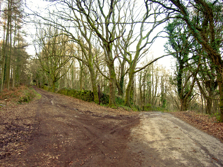
The communication in the area consists of footpaths and a single minor lane, which skirts the south edge of the common on its way south in the general direction of Tellech. This route, presumably the traditional funerary route that relates to the coffin stones, connects the area to the Old Church of Penallt, its wider agricultural hinterland and Trellech beyond.