Lower Wye Valley
015 Upper Redbrook Fieldscape
HLCA 015 Upper Redbrook Fieldscape
Medieval/Post-medieval agricultural landscape: varied pattern of small - medium fields; settlement predominantly dispersed farmsteads; traditional boundaries; relict archaeology: medieval monastic settlement/fields (Beaulieu or 'Grace Dieu' Grange); communication features (eg. incline over bridge, and industrial rail). Back to map
Historic Background
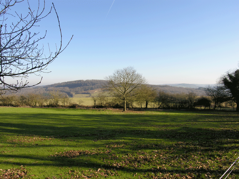
The historic landscape area of Upper Redbrook Fieldscape is an agricultural area which occupies the sides and plateau on the summit of a ridge which forms the eastern side of the Wye Valley. The area appears to have been progressively cleared from woodland and is bounded to the north and southwest by two areas of ancient woodland: Highmeadow Woods (HLCA 019) and Lord's Grove Woodland (HLCA 040) respectively. The settlement on the Kymin, and the area of registered parkland at the summit of the Kymin hill, border the area to the northwest. Woodland also forms a natural boundary to the east, which also coincides with the boundary of the administrative division of Monmouthshire Unitary Authority and the national border with England, and similarly the southern boundary, which runs through the centre of the village of Upper Redbrook, which straddles the border. Historically, the area fell within the parish of Dixton, in the hamlet of Wyesham, which was held by Edward, the fourth Earl of Worcester in 1607 (Bradney 1904), later the Dukes of Beaufort.
Activity here can be traced as far back as the Bronze Age based on the find of a barbed and tanged flint arrowhead in the area.
The area grew in importance during the medieval period, when there was a grange of the Abbey of Grace Dieu here. This Cistercian Abbey was founded by John of Monmouth as a colony of Dore Abbey around 1226, was but completely burnt by the Welsh in 1233, as they claimed it had been built on land that had been seized from them (Kissack 1974). The site of the Abbey was subsequently moved entirely, but the grange here remained, and is probably that referred to in 1291 as 'Wyesham Grange', and described in 1536 as 'towards Newland' (Williams 1976). In the fourteenth century, the existence of a Friary or Hospital, named 'Beaulieu of the Garth' is suggested (Rees 1932 SE sheet).
In the seventeenth century Redbrook became an important copper smelting centre; the village included two blast furnaces, two copper smelting works, two tinplate works, a paper mill, and several corn mills (Coates 1992). The Redbrook Works had closed by circa 1735 and later the sites were utilised for tinplate manufacture. The Upper Redbrook Works were closed in 1818, and subsequently demolished, and replaced by a brewery. The Lower Redbrook Works, however, remained in operation into the twentieth century (Coates 1992). Although this site is not within the character area, it played an important part in the development of Redbrook village, and of the area as a whole.
Part of the Monmouth tramroad crosses through Upper Redbrook village, over the B4231 via the Incline Bridge, now protected as a Scheduled Ancient Monument (SAM MM203). This tramroad was built by the Monmouth Railway under an Act of May 24th 1810, and was completed in 1812, connecting Howler's Slade in Coleford to Monmouth. It had been used to serve the Redbrook tinplate works further south via the incline bridge at Redbrook, now a Scheduled Ancient Monument (SAM MM203; PRN 02195g; NPRN 85227). The section of the tramroad in the area appears to be disused by the time it was mapped in 1887 (First Edition OS map), and by 1902, its route is shown cut by the line of the Coleford GWR branch line (Second Edition OS map). The latter railway line contoured the slopes above Upper Redbrook, cutting through the hillside via a tunnel and avoiding the incline bridge.
Historic Landscape Characteristics
Upper Redbrook Fieldscape is characterised by its varied fieldscape of medium to large regular fields and smaller irregular fields; the pattern has been dictated by topography, with regular fields generally located on the plateau and the irregular fields restricted to the steeper valley sides. Boundaries within this area are a mixture of hedgerows with distinctive hedgerow trees and post and wire fencing. Also characteristic is the area's relict archaeology; settlement and fields of medieval date associated with the grange at Beaulieu (PRN 08337g), now Beaulieu Farm (see below).
The field pattern has altered substantially from that depicted on the tithe map (1844) with substantial amalgamation in the south of the area, whilst further north, areas shown as unenclosed woodland on the First Edition OS have been cleared and enclosed. Cartographic evidence depicted this area (apart from adjacent to Beaulieu Farm) as relatively large, regular fields with straight boundaries, a pattern which is in strong contrast to the smaller irregular enclosures with curvilinear, winding boundaries which characterise the area further south towards Upper Redbrook village. These fields, however, have largely been amalgamated, while the regular enclosures to the north have been subdivided, creating a regular pattern of smaller rectangular fields.
The settlement pattern is characterised primarily by dispersed isolated farmsteads and associated outbuildings: Beaulieu Farm, Upper Beaulieu Farm, Duffield's Farm, The Elms, and the isolated barns of Jordan's Barn and Cockshoot Ash Barn. Settlement in this area, despite some alteration, has largely maintained its overall characteristic layout.
Beaulieu Farm is likely to be the earliest farm in the area and is referred to in 1560 as the 'grange at Bewley', and was a satellite of the Abbey of Grace Dieu (Williams 1990). The farmstead depicted on the 1844 tithe has largely retained its layout since the survey of the First Edition OS map. The latter shows the farmhouse with its own rectangular enclosure and opposite to the west a separate farmyard complex set within a elongated sub-rectangular enclosure clustered around a slightly splayed yard with an L-shaped range forming the north and west sides and a rectangular building, possibly a threshing barn to the south, and a number of other detached rectangular agricultural buildings to the south and north of the complex. On the basis of cartographic evidence the original farmstead and agricultural complex appears to survive with a few additional structures.
Upper Beaulieu Farm, probably originally a satellite of Beaulieu Farm, has been extended substantially; on the First Edition OS map it is shown as a group of three small rectangular buildings, most likely outbuildings associated with the nearby Beaulieu Farm, and remained as such until the twentieth century. The farm as it existed in the latter half of the nineteenth century comprised a range of closely paired parallel northwest-southeast aligned buildings set across a yard, with further range attached at a tangent to the northeast corner of the eastern of the two buildings. Upper Beaulieu Farm now consists of several large modern agri-industrial buildings to the south west of, and possibly incorporating part of the earlier farmstead, the site now reached by a partly re-aligned road from Beaulieu Farm, which largely follows the original access track adjacent to field boundaries.
Duffield's Farm exists today in a relatively unaltered state from its appearance on the First Edition OS map as a linear range with a cluster of outbuildings to the southeast within a D-shaped enclosure reached by a track from Upper Redbrook known as Duffield's Lane; this farm appears to have retained much of its original character. Duffield's Lane continues northwest through the character area passing Cockshoot Ash Barn through Lords Grove (HLCA040) towards Sky Farm (in HLCA 033) before entering the village of Wyesham, (HLCA035).
The Elms is situated in the south east corner of the area, situated close to the junction of Duffield's Lane with the main road that runs through Upper Redbrook across the south of the character area, The Elms appeared on the 1887 First Edition OS map as a staggered farmstead range with a cluster of agricultural buildings slightly apart to the north. In addition, the isolated Jordan's Barn and Cockshoot Ash barn appear relatively unchanged from early mapping.
Settlement within the area is also characterised by ribbon settlement at Upper Redbrook, the buildings here are a mix of front and end on cottages set back a short distance from the road each with its own fairly large plot of associated land. The number of buildings within the ribbon settlement at Upper Redbrook appears to have decreased since the (1887/1890) First Edition OS map, the earlier smaller rectangular and L-shaped buildings extended, eg. Bush House, Spring Villa and Rose Cottages. There has also been an extension of some earlier smaller buildings as at Founder's Cottage, Malthouse Cottage and Killma Cottage, as well as addition of new buildings within the area as at Orchard Bungalow, Valley Lodge and Springfield. Although extensively altered in parts many of the buildings within Upper Redbrook do retain much of their original character; usually rendered and lime washed with stone coursing. Some of the buildings are roofed with slates, whilst others are roofed by recent pan tile. The ribbon settlement although divided by a political boundary does give the Upper Redbrook area much of its character.
The area has a number of characteristic communication features including tracks, lanes both straight and winding, defined by natural topography and the earlier enclosure boundaries in the character area, in particular field boundaries, along with industrial rail, a route of the former Monmouth tramroad and the remains of the associated incline bridge (SAM MM203; PRN 02195g; NPRN 85227) survive in the area, as do features associated with the disused former Coleford GWR branch line, including its tunnel.