Lower Wye Valley
011 Monmouth
HLCA 011 Monmouth
Historic settlement core: Medieval/post-medieval settlement and associated Anglo-Norman castle; settlement pattern nucleated regular and organic (ie linear and irregular cluster); Post-medieval urban domestic, commercial, and civic buildings (medieval structures?); Anglo-Norman, medieval and post-medieval defensive features; relict and buried archaeology (multiperiod); communication features; Medieval and Post-medieval ecclesiastical features (churces, cemeteries and chapels); Industrial archaeology (eg. mill; brewery, site of tannery); historic associations. Back to map
Historic Background
The historic landscape area of Monmouth is situated on a low hill at the confluence of the Rivers Wye and Monnow and has been an important Anglo-Welsh border town throughout its history. Prehistoric activity in the area has currently only been evidenced by artefacts, and no structural evidence for settlement has been found. Evidence for Roman exploitation of the area has also been found as below-ground archaeology; it is largely accepted that a Roman fort recorded in the Antonine Itinerary as Blestium (Tuck and Jones 2007), was located at Monmouth. Excavations carried out by the Glamorgan-Gwent Archaeological Trust along Monnow Street, Monmouth revealed further evidence of Roman occupation. Although initial settlement is likely to have had military origins, based around the fort of Blestium, between the second and fourth century AD settlement here is likely to have been primarily civilian, with significant evidence of iron working indicating an economy strongly based in industry (Marvell 2001).
The present town largely dates from the Norman and subsequent periods; the building stock of the town retains a great deal of the military, ecclesiastical and secular buildings from this period onwards. Information regarding the early medieval period prior to the Norman occupation is scarce, and is limited to documentary sources relating to the eighth century church of St Cadoc, now the location of St Mary's Church, mapped by Speed as the 'Monks Church' (PRN 01224g). Following the initial Norman activity in the town the church of St Cadoc is thought to have been incorporated from circa 1075 into the Benedictine Priory of Monmouth, evidenced by grants of land to the Order.
William fitz Osbern founded Monmouth Castle, a Marcher castle, soon after the Norman invasion and at some point prior to 1071. The castle was strategically located making best use of the physical geography available; the castle is located at the peak of the low hill promontory overlooking the Wye and Monnow rivers close to the Forest of Dean. Norman lords held the castle as the headquarters of an independent lordship without incident until 1267. It was then granted, along with the Three Castles (White, Grosmont, and Skenfrith) to Henry III's son, Edmund Crouchback, when he became Earl of Lancaster. The castle has associations with a number of historic figures; perhaps most notably Henry V, who was born at the castle in 1387.
During the Civil War, Monmouth Castle was held variously for the Royalists and the Parliamentarian cause, finally falling to the Parliamentarians in 1645. Upon Cromwell's visit to the castle in 1646 he ordered it to be 'slighted' though it may have already been in a state of disrepair at this time (Evans 1953, 416) and in 1673 Great Castle House was built by Henry Somerset (later the first Duke of Beaufort) on the site and as a result today only a fragment of the once substantial castle remains intact. Until the Civil War a curtain wall, gatehouse and round keep had stood here. In 1875 Great Castle House became the headquarters of the Royal Monmouthshire Royal Engineers (Militia) (RMRE). The building is now largely used as a museum dedicated to the military history of Monmouth, particularly that of the RMRE. With origins dating back to 1539, the RMRE is the only modern-day regiment to survive from the Civil War.
The town of Monmouth developed as a commercial centre in the medieval period under the protection of its castle; Monnow Street became the focus for this early burgage development, flourishing by 1086 when it is recorded in the Doomsday Survey. The town continued to expand further and the suburb of Overmonnow (outside of the character area) known to have been in existence by the twelfth century; documentary references indicate that St Thomas's Church (PRN 01258g) at Overmonnow was in existence by 1186 (Brook 1988, 82). Expansion in the thirteenth century continued with the fortification of the river crossings into Monmouth, there were at this point four crossing points into Monmouth, the most famous of these being the Monnow Bridge and Gateway (PRN 01246g, 01257g NPRN 24219, 405876, LB 2218, SAM MM008). The burgesses also constructed Town walls around this time, these works were paid for by, and were the raison d'être for, the introduction of tolls, taxes on goods imported into the town.
.The fourteenth and fifteenth centuries saw a setback in the fortunes of the town through plague and rebellion, especially the Glyndwr rebellion of the fifteenth century. The town experienced a small revival later when Henry VI formally gave it borough status in 1447. However, it was not until the sixteenth century that a true revival in the town's economic fortune and industrial growth occurred. This accompanied a political resurgence that was experienced when, under the Act of Union of 1536, Monmouth became the shire town of the newly formed County of Monmouth. During the period many of Monmouth's earlier wooden buildings were rebuilt in stone, while medieval open hearths gave way to fireplaces and chimneys (Kissack 1989). Speed's map of 1610 shows the extent of the town and contemporary records indicate the town was flourishing. Later, the endowment of several almshouses and a grammar school by William Jones in 1616 ushered in a new era in the development of the town, as the wealth and influence of the Haberdashers Company was established (Kissack 1989).
Whilst the town did not expand in size greatly during the seventeenth and eighteenth centuries, influential county families began to build town houses in Monmouth during the period, many drawn there by the influence and popularity of the Beaufort family. The development of industry in the wider area brought about an influx of industrialists to the town and subsequently generated further house building. The Picturesque Movement of the latter half of the eighteenth century appears also to have had some impact; the need to accommodate the growing numbers of tourists possibly hastened the construction of inns and hotels in the town during the period.
Expansion and development in the surrounding area particularly at the market town of Abergavenny slowed the growth of Monmouth during the nineteenth century (Marvell 2001). As the county town of Monmouthshire, today Monmouth is a pleasant market town with considerable surviving historic character.
Historic Landscape Characteristics
Monmouth is largely characterised by its medieval layout and its historic buildings. The area contains 286 Listed Buildings, including four at grade I (Great Castle House LB 2217, Monmouth Castle LB 2216, Monnow Bridge and Gateway LB 2218, and the Shire Hall LB 2228); thirty are grade II*, the remainder are protected by grade II listing.
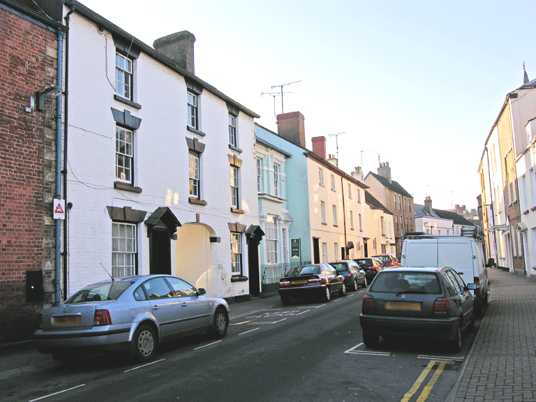
The settlement retains its original medieval street pattern preserved by the layout of the post-medieval buildings; south west of Monmouth castle the pattern is linear reflecting rectilinear burgage plots, whilst an organic nucleated cluster survives east of the castle and south of St Mary's Church. The variety of building type and material is extensive, ranging from post-medieval terraced housing, large town houses, hotels and theatres, to commercial, civic, ecclesiastic, educational and other urban buildings (some possibly masking medieval structures). A great many of the town's buildings have been refaced (Old Red Sandstone is common), or rendered.
The Monnow Bridge and Gateway (PRNs 01246g and 01257g; NPRNs 24219 and 405876; LB 2218; SAM MM008) is a result of centuries of alteration and addition to a thirteenth century stone (Old Red Sandstone) construction that replaced an earlier twelfth century wooden bridge (Newman 2000). The bridge has three segmental arches on hexagonal cutwater piers of the late thirteenth century. The much-altered gate has nineteenth century arches flanking the original central roadway arch, and has variously acted as tollhouse, guardroom, lock-up, and storehouse and also private dwelling. Defended medieval bridges were found throughout medieval Europe; the Monnow Bridge is particularly important as the only surviving example of its type in Britain.
The area's ecclesiastic characteristic is evident from medieval churches and chapels including St Mary's Church (PRN 01224g), the 'Monks Church' mapped by Speed, a foundation of Monmouth Priory mentioned in a grant of circa 1075. St Mary's Church is considered to be on the site of the eighth century church of St Cadoc.
Other than the Monnow Bridge and the town's churches, the main element to survive from the medieval period is Monmouth's Anglo-Norman castle (PRN 01234g; NPRN 32877; LB 2216; SAM MM159). The castle, established by William fitz Osbern in the late eleventh century as a Marcher stronghold, and later refurbished by the Lancaster family in the thirteenth and fourteenth centuries, comprises the remains two linked structures, both constructed of local Old Red Sandstone: the remains of the Great Tower (the taller of the surviving buildings), which dates to the first half of the twelfth century, and the great hall, which dates to the thirteenth century.
Other aspects that add to the military or defensive character of Monmouth include the military museum and garrison located in the seventeenth century Great Castle House, located within the curtilage of Monmouth Castle; this is an imposing three-storey building with a three-bayed central section and one-bay wings, constructed of square blocks of speckled Old Red Sandstone under a hipped roof. Great Castle House is also the historic Regimental Headquarters of the Royal Monmouthshire Royal Engineers.
Post-medieval buildings of note include the Independent Monmouth School for Boys (PRNs 01247g, 01248g, 01251g, and 04137g; NPRN 13000; LBs 2245, 8522, 85009, 85053, 85182, 85187, and 85214), which provides a strong visual impact. Monmouth School, set around a central courtyard, was initially constructed in 1614-15 with substantial addition between 1864-5, and now dominates the view of Monmouth from the Wye Bridge. Another important building is the Shire Hall (LB 2228), constructed in 1724 on the site of an earlier Elizabethan building of 1571 which also had a predecessor in the form a simpler small court building of 1536. It is thought the current building, constructed of limestone ashlar under a hipped roof, is the work of architect Philip Fisher (of Bristol). Several alterations include the statue of Henry V by Charles Pert in the central facade added in 1792. The building was extensively renovated in 1829 under the direction of architect Edward Haycock (of Shrewsbury) following an Act for the Improvement of the Town Hall. The main north-facing facade of the Shire Hall has five doubled bay windows over two storeys that are articulated by paired Ionic pilasters either side of the bays, whilst the open ground floor is supported by Tuscan columns and provides a market space.
The area is also characterised by industrial and commercial activity, potentially a further factor in earlier settlement location and development, the industrial potential proffered by the nearby iron ore deposits in the Forest of Dean and by an accessible waterway (the Wye) for movement of goods and materials add to the overall character of the area. Industrial and commercial remains or former sites include several medieval mills (PRNs 01226g, 02341g), a medieval bloomery (PRN 01251g), and the site of a medieval market (PRN 02341g), along with a post-medieval warehouse (PRN 01244g) and a post-medieval abattoir (PRN 04249g).
The town and surrounding area has numerous important historic associations with a variety of historic figures, ranging from Geoffrey of Monmouth, who wrote his Historia Regum Britanniae here, and early medieval Marcher lords, including William fitz Osbern, Earl of Hereford, the founder of Monmouth Castle, and Henry V who was born in Monmouth in 1387 (commemorated by a statue on the facade of the Shire Hall and the 'Kings Gardens') to Admiral Horatio Nelson, among many others. Mention should also be made of Sir Charles Rolls, co-founder of the Rolls-Royce car firm, who was brought up at the Hendre near Monmouth and whose ventures in balloons, early cars and aeroplanes are featured in the town's Museum. The Hendre estate now provides the magnificent surroundings for the Rolls of Monmouth golf course.