Lower Wye Valley
030 Tregagle and Pen-twyn Fieldscape
HLCA 030 Tregagle and Pen-twyn Fieldscape
Varied agricultural landscape: evolved irregular pattern of small fields (heavily wooded) around Tregagle, elsewhere larger curvilinear, rectilinear and sub-rectangular enclosures (partially amalgamation); loosely dispersed settlement of farms and cottages; scrub/unmanaged land; relict archaeology: medieval/post-medieval settlement/fields, prehistoric finds; communication features. Back to map
Historic Background
The historic landscape area of Tregagle and Pen-twyn Fieldscape is an agricultural landscape consisting of mixed irregular fields. It occupies the upper slopes of the Wye Valley, west of and above the steep, and heavily wooded lower valley side. The area is divided in two by the line of Lone Lane, set within a slight east-west aligned valley. The majority of the area falls within the parish of Penallt, and formed part of the manor of Trellech in the lordship of Usk.
Very early activity in the area is attested by a Neolithic findspot. Although the area was likely to have been historically much more heavily wooded, occupation here has been continuous from at least the medieval period, with a deserted medieval settlement, and other potential early features in the area. In the later medieval period there was settlement in the area along the roads, mainly at Tregagle and Pen-twyn (Locock 2000, 29).
There appears to have been significant encroachment into the woodland in the post-medieval period, with a demand for fuel, quarrying and pasture, and any surviving woodland in this area had been cleared by the nineteenth century. By the date of the tithe map (1847) the area has been fully enclosed and the varied evolved irregular field pattern established. This field system has been relatively unchanged since the tithe map of 1847, although there has been some amalgamation, particularly to the north and east, between this date and the publication of the First Edition OS (1887), and subsequently further minor amalgamation has occurred during the twentieth century, particularly of the larger fields at higher elevation in the north of the area (OS 2006 1:10000 Landline data).
Historic Landscape Characteristics
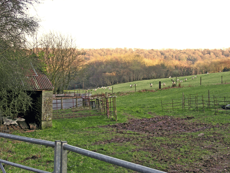
Tregagle and Pen-twyn Fieldscape is characterised as a varied agricultural landscape with associated agricultural settlement. The fieldscape has an evolved irregular pattern with small fields (heavily wooded) to the south around Tregagle, combined with a partially amalgamated area of larger curvilinear, rectilinear and sub-rectangular enclosures bisected by Lone Lane, to the north.
The fieldscape appears to have developed from former medieval open field, and has later phases of encroachment and more regular enclosure north of the Argoed, possibly associated with the Enclosure Act of 1810. Larger fields generally occupy the upper slopes, whereas the steeper lower areas, to the east and south of the character area, and along the bottom of the shallow valley in the middle, are characterised by smaller enclosures. The area to the south around Tregagle has smaller evolved irregular fields, while at Fruid Wood slightly more regular enclosures are visible. Part of this fieldscape may relate to medieval occupation, the fields to the south of Lone Lane, which lie closest to the settlement in the area, run in long, narrow, parallel strips back from the line of the road, reminiscent of a medieval strip-field system, with the larger fields on the upper slopes being enclosed at a later date.
Surviving post-medieval farm buildings and agricultural structures enhances the agricultural character of the area. These include the barn complex at Pen-twyn farm (in the ownership of the Gwent Wildlife Trust), which allegedly incorporate earlier structural elements.
The field boundaries in the area are diverse; they comprise of a mixture of earth banks with hedges, distinctive hedgerow trees and some post-and-wire fencing. Dry stone or mortared walls bound the lanes, which run through the area. There is an unusual stile in the boundary wall close to Cherry Tree Farm, which is formed of large slabs of stone inclined to form a V-shaped opening in the wall, which serves as an opening but is too narrow for farm animals to get through. The area is currently under grass and dry pasture, with some arable in the form of cereal crops. This has also remained largely unchanged since the date of the tithe map; the accompanying apportionment lists grass and arable as the main uses of the land.
The characteristic settlement comprises ribbon development, extant in 1847, of farmhouses and cottages along Lone Lane, the main communication route through the area (tithe map). Lone Farm and Cherry farms are now both substantially altered. Lone Farm originally fronted the road with parallel ranges of agricultural buildings, while Cherry Orchard Farm, to the north, originally comprised the main house (now extended) set back from the road within a garden and two agricultural buildings either side of an access track (tithe map, and First to Third Edition OS maps). Pen-twyn farm and Glyn Farm maintain their original layouts: Pen-twyn has a farmhouse with a detached linear agricultural range, whilst Glyn Farm at the extreme north of the area retains farmstead and rectangular yard with buildings on three sides of a square yard (recent addition of large rectangular agricultural buildings to the east of the original farmstead).
Towards the south of the area, in the village of Tregagle, characteristic settlement comprises dispersed farmsteads and cottages adjacent to and accessed by the irregular network of lanes. The majority of the cottages, and farms, appear to be in existence from the tithe map, and survive relatively unchanged in layout. One particular example is the early nineteenth century farmhouse at Pool Farm, in the southwest of the area, and its associated farm buildings, essentially unchanged in layout from the First Edition OS map, with a detached linear agricultural range to the west of (on the opposite side of the lane) the farmhouse with paired pig sties to the north. The principal building material is of coursed stone with slate roofing, although, an interesting exception is Cherry Orchard Farm, which has an ashlared façade, unusual for the area.
Relict/buried settlement and agricultural features of medieval date include the remains of a deserted medieval settlement to the northwest of the area (PRN 01890g), north of Pentwyn Farm, whilst evidence has also been uncovered for the existence of a small settlement of late medieval date at Tregagle (Locock 2002, 29). In addition the field pattern adjacent to Lone Lane is considered to be the remnants of a medieval open field system, and the dispersed settlement along the lane here could have a medieval precursor.
The area is also characterised by surviving parcels of ancient semi-natural and replanted woodland, mostly along its boundaries, consisting mainly of mixed deciduous and other broadleaf types, with some coniferous. Historically the area was probably far more heavily wooded. Encroachments into the woodland for pasture, quarrying and fuel however, meant that by the time of the tithe map, the woodland has been largely cleared with only small stands of trees remaining. Many of the field boundaries, particularly in the south of the character area, comprise hedges with distinctive hedgerow trees, possibly indicating the enclosures were won from woodland. Communication in the area consists mainly of winding lanes and minor roads, on which the settlement is focussed. These transport routes are generally bounded by dry stone or mortared walls, and include some interesting agricultural features such as the distinctive stile discussed above.
An additional characteristic of this area is industrial archaeology; the site of a corn mill and associated mill pond, now dry, is located at a house known as 'The Generals' on the north side of the Cadora Brook, while the other extant remains comprise a wheel pit (Coates 1992, 32).