Historic Landscape
Characterisation
The Rhondda
035 Mynydd-y-Glyn
HLCA 035 Mynydd-y-Glyn
Mountain or upland sheepwalk; relict upland agricultural and industrial
landscape; modern reclamation and forestation.
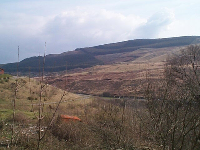
(Photo: GGAT HLCA035)
Mynydd-y-Glyn showing area of landscaped workings and forestry.
The historic landscape area of Mynydd-y-Glyn is essentially an area of upland landscape, predominantly located outside the boundaries of the Rhondda Special Historic Landscape.
A significant proportion of the area has been heavily exploited for coal tipping and was formerly characterised by industrial features, such as old quarries (1st edition OS 1884) and the extensive tips, now reclaimed, connected by tramway incline (with engine house) to Coedcae Colliery (2nd edition OS 1900), later Lewis Merthyr Consolidated Collieries (1921 edition OS map), at Hafod in the valley below. Other quarries and tips are indicated in the area above Glynfach. The only register for the area on the SMR is a large disused quarry (at ST 0448 9044) situated within modern forestry plantation.
Earlier features are primarily associated with the use of the area as upland sheepwalk and include post-medieval sheepfolds and upland boundaries of drystone and post-and-wire construction.