Historic Landscape
Characterisation
The Rhondda
027 Brith-weunydd and Troed-y-rhiw
HLCA 027 Brith-weunydd and Troed-y-rhiw
Relict agricultural landscape to an extent modified by industrial development;
distinctive and possibly early boundaries; formerly part of medieval Cistercian
grange; post-medieval upland settlement (longhouses); early communications
corridor; remnant ancient woodland and Coedcae field names; industrial
landscape associated with mineral extraction, predominantly coal.
Click here for character
area map
(Back to map)
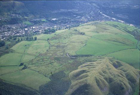
(Photo: GGAT HLCA027)
Troedyrhiw: post-medieval enclosure and spoiltips above Ynyshir.
The historic landscape area of Brith-weunydd and Troed-y-rhiw formed part of the extensive Cistercian Grange of Penrhys during the medieval period, which was broken up into smaller holdings and leased from the early 14th century. Under the Cistercians, and later their tenants, the area was primarily used for sheep grazing; this use continued the following the dissolution of the monasteries in the 16th centuries. The post-medieval farmsteads, Brith-weunydd (1633), Llethr-ddu, Penrhiw and Troed-y-rhiw, from which the area was later farmed date from the 17th and 18th centuries and are situated on the lower slopes to the south. These now lie within the area and the adjacent urban HLCA 005 Trealaw. The most interesting example is the farmstead of Troed-y-rhiw; a longhouse of c.1700, later rebuilt, with central and gable fireplaces, entrance to the side of the central chimney, though without the usual direct entrance between the byre and living quarters. The building is categorised as a three-unit, two-half storey lobby-entry-house (Lobby-entry group: internal-chimney houses, RCAHMW). Nearby the ruined outbuilding at Penrhiw is also considered to be a possible longhouse. The Tithe map of 1844 and the first edition 6-inch OS map of 1884 show these farms prior to the changes of the late 19th/early 20th centuries, set within a landscape comprising a mixture of large, medium and small enclosures.
From the end of the 19th century the area's minerals were exploited and the local pennant sandstone quarried for local house construction; the earliest industrial features, shown on the 1st edition 6" OS map of 1884 are a quarry and incline above Brith-weunydd Colliery, Trealaw and workings within Coed Ynyshir. Later numerous minor industrial features left their mark on the character of the area, including quarries, tramways/inclines and spoil tips, are depicted on the 2nd edition and 1921 edition OS maps.