Historic Landscape
Characterisation
The Rhondda
019 Pontygwaith, Tylorstown and
Stanleytown
HLCA 019 Pontygwaith, Tylorstown and Stanleytown
A composite colliery settlement area comprising three closely associated
2nd phase 'pithead' settlements associated with two/three collieries;
residential settlements with post-1880s housing stock, including colliery-built
housing, with minor functional/morphological variety and commercial development.
Click here for character
area map
(Back to map)
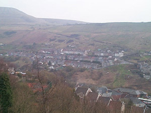
The historic landscape area of Pontygwaith, Tylorstown and Stanleytown comprises three settlements, which evolved to serve the collieries of the Mid-Fach, as the area is known. Straddling the Afon Rhondda Fach, the border between the parishes of Ystradyfodwg and Llanwonno, the area was formerly low-lying land belonging to four estates including the farms of Cynllwyn-du, Cefn Llechau-isaf (Cefn Lleche), Cefn Llechau-uchaf (Cefn Lleche Uchaf), Hendre Faelog, Penyrheol Llechau (Penheol Lleche) and Penrhys-isaf (Penrhys issaf). The three settlements of Pontygwaith, Tylorstown and Stanleytown arose around the first colliery to be established in the area. A single shaft sunk in 1858 by Thomas Wayne, officially called Cynllwyn-du (known locally as Pwll Waynes), and it later was renamed the Pontygwaith Colliery. The Penrhys Colliery was established in 1872, with the sinking of two shafts by Alfred Tylor (after whom Tylorstown is named), both this colliery and the Pontygwaith were purchased by David Davies and Company; the former in 1894 and the latter in 1896 and were renamed the No. 6, 7 (Penrhys) and 8 (Pontygwaith) Collieries. An explosion on the 27 January 1896 left 57 miners dead. An additional pit was sunk in 1901 and electrification of the collieries together with the neighbouring collieries at Ferndale was carried out in 1908. In its heyday the collieries employed around 3,000 men and boys, however geological problems eventually lead to closure, starting with No. 6 and 7 in 1936, complete closure occurring in 1960, despite a brief upturn in production. The site was subject to a £1.2 million reclamation scheme implemented in 1981 (Carpenter 2000).
The 1st edition OS depicts the bridge, a late 18th century humped back bridge, and Inn at Pontygwaith, an Old furnace, adjacent to a track and the Taff Vale Railway, to the south of Pontygwaith bridge (from which the bridge and ultimately settlement takes its name), the Pontygwaith (Cynllwyn-du) Colliery, the Pendyrus Colliery, both with engine houses and shafts and a possible row of cottages to the northwest and a limekiln (1st edition 6-inch OS map of 1884, surveyed in 1875). The colliery settlements first appear on the 2nd edition OS map: the linear form of Pontygwaith, including Brewery, Deri, Madeline, and Llywelyn Streets, situated on the east facing slopes west of the river, Bryn Terrace, Pleasant View and Brondeg Street in Cwm Waun-newydd and a small amount of ribbon development i.e. Furnace Road and Margaret Street, the settlement includes a church, Holy Trinity (EM Bruce Vaughan, 1882-3), post office, hotel, chapels and Pontygwaith station on the Taff Vale Railway; opposite on the eastern side of the valley are the linear terraced houses of Stanleytown, eighty of which were erected by the Stanley Building-club in 1895, TR Phillips of Pontypridd the architect (Newman 1995), and consists of Upper, Middle (colliery-built houses, include 10 on Middle Terrace constructed by David Davies and son) and Lower Terraces. Tylorstown to the north displays a linear grid layout and includes at the time Arran Terrace, Bribed Road, Bryn Eulogy Terrace, Dolce Terrace, East Street, Edmonds Street, and Gwernllwyn Terrace, the settlement has a church, vicarage, chapels and schools, while to the north lies the Pendyrys Colliery, complete with engine house, magazine and reservoir (2nd edition 6-inch OS map of 1900, revised 1897-98); the cemetery, near Penrhys dates to this period, its chapel built 1884, by WH Jenkins and TR Phillips.
By the publication of the 1921 edition a new bridge has been constructed over the Taff Vale Railway linking Brewery Street and Margaret Street, Pontygwaith has gained Tanybryn Street, while Madeline Street has been completed and extra terraces built in Cwm Waun-newydd, including Woodland Road; Witherdene Road and Llanwonno Road have been added to the south end of Stanleytown; while in Tylorstown additional streets have been constructed including Parry Street, Brynhyfryd Street, Charles Street and Vivian Street, extra terraces contour the slopes above East Road, including Church Terrace, Donald, Eric and Keith Streets and two new schools have been built above Arfryn Terrace (1921 edition 6-inch OS map, revised 1914-15). A new electric power station has also been constructed east of the Taff Vale Railway, near Cynllwyn-du Colliery; this power station supplied the collieries, powering all haulage, pumping, screening plants and ventilation by the end of 1908. By this date the collieries of Pendyrys and Cynllwyn-du are connected to each other by tramway.
