Historic Landscape
Characterisation
The Rhondda
006 Tonypandy
HLCA 006 Tonypandy
Significant commercial and service centre (including Italian cafes and
hair dressers); composite settlement, comprising post-medieval precursor
centred on Pandy or fulling mill with 1st phase ribbon settlement, with
extensive grid-layout additions, predominantly during the 2nd phase; later
re-development of initial 1st phase area as commercial centre during late
19th early 20th century; retains typical terraced housing, shops, chapels,
and modest public buildings of the period; housing predominantly speculative
during later phases.
Click here for character
area map
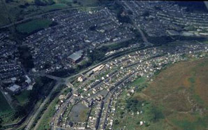
The historic landscape area of Tonypandy originates from a nucleus or core of settlement around the Pandy or fulling mill (the remains of which survive) and Pandy Bridge at Tonypandy, indicated on the Tithe map of 1844, north of Nant Clydach on the land of Penpant Clydach and Tyr y pandy (Tir-y-pandy), part of the estate of Can De Winton. At the time this area comprised the mill ruins and garden, an old tucking mill, a house and garden all on the holding of Tyr y Pandy and a Court House and garden on Penpant Clydach Farm. The area south of Nant Clydach, which is also taken by the later industrial settlement, is part of the Dunraven Estate chiefly the lands of Gelli Fallwg Farm. Settlement here comprised a manufactory house and garden adjacent to Nant Clydach and Ton Pandy Cottages near the southern extent of the later settlement. By 1875 Tonypandy had developed in typical ribbon fashion as a linear roadside settlement along De Winton and Dunraven Streets as far south as the Tramway and Nantgwyn. The settlement comprised detached, semi-detached and terraced rows of cottages, often with the garden or yard down slope of the habitation; also extant were three Inns/Public Houses, the De Winton Hotel and at least six chapels of various denominations. The Pwllyrhebog Branch of the Taff Vale Railway passes through the northern part of the settlement up Cwm Clydach (1st edition 6-inch OS map 1885, surveyed 1875). The nearest collieries to Tonypandy at the time were the Adare Colliery of 1879 (later the Pandy coal pit), the Anthony Pits (1910), and the Nantgwyn Coal Pit (1892).
During the late 19th century the expansion of Tonypandy was carried out to an organised grid pattern layout, to the southwest of Dunraven Street, and north of the Taff Vale Railway, including Primrose Street, Kenry Street and Court, Thomas and Charles Streets. At the time, the Ely Valley Branch of the GWR, before it turns west up Cwm Clydach, delimits the western edge of Tonypandy. Building-clubs were active in the area during the period; for example the Dunraven Building-club constructed ten dwellings on Primrose Hill in 1890 (Fisk 1995). It is also notable that this 2nd phase housing expansion was carried out predominantly on behalf of property investors and/or as speculative ventures (Jones 1969). New aspects of the town confirming the status of Tonypandy among other valley communities during the period include the Town Hall, the Church of St. Andrews (1876-7), and schools. An additional coal pit, the Nantgwyn Coal Pit is shown on the 2nd edition 6-inch OS map, which no doubt contributed to the expansion of the town (2nd edition 6-inch OS plan, 1901, revised 1898). By 1914/15 Tonypandy has expanded north and west to its current limits to include Danycoed Terrace and Ely Street, new developments include the Gas works by the Afon Rhondda and a football ground adjacent to the Ely Branch of the GWR.
Tonypandy town centre is dominated by shops, chapels and modest public buildings of the late 19th/early 20th century (more recent additions include the new public library); reflecting the importance of the town's service industries to the Rhondda Fawr area during the period. Dunraven Street, the main street of Tonypandy presents an array of characteristic buildings, including the Gothic Trinity Calvanistic Methodist Chapel (1886) and Hall (1893), Ebeneser Independent Chapel (Semi-classical, 1867-8), Moriah Chapel (Perpendicular, 1905), Bethel Baptist Chapel, the Town Hall (1892) now converted to commercial uses, the Art Deco Post Office (1938). Also evident are terraces of shops with dates 1915 (Baroque terracotta details), and 1905, and terraced housing which recall the mid-19th century origins of the town, especially Nos. 137-145 Dunraven Street and a grouping on Gilfach Road.
