The Historic Landscape Character Areas (HLCAs)

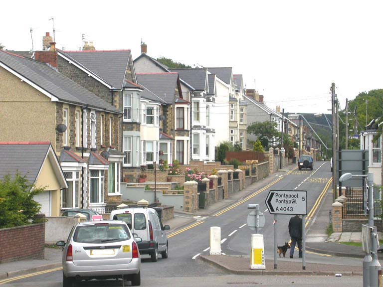
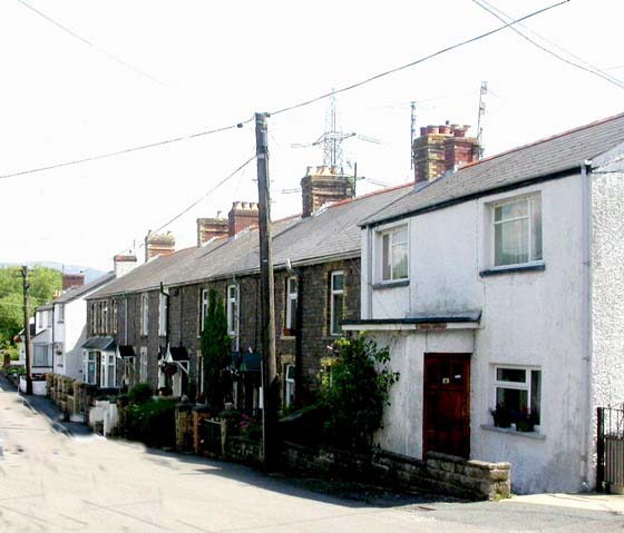
HLCA001 Blaenavon Urban Core
Nineteenth century urban settlement associated with the development of the Blaenavon ironworks and related extractive industries. Built environment predominately Characterised by industrial terraced housing and planned street pattern with associated civic buildings, chapels and commercial centre; important historic associations.Back to Map
Click here for further information about this Historic Landscape Character Area
Click here for a character area map
HLCA002 Blaenavon Urban Extension
Late nineteenth and twentieth century urban settlement, planned though some early organic development. Large middle class houses, modern terraced and council housin. Remnant agricultural landscape.Back to map
Click here for further information about this Historic Landscape Character Area
Click here for character area map

HLCA003 Glantorfaen
Area characterised by small clustered settlement of isolated industrial rows. Transportation and communication features, including industrial and public railway, tramroad network, roads, footpaths and tracks. Remnant agricultural landscape.Back to map
Click here for further information about this Historic Landscape Character Area
Click here for character area map
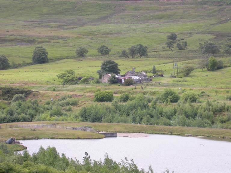
HLCA004 Coity Enclosed Landscape
Area characterised by pre-industrial enclosed agricultural landscape and settlement possibly dating from the medieval period. Largely relict evolved/irregular field pattern. Traditional field boundaries. Domestic structures and agricultural buildings. Water management features.Back to map
Click here for further information about this Historic Landscape Character Area
Click here for character area map
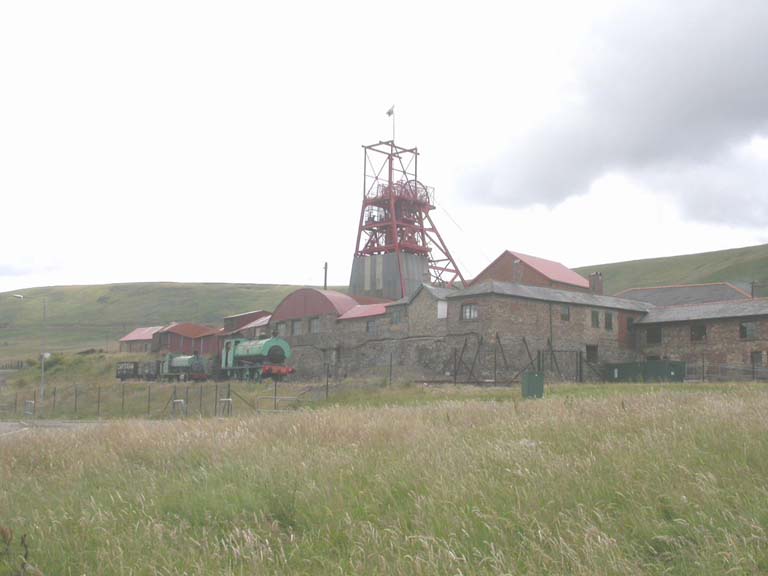
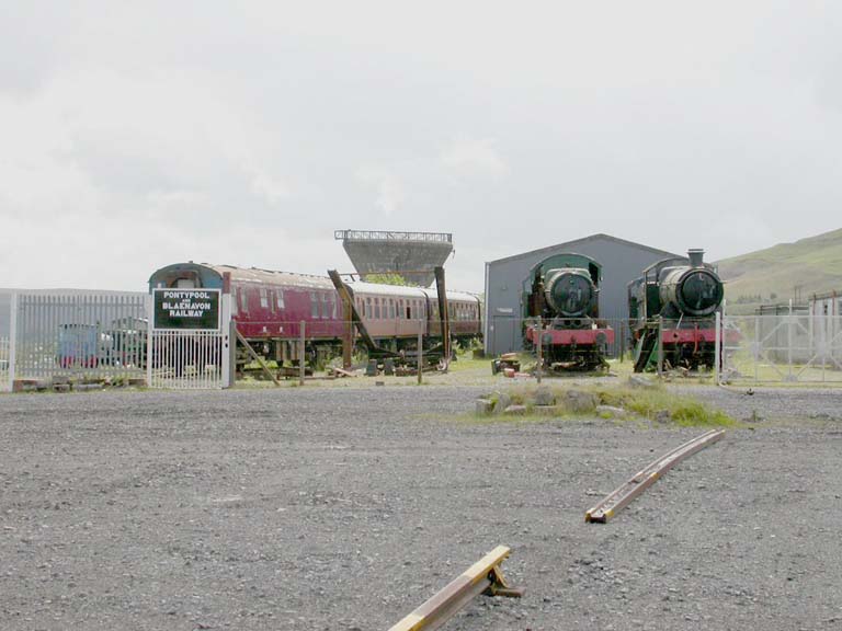
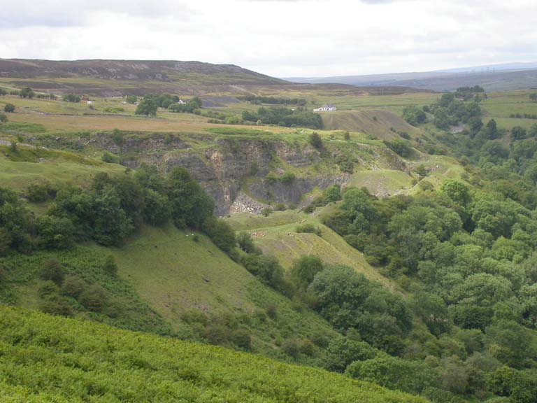
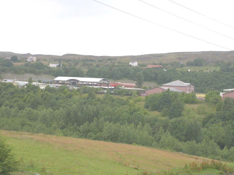
HLCA 005 Forgeside and Big Pit
Relict industrial landscape characterised by nineteenth century industrial processing, associated extraction and waste tips; Big Pit colliery workings and former site of the later Blaenavon ironworks. Possible buried remains of features relating to Blaenavon ironworks. Important transport links: railway and tramroad. Water management features. Historic events and persons associated with the area.Back to map
Click here for further information about this Historic Landscape Character Area
Click here for character area map
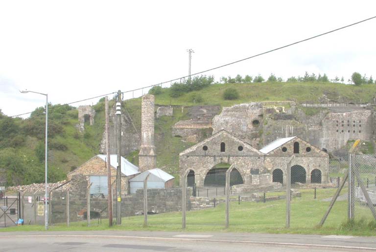
HLCA 006 Blaenavon Ironworks and Upper Brick Yard
Internationally important industrial processing and extraction area (including waste tips). Nationally significant industrial transport links (tramroad network). Characteristic industrial housing. Historic associations.Back to map
Click here for further information about this Historic Landscape Character Area
Click here for character area map
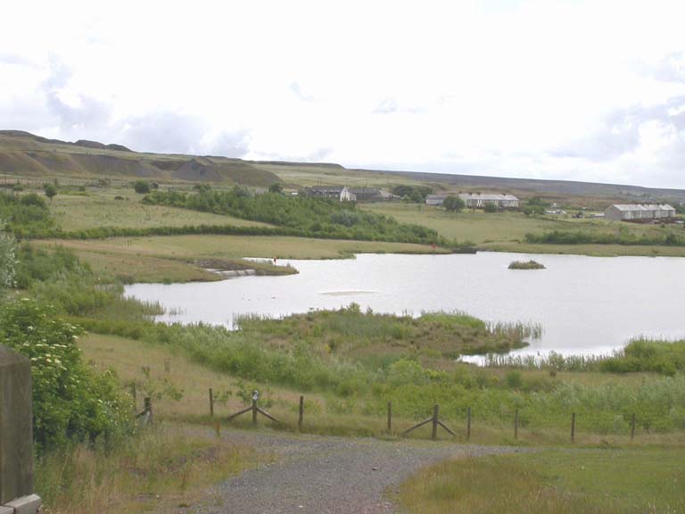
HLCA 007 Garn Lakes (Kay and Kears Reclamation)
Formerly an industrial extractive landscape, now largely characterised by reclamation and wetland nature reserve; water management features. Also characterised by buried industrial and pre-industrial agricultural settlement remains.Back to map
Click here for further information about this Historic Landscape Character Area
Click here for character area map
HLCA 008 Garn-yr-Erw Transport Corridor
Transport corridor with industrial and public railways, tramroad network, tracks and lanes. Scatter of isolated industrial rows and cottages, with a church and school, at Garn-yr-Erw. Remnant post-medieval agricultural landscape and minor industrial extraction.Back to map
Click here for further information about this Historic Landscape Character Area
Click here for character area map
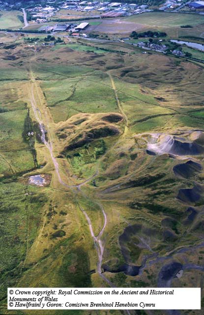
HLCA 009 Cefn Garnyrerw and Pen-ffordd-goch Extractive Area
Relict industrial landscape characterised as open upland common and principal early extractive area in Blaenavon for coal, iron ore, fire clay and limestone. Important transport networks and features and intensive water management systems. Post-medieval encroachment.Back to map
Click here for further information about this Historic Landscape Character Area
Click here for character area map
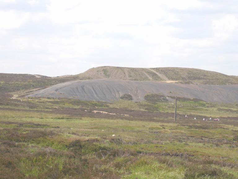
HLCA 010 Canada Tips and Blaen Pig
Extractive landscape dominated by WWII opencast workings and waste tips. Nineteenth century industrial extractive features related to quarrying and mining. Historic associations.Back to map
Click here for further information about this Historic Landscape Character Area
Click here for character area map
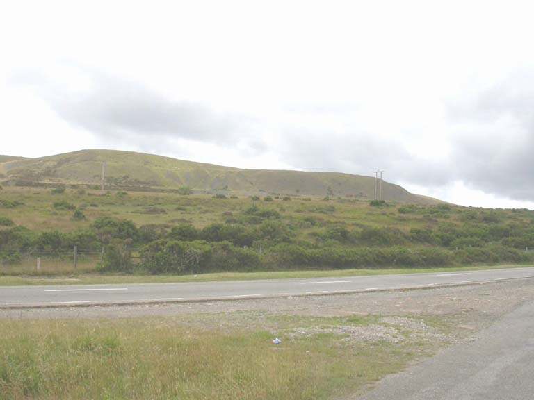
HLCA 011 Blorenge and Gilwern Hill
Relict industrial extractive upland landscape associated principally with limestone extraction. Other major characteristics are transportation networks and metal processing. The area is also characterized by relict industrial settlement, formerly isolated rows within discrete groupings, and by post-medieval encroachment and prehistoric funerary/ritual features.Back to map
Click here for further information about this Historic Landscape Character Area
Click here for character area map
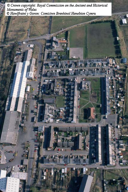
HLCA 012 Forgeside Settlement
Industrial residential area characterised as a small, compact, regular-grid planned company settlement related to development of the later Blaenavon ironworks at Forgeside as well as Big Pit and other collieries. Industrial terraced housing and twentieth century council estate development.Back to map
Click here for further information about this Historic Landscape Character Area
Click here for character area map

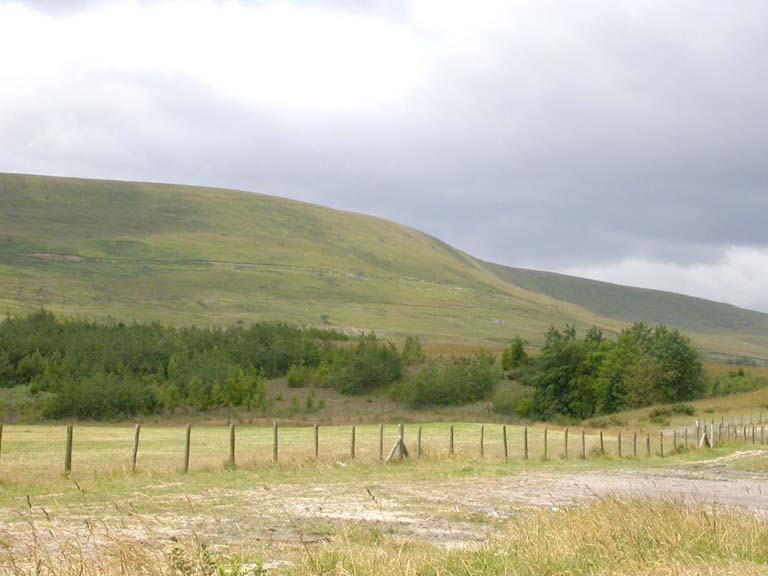
HLCA 013 Cwm Llanwenarth and Cwm Craf
Enclosed agricultural landscape of evolved, irregular field pattern with traditional field boundaries and characteristic vernacular buildings: stone built farmhouses and cottages. Dispersed patches of ancient woodland and some plantation. The major industrial characteristic is related to transport networks. Historic associations.Back to map
Click here for further information about this Historic Landscape Character Area
Click here for character area map
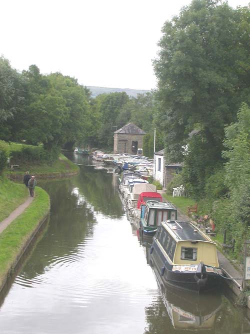
HLCA 014 Govilon
Small canal side settlement characterised by domestic housing, ranging in date from the seventeenth century to the twentieth century, vernacular buildings, industrial and social housing. Industrial transport/communication: associated with the canal and wharf. Other characteristics include industrial and agricultural processing ie milling.Back to map
Click here for further information about this Historic Landscape Character Area
Click here for character area map
HLCA 015 Llanfoist
Small rural settlement: nineteenth century ribbon settlement and twentieth century planned estates. Variety of domestic housing, vernacular buildings, industrial and social housing. Transport networks including road and links to Llanfoist wharf and canal (HLCA013). Minor industrial processing features. Back to map
Click here for further information about this Historic Landscape Character Area
Click here for character area map

HLCA 016 Cwm-mawr and Coed-y-Prior
Area characterised as enclosed agricultural landscape with characteristic stone built farmhouses and cottages. Communication features including the Monmouthshire and Brecon Canal. Ancient and other woodland.Back to map
Click here for further information about this Historic Landscape Character Area
Click here for character area map
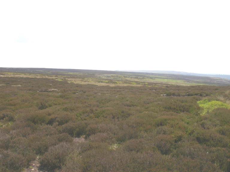
HLCA 017 Mynydd y Garn-fawr
Unenclosed upland landscape characterised by pre-historic funerary/ritual features and livestock grazing. Very minor industrial features mainly boundary marker stones.Back to map
Click here for further information about this Historic Landscape Character Area
Click here for character area map

HLCA 018 Cwmavon Industrial Transport Corridor
Major transport corridor, also characterized as a rare surviving medieval and post-medieval agricultural landscape with areas of woodland, scattered post-medieval farmsteads, and industrial processing at Cwmavon forge with associated industrial housing.Back to map
Click here for further information about this Historic Landscape Character Area
Click here for character area map
HLCA 019 Mynydd Varteg Opencast
Extractive landscape dominated by modern opencast workings and waste tips. Former industrial extractive features related to quarrying and mining were previously characteristic of the area.Back to map
Click here for further information about this Historic Landscape Character Area
Click here for character area map
HLCA 020 Coity Mountain
Predominantly unenclosed upland landscape characterized by agricultural stock management, boundary markers and prehistoric funerary ritual features. Another main characteristic is industrial extraction given the numerous quarries and collieries once in the area. Historic events.Back to map
Click here for further information about this Historic Landscape Character Area
Click here for character area map
HLCA 021 West Blaenavon Industrial Estates
Area characterised by modern industrial estates. Previously dominated by collieries and associated buildings, industrial terraced rows and tramroad links. Buried archaeological remains. Back to map
Click here for further information about this Historic Landscape Character Area