Gower
040 Scurlage and Berry
HLCA040 Scurlage and Berry
Post-medieval/medieval agricultural landscape and former manorial centres (Scurlage Castle - secular; Berry - monastic): post-medieval semi-regular fieldscape; shrunken medieval/post-medieval clustered settlement of Scurlage Castle and linear settlement of Berry; relict and buried archaeology; limestone extraction and processing. Back to Map
Historic Background
The historic landscape area of Scurlage and Berry roughly equates to the extent of the medieval knight's fee of Scurlage Castle and the Hospitaller's manor of Berry. It has been conjectured that during the early medieval period the area formed part of a much larger Welsh 'maenor', remnants of this large estate survived in a much-reduced form following dismemberment under Anglo-Norman control. The area was originally located within the Welsh medieval Cwmwd of Gwyr, within the Cantref of Eginog, later the area was divided between the knight's fee of Scurlage Castle, and Berry granted to the Knights Hospitallers, and became a holding in Anglicana. During the reorganization of the post-medieval period the area fell within the Hundred of Swansea in the County of Glamorgan.
An Iron Age settlement at Berry Wood and a find of a Roman coin attest to occupation from at least the late prehistoric period. By the early medieval period, it is likely that the area formed part of the larger Welsh unit or 'maenor' of Llandimore, and that this larger holding was broken up by the end of the twelfth century as a result of grants to religious orders and the creation of sub-fees (Draisey 2002). The area of Scurlage and Berry as a separate entity and knight's fee appears to date from c.1202, when the Scurlage family moved to Gower and became Lords of Scurlage Castle. Nicholl suggests that the Scurlages may have established themselves on land carved out from what had been the territory of the Old Welsh priory of Llangennith (Nicholl 1936, 136-137). Later references claiming the area to be one of the Ancient Fees of Gower are considered to be unreliable (Nicholl 1936, 168; Draisey 2000, 14-15).
Nicholl relates that the Scurlage family of Scurlage Castle ended in an heiress, wife of a Mansel, who in conjunction with the de Stakepoles, succeeded to their possessions in the mid-14th century (Nicholl 1936, 136 and 185). Writing in the sixteenth century Rice Merrick mentions Scurlage as being one of the Castles or Piles of Gower (James 1983, 116), during the period the lordship of Scurlage belonged to Sir Edward Mansel, knight (James 1983, 121).
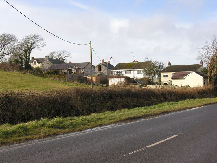
The first edition OS 25-inch map shows the settlement layout, which is largely unchanged apart from slight changes made during the twentieth century with little apparent change notable in the field pattern apart from minor amalgamation. The field pattern of the entire area is in place by the late 18th century (1785 estate plan) and little change is noted throughout the 19th and 20th centuries (tithe map c.1840; 1st, 2nd, and 3rd edition OS maps). The main agricultural settlement of Scurlage Castle is shown as a clustered grouping of post-medieval farmsteads and associated outbuildings set with a matrix of small enclosures and yards at a road junction between the road from Llanddewi to Port-Eynon and the lane/trackways to the associated field system. The post-medieval farms of this settlement comprised the L-shaped arranged farmsteads and outbuildings of Scurlage Court Farm (Scurlage Castle Farm on the estate map of 1785) and Scurlage Castle Farm (West), a nineteenth century addition, and set back and east of the main north-south road, the long linear range of Scurlage House (1785) or Castle, the latter with the apparent remains of the medieval castle indicated as a short length of wall to the west. A group of un-named roadside buildings with yards stand a little further to the west, probably nineteenth century agricultural worker cottages (not shown on the estate map of 1785). Scurlage is thought to have had a medieval precursor and may represent a shrunken medieval village. The other main settlement on the first edition OS map is the linear post-medieval settlement of Berry located at the southeast limits of the area comprising Berry Farm, Berry Hall, and Berry. The OS map evidence suggests that many of the farmsteads and associated buildings of this settlement may survive embedded within the agricultural buildings of the expanded twentieth century farms. The first edition also shows four quarries and associated limekilns mostly dispersed throughout the fieldscape, all disused. These kilns, given their distance from main lines of communication and coastal shipping points, are likely to relate to local post-medieval agricultural improvement generated by the Mansel estate and are probably of late eighteenth or early nineteenth century date.