Gower
032 Pitton and Pilton
HLCA032 Pitton and Pilton
Post-medieval/medieval agricultural landscape and manorial centres: varied enclosure pattern; traditional boundaries and green lanes; small clustered and dispersed settlement; post-medieval farms with medieval precursors; prehistoric find scatters; rural industrial processing features. Back to Map
Historic Background
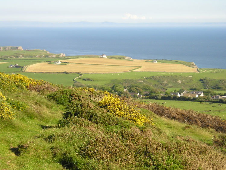
The historic landscape area of Pitton and Pilton comprises the extent of the former Manors of Pilton and Pitton alias Fernhill, to the east of Rhossili and Middleton. The southern boundary of the area is defined by the upper edge of marginal coastal land and extent of enclosure.
Occupation of the area dates back to the Palaeolithic period with significant assemblages of flint blades and flakes being found along the margins towards the coast; this area saw continued occupation throughout the prehistoric period attested by other assemblages and finds, primarily flakes, blades and cores, but also tools, including a microlith of Mesolithic date.
There is little known about the area's history during the Roman and Early Medieval period, though it is likely that productive land in this area continued to be exploited until the Anglo-Norman incursions of the twelfth century. A charter of 1306 indicates that Fernhill and Pilton was one of 13 'old knights' fees'. It is known that the de Penres (Penrice) family, who also held the fief of Mounty Borough (later Penrice and Horton), also held the fief of East Pilton. It is likely that the post-medieval settlements of East and West Pilton and Pitton are the sites of former medieval settlement (i.e. Deserted Medieval settlement).
During the post-medieval period the area, along with most other parts of Gower, underwent major changes to its agricultural landscape and tenure patterns. The Mansel family emerged as the main landowner within the area, the largest of the Gower landowners. Whilst remnants of the former medieval system of open field are traceable in the landscape as fossilized quillets or landshares within the field pattern, the current enclosed landscape relates largely to the consolidation of holdings initiated during the sixteenth century.
The main settlement within the area is that of Pitton, and comprises the seventeenth century storeyed hall of Great Pitton Farm and its ancillary buildings. As a storeyed hall, this building is relatively unusual for Gower, and appears to indicate a particular level of status, which perhaps relate to undeveloped manorial centres. In c.1780 Great Pitton formed part of the estate of George Venables, 2nd Baron Vernon of Briton Ferry. In 1845 it is recorded as the tenancy of George Beynon in the estate of Sir Josiah Guest. The Beynon family were leading local Methodists and the kitchen and barn at Great Pitton were used for Wesleyan Methodist meetings during the eighteenth and nineteenth centuries, later a chapel was erected in 1833, in the lane below Great Pitton Farm. Apart from the Vernons of Britton Ferry the other major land owning estate in the area during the post-medieval period was that of the Penrice family.
The first edition OS 25-inch map shows the four main settlement clusters of the area, Pitton, Pitton Cross, Pilton and Pilton Green, with outlying farmsteads to the north and west of the area. Pitton comprised and still comprises the main farmstead and U-shaped range of farm buildings that comprise Great Pitton Farm, with its ribbon of associated cottages, saw pit and nearby old limekiln, and a Methodist (Weslyan) Chapel, Pitton Farm, extending north on the winding lane that leads to Corner House Farm and the cross road junction with the Rhossili Road. Immediately north of the road Gables Farm is shown on the lane to the north continuing past a smithy and Pitton Mill (Corn) and a number of cottages within a wooden stream valley. The area to the north is shown as a matrix of unimproved and improved enclosures of varied type, which appear to have been won from the adjacent common or waste over a period of time, and probably relate to a mixed process of hill land enclosure and encroachment. Within this area outlying cottages and farmsteads are shown set close to the present margin of the common; these include Prospect Cottage, Hoarstone, Kenmoor, Fernhill and Sluxton with its sawpit. To the east of Pitton the settlement of Pitton Cross is found; at the date of the first edition 25-inch OS map, this comprised a single farmstead, and a triangular-shaped area of Common, slightly to the east lay Pitton Moor Cottage (within the adjacent area), and to the south east Kimley Moor Farm and dispersed cottages. The hamlet of Pilton, probably a deserted medieval settlement, comprised the adjacent farmsteads of West and East Pilton each with their own stretches of linear rough grazing (possible drove routes) leading to what appears to be former moorland, that of the former surviving as enclosed rough grazing, the latter improved group of enclosures known as Kimley Moor. At the eastern edge of the area the settlement of Pilton Green is depicted, at this date it comprised (South) Pilton Green Farm separated from Pilton Green Farm Cottage and Green Cottage by an irregular-shaped open area or green.
It is likely that rural crafts and industry has a long history in the area with milling dating back to the medieval period if not before. Manorial holdings during the medieval period would usually have included at least one mill; the earliest mention of Pitton Mill is a reference to a lease for a gristmill dating to 1631, the lessee a Philip Tailour. It is likely that a mill was in existence at the site prior to the seventeenth century. According to documentary evidence (a combination of leases and rent rolls in the Penrice collection) the mill was repaired in 1725 and leased to John Evan in 1759, Mary Evan in 1793, John Ace 1796, William Evan c.1800 and William Taylor from 1845 to its closure in 1899. This mill is thought to have supplied most of the barley and oatmeal for the parish of Rhossili (Taylor 1991, 20-21).