Gower
039 Newton

HLCA039 Newton
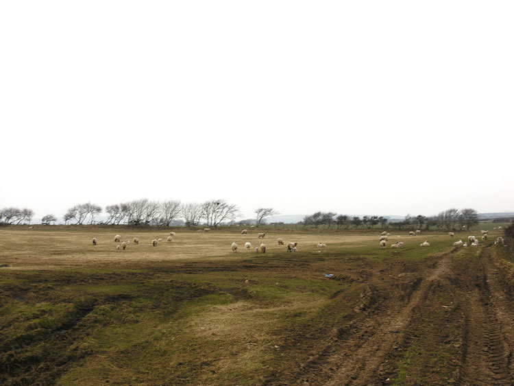
Largely post-medieval agricultural landscape: varied fieldscape and dispersed post-medieval settlement; buried prehistoric and medieval archaeology, including a scheduled ritual site. Back to Map
Historic Background
The historic landscape area of Newton comprises the extent of enclosed agricultural land associated with the Newton and Pilton Moor. Place-name and cartographic evidence suggests that the enclosed landscape of the area generally represents later enclosure of waste and establishment of new settlement by the early post-medieval period on the margins of the Manor of Henllys.
Occupation of the area, however dates back to the prehistoric period attested to by finds of the period, including flint scrapers and flakes and retouched flake. Examination by the RCAHMW of aerial photographs of the area taken in 1964 led to the discovery of a henge monument, a monument characteristic of the Neolithic period (RCAHMW); this monument (SAM GM580; 00123w; 309758) comprises a ditch 5m wide and 53m overall in diameter, with two dark spots and a third less well defined internally on the eastern side, suggesting the presence of a ring of five or six large pits in a circle 7m within the lip of the ditch. A broad band of lighter colouration has been interpreted as resulting from the levelling of a bank within the inner circle, and there may have been an entrance about 5m wide on the west. It was photographed again by RCAHMW in 1992, this time revealing two additional pits west of those identified in 1964.
Otherwise little is yet known of the early history of the area, though evidence for occupation reappears during the medieval period by the remains of at least one rectangular medieval building (RCAHMW 1982, 361 MI 4). The latter is at the western edge of an area of evolved fieldscape of smaller enclosures, including remnants of strip fields, which probably represent early enclosure from the waste. The landscape history of this area has as yet not been studied in detail, nor has the area been subject to comprehensive field survey; future study may allow better understanding of the landscape development here.
During the post-medieval period the area, along with most other parts of Gower, underwent major changes to its agricultural landscape and tenure patterns. The Mansel family emerged as the main landowner within the area, the largest of the Gower landowners. The current enclosed landscape within this area appears to relate in part to eighteenth century consolidation of holdings and encroachment initiated possibly earlier during the 16th or 17th centuries, however further detailed research is again required to confirm this. The mid-18th century date of Newton farm, the main farmstead of the area and the larger size of the immediately adjacent enclosures within the area would support this assertion.
The house at Newton (01641w; 19455) has a number of noteworthy architectural features, the internal chimney faces the hall with the timber tread outshut staircase to the left and its 'lobby entry' to the right. The building has masonry partitions; there are only a few examples of this feature on Gower however many more survive further east. Also there are exposed beams, the profiles being medium and hollow with fillet and having decorative ogee mouldings.
The first edition OS 25-inch map and earlier estate maps show that the field system remained largely unchanged from the eighteenth century, with only minor amalgamation of some of the smaller enclosures or strip fields taking place during the latter part of the twentieth century. Areas of enclosed rough grazing depicted on the first edition map, particularly to the north and west of the area may be an echo of the former waste or unenclosed common, once prevalent in the area; this is to an extent confirmed by place name evidence around the periphery of the area such as Pilton Moor, Kimley Moor and latterly Keen Moor farm. Later edition maps chart to gradual improvement of the grazing within the area. In addition to detailing the varied evolved field pattern of the area, the first edition map shows a number of minor agricultural features such as ponds, trackways and ditches, but also isolated structures, possibly beast houses or fieldbarns.
Newton farm is shown as an extensive range of buildings set within a series of small rectangular yards and orchards. The layout appears little changed today to that on the first edition; Newton farm forms an L-shaped range with a northern wing of attached outbuildings with a separate structure to the east across a yard, a range to the west and a further building to the south. A limekiln and associated old quarry is depicted nearby to the northeast of Newton on the first edition map, both are noted as old on the second, the limekiln (02456w) according to records has been destroyed. The other farmstead noted at the time is Pilton Moor, a relatively minor holding to the northeast side of the Green or common at Pilton Cross L-shaped range of farmstead and attached byre.