Gower
051 Kittle
HLCA051 Kittle
Largely post-medieval agricultural landscape and former manorial centre: dispersed farmsteads and small clustered settlement; agri-industrial features; communication routes; woodland; and findspots. Back to Map
Historic Background
The historic landscape area of Kittle represents the extent of major enclosure amalgamation within an otherwise largely unaltered agricultural landscape largely equating to the former fee of Kittle minus Kilvrough.
The earliest evidence for the area dates from the Bronze Age; principally a large bronze hoard found in the early nineteenth century at Langrove (00308w). Other finds include a Roman bronze handle (03185w) as well as second century pottery and bronze brooch found at Barland quarry (01150w). Of fourteenth century date is an Edward III penny (03218w) found at Kilvrough farm.
During the Medieval period this area formed the Norman fee of Kittle, later incorporated into the manor and parish of Pennard. Little is documented of the area until the seventeenth century in reference to quarrying when the tenants of the 'Manor of Pennard, Fee of Llonnon and Kittle . may freely by the custome of the said Lordshippe tyme out of minde there used without any licence of the Lord of the said Mannor Digge and break up all manner of Stone at their pleasures' (Harding 2000, 14). Many quarries and the remains of limekilns exist in the area today most representing increased improvement of agricultural lands generated by the local estate during the late eighteenth and early nineteenth centuries.
The fee continued to be surveyed along with the manor of Pennard in the eighteenth century and is recorded in Gabriel Powells' Survey of Gower 1764 as consisting of both freehold and copyhold lands, a change from 1745 when all land was copyhold. Tenants of the area are also reported to have paid a fee for the privilege of grazing their livestock on nearby common land (Harding 2000, 11).
Cartographic evidence shows that the area was divided into sharelands dating back to the medieval period. A few are depicted on the tithe map of 1848 around the areas of Great Highway and Kittle village. The field system has been gradually amalgamated through successive years and presently few indications of strip fields remain unlike the surrounding areas of Pennard and Bishopston.
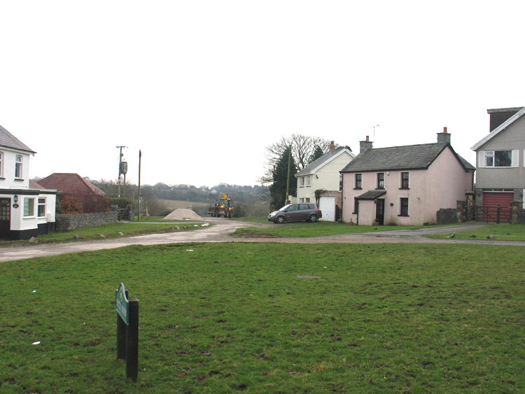
By the post-medieval period a small settlement had developed as Kittle Village, essentially a cluster of cottages around a green at the cross roads at the northern end of the Bishopston valley on the outskirts of Barland common (depicted on tithe map 1848). Other settlement of the area consisted of a scatter of farmsteads, by 1848 these included, Langrove (02437w; 19125; 19127), Great Highway (18860), Kilvrough Farm and Kittle Hill (01491w; 19110 most likely eighteenth century in date) and Great Kittle (18100), which is known to have dated from at least the sixteenth century and may have previously been the chief residence and holding of the fee of Kittle. Great Kittle is associated with the Gronow family known to have been established in the area from 1533 at least and regarded as a minor gentry family at this time (Morris 1998). Kittle Hill's farmland appears to have been carved out of the woodland in the north of this area.
Changes noted between the first edition 25-inch OS and the tithe map indicate little expansion of settlement apart from a few cottages and a public house at Kittle Green and the addition of the 'new' farmhouse at Great Kittle. Later settlement expansion in the area of Kittle village only came during the second half of the twentieth century, which now comprises mainly of detached properties with small gardens. Kittle Hill farm has also grown, becoming the most dominant farm in the area along with Kilvrough farm. The area north of Langrove is now the location of the Canisland Park development.