Gower
001 Llanrhidian Sands and the Lougher Estuary
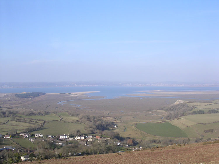
HLCA001 Llanrhidian Sands and the Lougher Estuary
Intertidal landscape: buried landscapes; exploitation of the marine environment; transportation and maritime features. Back to Map
Historic Background
The historic landscape area of Llanrhidian Sands and the Loughor Estuary is delineated by the boundary of the AONB to the north and east, encompassing estuary mud and sand flats at the mouth of the River Loughor; bounded by salt marsh to the south and sand dunes to the west.
Direct archaeological evidence for the area is limited to a number of post-medieval wrecks. Historically, the Loughor Estuary was an important access point for boats at least from the Roman period. An auxiliary fort founded c.AD75 at Loughor (Leucarum) was strategically placed at the narrowest crossing point of the River Loughor; presumably movement from the estuary to further upstream could be controlled at this point. A known Roman presence in the Llanelli region may also indicate further use of the estuary and pills to land boats here as well and giving access to the River Lliedi. This area was most likely utilised for both military and commercial purposes during the Roman and following periods. Normans may also have taken advantage of sea routes when establishing control of the area.
Development of settlement along the coast during the medieval period initiated an increase in maritime trade through the estuary. A number of major pills run through the area, to the salt marsh to the south (HLCA 004), namely Burry, Great, Leason and Llanrhidian Pills. Although no structures have been found in the area, these channels were certainly navigable at this time. Although just outside the area, the monastic settlement formerly at Machynys, most likely established in the sixth century highlights the significance of the estuary during this period; at high tide the water would have cut the monastery off from the mainland, forming a small island, in common with other monastic island sites in the surrounding area.
Navigation of the estuary, river and pills is better documented in the post-medieval period. Loughor is mentioned in the Welsh Port books of the sixteenth century (Lewis 1927); however, it never developed into a major port as maritime activities were more focused on Llanelli. Exportation of coal from Llanelli through the estuary to as far a field as France and Portugal is recorded from the sixteenth century as well as trade in soap, slate, brass, walnuts, wine, butter and tobacco (Dunning and Howell 2005). In the eighteenth century Jacob Dumain was appointed as 'waiter and searcher at south Burry', in charge of regulating the coal trade along the southern part of the estuary as well as keeping a watch on smuggling (Cooper 1998). Docks situated along the coast include those at Penclawdd and Llanmorlais. Traces of later docks and wharves are present at Loughor and nineteenth century navigation charts detail shipping utilising the estuary (Marvell and Owen-John 1997). Wrecks found in the area include Adventure, ECT, William and Mary and Harmony. A further example is found in the tale of the 'Dollar Ship of North Gower'. A ship known as the 'Scanderoon Galley' (03048w) was supposed to have become stranded here, sinking into the mud. It is reported that twelve chests of gold were on board, all but one were salvaged; many years later a local man suddenly became very rich, it is said that he had found the lost chest (Edmunds 1979). The course of the river and its tidal range has indeed changed over the years, however the estuary is still navigable at high tide by smaller vessels.
Marine exploitation of this area was common, including fishing of the pills but more notably cockling. This activity probably dates back to when people first inhabited the area, no doubt an integral component of the diet of the region. Certainly since medieval times, this activity became more large scale; cockles were gathered from the estuary flats between tides by the women of the local villages such as Llanrhidian and Penclawdd. Little is documented about the early process but as traditions were strong in the area it seems as if cockling remained the same way for hundreds of years. In the early eighteenth century cockle gathering as an industry to supplement income increased. Women of the villages were hardworking and strong, working many unsociable hours whilst their husbands worked the mines and collieries (Roberts 2001).