Gower
059 Langland Bay Golf Course
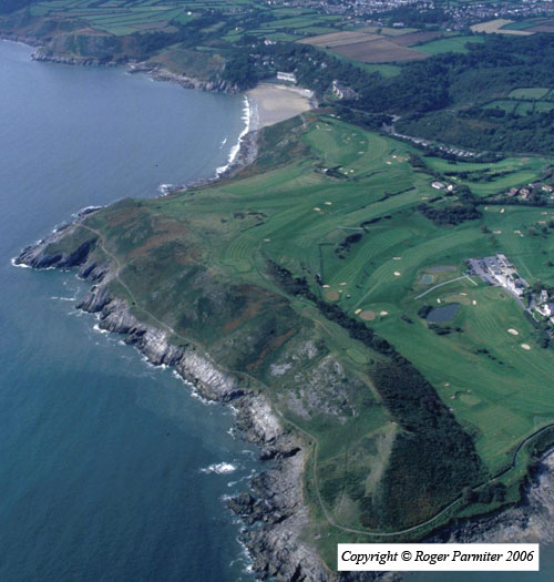
HLCA059 Langland Bay Golf Course
Remodelled and designed former agricultural landscape: tourism and leisure; former agri-industrial features. Back to Map
Historic Background
The historic landscape area of Langland Bay Golf Course encompasses the extent of Langland Bay Golf course and chalet park at Summercliff.
Situated just southwest of Newton, this area was formerly agricultural land within the wider agricultural landscape of Oystermouth parish with a section of unimproved land for grazing along the cliff edge. Longland Farm is now the site of the clubhouse and it appears the present building is an extension of that shown on the first edition 25-inch OS map. The extent to which original structures survive is unknown. The tithe map of 1844 shows the area much as on the first edition OS though with more remaining strip fields around Longland. It is likely that the field pattern was progressively amalgamated from the end of the seventeenth century. Cliff Cottage (583) is also depicted on the tithe map and still remains today, no further information is known. The first edition also depicts two old limekilns and a quarry on the outskirts of the area.
The field boundaries remained in place until at least the 3rd edition OS map and little further amalgamation appears to have taken place by this date despite the area being established as a golf course in 1901 and references to golf being played here in the nineteenth century. 'Golf Course' is marked on the third edition OS map. It seems that a clubhouse was established in 1901, yet the golf course was not officially opened until 1904; meeting minutes record these dates (www.langlandbaygolfclub.com). The area has been relandscaped since this date, and the clubhouse was refurbished in 2003. Summercliff chalet park is located in the northwest corner of the park.