Gower
053 Oxwich and Nicholaston Burrows
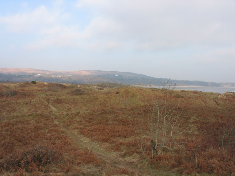
HLCA053 Oxwich and Nicholaston Burrows
Besanded landscape: buried archaeology; medieval field boundaries; and intertidal features, mostly post-medieval. Back to Map
Historic Background
The historic landscape area of Oxwich and Nicholaston Burrows is a besanded landscape of unknown archaeological potential. The boundaries of the area are the mean high watermark and the inland extent of sand dune systems at Oxwich and Nicholaston. The area forms the Oxwich Bay SSSI, and Oxwich National Nature Reserve. The dune systems of the area are largely fixed, through vegetation, though remain unstable along the periphery. The area bounds the marsh of Oxwich Marsh (HLCA 054) and the wooded escarpment of Nicholaston Woods (HLCA055) to the north. Its particular historic landscape importance lies not in the present ground surface, but in the potential for evidence for past land use preserved under the sands.
Little additional information is available, however, regarding the remains in the area beyond a section of badly preserved drystone walling (00795w), running northwest - southeast, below the steep cliffs at Nicholaston Burrows, thought to be medieval in date. Finds on the intertidal zone to the east dating from the Roman and Medieval period could indicate potential occupation or at least activity in the area. The area, now in the ownership of the National Trust, previously formed part of the extensive holdings of the Penrice Estate of Mansel-Talbot family and was common land subject to grazing.
As a coastal sand dune system, it is likely that it would have been use as a rabbit warren during the medieval period, though no physical remains associated with this use are known.
In 1878 it is recorded that human remains were found in association with a sixteenth century watch key with the coat of arms of the Davenport family, near the bathing house at Oxwich (00290w).
The late nineteenth century the first edition OS 25-inch map indicates that the area contained a boat house at the high tide mark near Oxwich, whilst a breakwater, possibly associated with the eighteenth century improvements to Oxwich Marsh (see HLCA054), is shown located on Nicholaston Pill, at the eastern end of the Oxwich Dune System. A coal yard associated with coastal trade, and possibly relating to the activities of the lime industry in the adjacent areas of Oxwich and Penrice, is located at the Oxwich end of the Burrows.