Merthyr Mawr, Kenfig and Margam Burrows
017 Ochr Draw and Island Farm
017 Ochr Draw and Island Farm
Largely post-medieval agricultural landscape, with evolved but fairly regular field pattern and distinctive boundaries; post-medieval agricultural settlement; communications corridor including line of Roman road (Caerleon-Loughor) and public/industrial rail. Back to Map
Historic Background
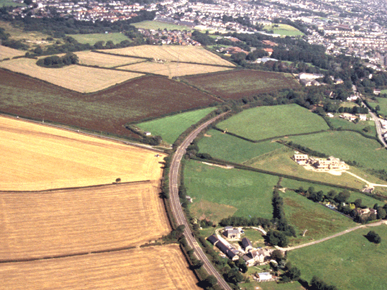
The historic landscape area of Ochr Draw and Island Farm comprises a surviving fragment of agricultural landscape now dominated by regular fields, which represent the final stages of rationalisation of a former medieval pattern of strip fields. The Dunraven Estate maps and the Tithe map of the area indicate stages in the development of the current post-medieval field pattern from the vestiges of survival of the former medieval 'infield-outfield' system characterised by varied dispersed ownership of small plots or quillets throughout the area. By the latter half of the 18th century land ownership in the area has already been largely consolidated and the majority holding by this date is under the control of the Dunraven Estate, however lesser holdings survive, isolated within and dividing the Dunraven lands into fragmentary parcels. The 1st edition 6-inch OS 1884 depicts the former farmstead of Island Farm, now demolished and replaced by a retail park, and just beyond the boundary of the character area. The farmstead itself dated from the 19th century; its plan typical of an industrial agricultural farm with agricultural buildings, set apart from the dwelling, and arranged around a rectangular yard.
The surviving buildings of the area include Ochr Draw Farm adjacent to the line of the Vale of Glamorgan Railway (location unchanged from 1st edition OS 6-inch 1884) and Newbridge Farm, the latter an interesting early 17th century 3-storey farmhouse with 19th century additions and internal alterations (Listed Grade II along with an outbuilding). The house, though subject to recent drastic restoration retains a number of original features including hollow- and sunk-chamfered mullioned windows, entrance doorway with carved spandrels and a hollow-and-wave moulding, and hoodmoulds. Island Farm Barn, an isolated field barn with an adjacent cruciform pond, depicted on the Tithe of 1840 within an enclosure called 'Cae Skibbor' (Barn Field), also remains.
The Vale of Glamorgan Railway in use for mineral and passenger traffic since 1897 (virtually a subsidiary of the Barry Railway from inception) crosses the eastern part of the area. The line survived to be separately amalgamated into the GWR under the Railways Act, 1921, ceased passenger services in 1964, but continued open for through-freight, notably coal to the CEGB Aberthaw Generating Station, its usefulness boosted by an additional single line extension just to the north of the area in 1980, to serve the Ford Company's Bridgend plant.
Just beyond the eastern boundary of the area lie remains of clay pits associated with the well-known Ewenny Pottery and Clay Pits Pottery.
An interesting, though generally uncharacteristic feature of the area are the remains associated with the Island Farm WWII Prisoner of War Camp, built as a barracks for munitions workers during the late 1930s and adapted for use as a prison camp and in 1943 the scene of the only major escape of German POWs.
Historic Landscape Characteristics
Ochr Draw and Island Farm, a largely post-medieval agricultural landscape, is characterised by evolved but fairly regular field pattern of medium-large regular fields; distinctive boundaries and an associated loosely dispersed settlement pattern of isolated farms/cottages, including interesting examples of vernacular architecture, such as Newbridge Farm. The area contains an important communication route (ie the Roman road between Caerleon-Loughor, its alignment preserved by two sections of straight field boundary), as well as tracks, and lanes both straight and winding of early post-medieval if not medieval date including Heolgam (the crooked way) depicted Tithe of 1840. The eastern side of the area is clipped by the extant line of the former Vale of Glamorgan Railway, while the north of the area is crossed by the A48.