Gower
007 Llanmadoc
HLCA007 Llanmadoc
Post-medieval/medieval agricultural and settlement landscape: organic settlement centred on medieval church; early medieval ecclesiastic centre; ribbon development and clustered settlement; varied fieldscape; dispersed farmsteads; post-medieval vernacular buildings and features; agri-industrial features; scattered finds; historic associations. Back to Map
Historic Background
The historic landscape area of Llanmadoc encompasses the village settlement and its surrounding associated field system bordered by the mass of Llanmadoc Hill (HLCA 012) to the south, and Cwm Ivy Marsh (HLCA 005), Burry Holms and the Tors (HLCA 006) to the northwest and Cheriton and Burry Pill (HLCA 018) to the east.
Llanmadoc sits at the foot of Llanmadoc Hill, near the Burry River. Although there is a great deal of archaeological evidence of Bronze Age activity on the Llanmadoc Hill, there is little to suggest contemporary settlement in this area, though this is quite probable considering its prime location in fertile land close to the sea.
As it currently stands, St Madoc's Church, Llanmadoc, (LB 11532 II) dates to the twelfth century, however it is regarded as having been founded much earlier in the sixth century by Saint Madoc. Following the Anglo-Norman annexation of the area the church was granted first to the Knights Templar in 1156 by Margaret, Countess of Warwick and, after the suppression of the order imposed by Pope Clement V in 1309, to the Knights Hospitallers of St John of Jerusalem. In turn the church passed to the crown with the dissolution of the monasteries under Henry VIII. Little of the history of the church is documented until the late nineteenth century when renovations began. The present condition of the church is due to Reverend J D Davies, a local historian, who contributed £500 to the restoration of the building; completed in 1866, this included the partial rebuilding of the nave, tower and chancel. All the windows were restored, except the eastern window to the south of the chancel, which may be the original medieval east window relocated.
The church houses two early medieval monuments, both scheduled, one a pillar stone (SAM GM223A) located in the churchyard and dating between the seventh and ninth centuries, the other a stone sporting two incised crosses and dating from before the ninth century (SAM GM223B) was found in the churchyard wall and has been relocated.
As is a general characteristic of the Gower, due to its limestone belt and the exploitation of this resource, limekilns and quarries can be found in the area surrounding Llanmadoc village. They survive in varying conditions depending on their date not merely because of age but because later kilns, built after the late eighteenth century were more substantial structures built for continual use. It is generally observed that while the limekilns of the Gower are by no means considered the best examples in Wales, due to the peninsula's relative isolation the broad spectrum of surviving examples allow the development of the industry to be charted. Certainly, when Samuel Lewis wrote in 1833, the trade in limestone was still considerable with exports to Cornwall and Devon (Lewis 1833).
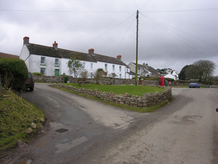
The first edition 25-inch map depicts the village Llanmadoc, the cluster of farms, which form the hamlet at Cwm Ivy, and the ribbon development at Frog lane, as well as various isolated dispersed farms and cottages mainly along the southern and western fringes of the area. The settlement of Llanmadoc is likely to have initially developed as a nucleated settlement focused on its early medieval church, St Madoc's and its partly curvilinear churchyard, (the most markedly curvilinear side to the north is part of a post-1945 extension). The early centre lies at the junction of the main east - west route and a north - south route running from the coast beyond the farmsteads at Cwm Ivy, via Catchpool Farm to the common of Llanmadoc Hill. The area to the northeast of the church appears to have been associated with the medieval grange of the Knights Templers; the curvilinear enclosure directly opposite and east of the church may be of some significance (though only further survey and/or excavation can provide concrete proof), whilst scattered finds of medieval coins and other finds from fields close by to the north and east are certainly indicative of activity. It is likely that the granting of the church and Manor to the Templars would have lead to the displacement of the civil settlement, and this may be reflected in the location of the present post-medieval settlement, which extends away from the church and presumably its ecclesiastic holdings.
The first edition 25-inch OS map and earlier cartographic material show the settlement as a largely ribbon development of farmhouses and cottages, extending east from Big House Farm (02608w; 37468; LB 11723 II) to just beyond the junction with the lane running southeast to Rhiwlas Green. The earliest nucleus of which may be represented by that part of the settlement located within the curvilinear enclosure encompassing Big House Farm. The latter is situated overlooking the green to the southeast of church set back behind a walled garden of rectangular plan with its former stable yard to the west. The settlement is associated with a matrix of varied but mostly irregular enclosures, surrounded by what appears to be remnant common or open land. Rhiwlas Green appears as a small distinct hamlet of cottages again associated with small irregular enclosures, and a common green, extending as far as Hill Cottage and the boundary of the main common of Llanmadoc Hill. At some distance to the main settlement is the roadside settlement of Frog Lane, which extended from the former Farmer's Arms to the Britannia Inn at the edge of the open common to the east; the latter known to be an Inn before 1880 is unidentified as such on the first edition 25-inch OS map. Further to the east, built on the open rough grazing, probably former common, are Trinity Chapel (Calvinistic Methodist), a smithy (now ruinous) and a couple of springs. Trinity Chapel was built in 1817 as a school and meeting-house at the expense of Lady Barham of Fairy Hill, Reynoldston. The chapel was rebuilt in 1868. The hamlet of Cwm Ivy comprised the farm of Cwm Ivy Court Farm, with its extensive outbuildings, and the slightly smaller farmsteads of West Cwm Ivy and East Cwm Ivy, and other cottages are shown.
The wider fieldscape, shown on the first edition 25-inch OS map, comprised a varied and generally irregular pattern of enclosures with fossilized strip fields noted to an extent throughout the area, though with a particular concentration in the area north of Llanmadoc between Frog lane and Cwm Ivy. This, perhaps unsurprisingly, located in close proximity to the existing settlement probably represents the former sharelands of the medieval openfield. Further afield to the west there is a notable distribution of dispersed farmsteads ranged along the edge of the common of Llanmadoc Hill, frequently associated with areas of intake or piecemeal encroachment of the common's margins. These holdings, which include Lagadranta, Little Lagadranta, Phillistone (19727), and Hills, probably represent post-medieval settlement associated with consolidation of holdings following enclosure from the seventeenth and eighteenth centuries, based on possible outfield and meadowland away from the main open field. In addition to the settlement already noted a number of small isolated cottages, such as Danes Dyke (01723w; 18537), Underhill (20250) and Hill Cottage or Hillside (19032; 01856w) are visible along the margins of the enclosed land; these are frequently located on lanes and tracks giving access to the common, or as in the case of Pill Cottage on the routes leading to the coast. These were probably the dwellings and smallholdings of agricultural labourers and quarry workers.
There appears to have been little major change to the field pattern since that depicted on the first edition 6-inch and 25-inch OS maps, apart from minor amalgamation of some of the stripfields to the north of the village, and some of the smaller or less regular enclosures.
The first edition OS maps indicate a number of small quarries most with attendant limekilns; examples are found at Hills Farm, to the east of Cwm Ivy and in the area to the south of Pill House; these minor industrial extractive and processing features tend to be located on trackways leading to the coast and obviously form part of the extensive coastal trade in lime products which was prevalent from the early nineteenth century. Lewis writing in 1833 recorded that Llanmadoc 'carries on a considerable trade in coal and limestone, in which about thirty vessels, varying in burden from twelve to twenty tons, are employed: in these vessels the coal is brought from Loughor and Llanelly, and the limestone conveyed to the counties of Devon and Cornwall' (Lewis 1833). Production was apparently in decline by 1913; at least one kiln at to the south of Pill Cottage was described as old or disused by the survey of the first edition OS map, however the majority were disused by the publication of the second edition. It is known that the last commercial kiln to operate in the area was one of those located at Hills farm, at the west of the area; this closed during the 1930s (Toft 1988b).