Gelligaer
003 Western Enclosed Common
HLCA 003 Western Enclosed Common
Roman road; distinct field boundaries; prehistoric funerary monument; important relict medieval archaeology; enclosure. Back to Map
Historic Background
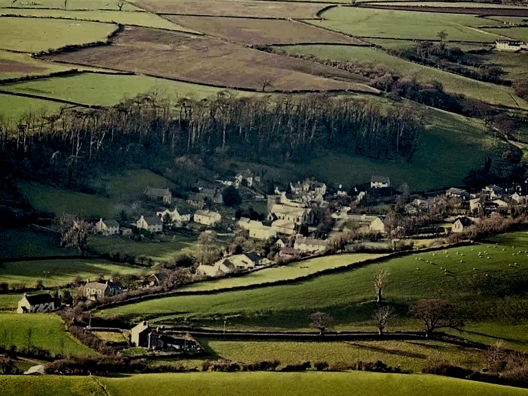
The historic landscape character area of the Western Enclosed Common comprises an area of enclosed improved pasture, which formerly would have been open upland. The whole area gently rises from the settlement of Gelligaer northwards in a series of stepped plateaux, the western flanks of which are indented by the small wooded valleys of Nant Llwynog, Nant Wen, Nant y Garth and Nant Ddu.
This area is characterised by a gently rolling plateau landscape of enclosed pasture with loosely dispersed farm settlement. In the south it is dissected by the line of the Roman road, known as Heol Adam, proceeding northwards from the forts at Gelligaer. This part of the character area is dominated by the place name Adam - 'Penheol Adam', 'Tir Adam Uchaf', 'Tir Adam Isaf'. However, the origin of this personal name is unknown, though it is suggested that it is derived from the biblical Adam -the first man - which adds folk-lore and credence to the antiquity of the road. Some dispersed ribbon settlement exists along Heol Adam, which future housing infilling would intensify.
Throughout the area the fields are mainly small to medium rectangular enclosures, normally with straight-sided boundaries. In the southern part these comprise earth banks, roughly lined with Pennant sandstone, supporting small trees and shrubs, mainly holly, hawthorn and ash. Further north, nearer to the open common, the field boundaries also comprise large dry-stone walling and there is evidence for the spacial and chronological development of these two types of field boundary - from a clawdd type in the south to predominantly dry-stone walls in the north. The fields in the southern area show some slight indication of former ridge and furrow.
Archaeologically little is known of the southern part of this area, where agricultural activities may have destroyed much of the evidence. Maen Cattwg, the large Bronze Age cup-marked stone is a notable exception and the dominant feature in the landscape.
The chronological development of this area would benefit from detailed study. The enclosed field pattern had been laid by the end of the 18th century and shows little change to that existing today. Aerial photography indicates a complex palimpsest of archaeological features with clear indications of field systems earlier than the formal enclosures. This pattern could be associated with medieval or early post-medieval activity involving organised encroachment onto the flanks of the Common. It is noticeable that the individual plateaux contain the relict remains of probable medieval settlement such as at Coly-Uchaf and Coed y Hendre. Both these sites, containing rectangular buildings similar to the platform houses elsewhere on the Common, are unexcavated.
Historic Landscape Characteristics
The area is characterised by its enclosed pastureland, which had formerly been open upland common, and small loosely dispersed farm settlement. The field boundaries are of the clawdd type though chronological progression to large dry-stone walling in the northern part of the area is discernible. Prior to the enclosure, which had occurred by the late 18th century, the area had been organised into a field pattern probably associated with the known medieval dispersed settlements in the area.