Gelligaer
006 Pen Garnbugail/ Mynydd Fochriw Open Common
HLCA 006 Pen Garnbugail/ Mynydd Fochriw Open Common
Prehistoric funerary monuments; Roman road; medieval relict archaeology; field systems; inscribed stone. Back to Map
Historic Background
The Historic landscape character area of Pen Garnbugail/ Mynydd Fochriw Open Common is characterised by its high upland moorland environment, used for mountain pony and sheep rough grazing. Historically it is distinguished for the intensity of relict archaeology mainly prehistoric funerary monuments, important medieval settlements and field systems. The Roman road, running from Gelligaer in the south to Brecon in the north is generally well preserved and is a key landscape feature.
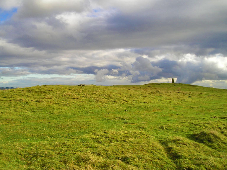
The relict prehistoric landscape is visually dominated by the Bronze Age cairn of Pen Garnbugail. It stands near the summit of Cefn Gelligaer and consists of an almost circular mound, measuring 15.5m by 16.4m. It is bounded by a kerb of one or two courses of large slabs laid flat, about 0.3m high and still exposed in places. At the centre is a damaged cist.
Pen Garnbugail, however, only represents a class of monument that proliferates in this area, many, including cairn fields, lying close to this cairn and on adjacent areas including Mynydd Fochriw (Roberts, pers comm).
Archaeologically this area is probably most notable for the medieval platform houses, excavated by Aileen Fox between 1936 -8. The Dinas Noddfa settlement lies on the western fringe of the area overlooking the little valley of the Cwm Bargoed Taf. It comprises two rectangular house platform sites and associated earthworks including banks for enclosures and evidence for large-scale cultivation, which may be contemporary with the structural evidence. These sites were the first of their class to be excavated in Wales and, although they did not provide dating evidence, were significant for the archaeological information they produced on house form, construction, materials employed, etc. Further excavation by Fox in 1938 on three platform houses on the eastern fringe of the area produced dating evidence for 13th century occupation. These examples form part of a group of at least eleven platform houses situated on open moorland on the eastern side of the ridge. They represent the largest concentration of platform houses currently known in south-east Wales.
The area is also notable for the well-preserved course of the Roman road running north-south to the east of Pen-Garnbugail on the line of a former prehistoric trackway. This section of the Roman road, comprising a pronounced agger with ditches either side, is one of the best preserved examples in south-east Wales. Below the road to the east lies an inscribed standing stone set within a small oval enclosure (see frontispiece). It is a roughly squared pillar-stone made of the local Pennant sandstone series. Lettering indicates a late 6th or early 7th century date.
Historic Landscape Characteristics
This area of open upland common is visually dominated by the remains of Pen Garnbugail, a large Bronze Age cairn at the highest point on Gelligaer Common. The area is enriched by the dense presence of prehistoric funerary and ritual monuments, which give it its main theme and texture. The landscape is also characterised by the very significant remains of medieval settlement in the form of platform houses and associated landscape features, including field boundaries and possibly also ridge and furrow. The excavation of these settlements in the 1930s is also historically and culturally significant as they constitute the first major archaeological work in Wales into this type of native Welsh settlement.