Historic Landscape
Characterisation
Merthyr Tydfil
079 A470(T) Road
HLCA 79 A470(T) Road North-south road transport corridor, late 20th century; former railway corridor (second half of 19th century); former industrial extractive landscape associated with the steam coal trade.
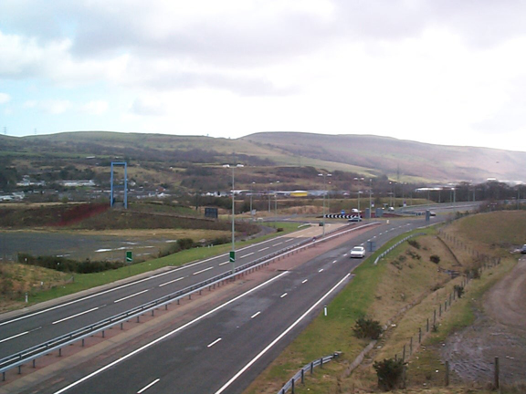
(Photo: GGAT Merthyr 079)
A470(T) Road character area: modern road corridor linking Merthyr Tydfil
with Cardiff.
Summary
An important north-south road transport corridor, linking Merthyr Tydfil with Cardiff. Of late 20th century construction, it replaces a former railway corridor with industrial extractive features.
Historical background
The historic landscape area of A470(T) Road comprises a late 20th century road transport development, one of several civil engineering schemes upgrading the main North - South route in Wales.
The routes of the former Castle Pit Railway (1850s) and the GWR and Rhymney Joint Line (Merthyr & Quaker's Yard Branch), constructed in 1884/85 were located within the area south of Upper Abercanaid.
The area also included collieries associated with Cyfarthfa, ie the site of Gethin No.2 Pit, and, just beyond the southern boundary of the historic landscape, part of the former the Castle Pit site, Troed-y-rhiw, sunk in 1866-1869, to exploit the profits to be made from the valuable steam coal trade. During the 1860s, the workings at Gethin, which had opened in the previous decade, were further developed during the 1860s to take advantage of the increasing demand for steam coal, though the Cyfarthfa leases for this and other collieries in the area expired in 1924. The collieries of Gethin and Castle Pit saw further activity during World War II, though finally closed in 1947, the year of nationalisation.